Labor Day Weather More Humid Chance Showers Thunderstorm
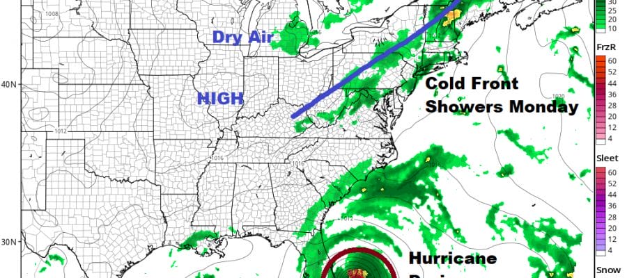
We are two for two this Labor Day weekend and we would love to stretch it out to three for three however we do have a cold front that is a approaching. That means we head into some questions for Monday regarding clouds and the chance for showers or perhaps a thunderstorm. There isn;t much nearby on the satellite and radars tonight but out to the west you can see the heavier cloud cover across upstate NY and back into Pennsylvania. Those clouds will head east overnight. Temperatures will settle mostly in the 60s over night with a few 50s in cool spots.
SATELLITE

REGIONAL RADAR

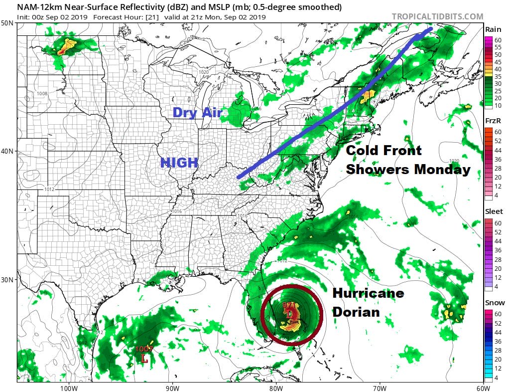
Our regional radar is showing a large area of showers and thunderstorms well out to our west at the moment and not showing a whole lot of eastward progress. There a few patchy clouds across Pennsylvania and the Catskills as warmer more humid air arrives mostly aloft overnight and then right at the surface on Monday.
LOCAL RADAR NEW YORK CITY

LOCAL RADAR PHILADELPHIA


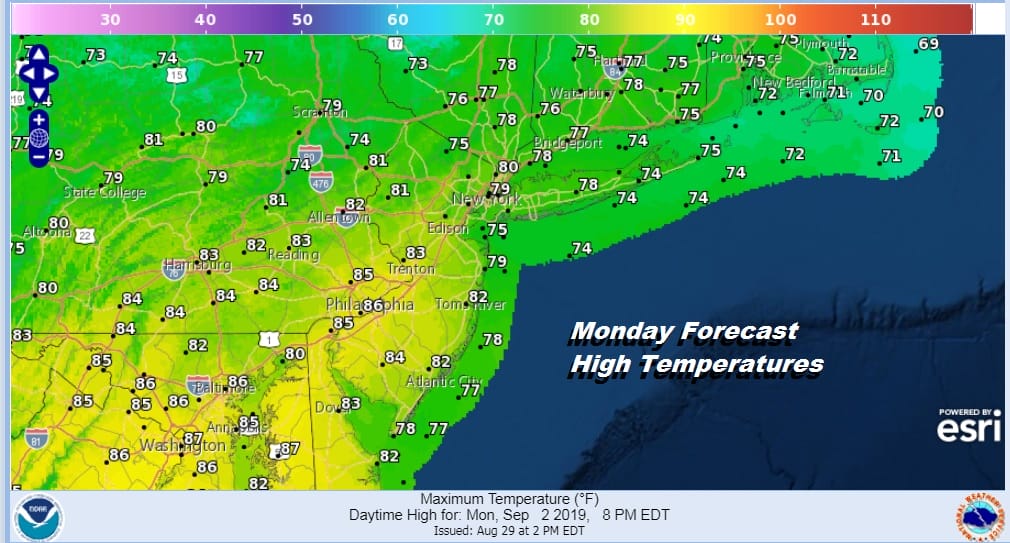
Monday brings clouds with some breaks of sun but it will be more humid with highs reaching the upper 70s to lower 80s. There could be a few showers around in the morning into the afternoon. Late in the afternoon and evening some showers and a few rumbles of thunder could occur so plan accordingly. The front will move through Monday night and it keeps on going so we should see improving weather conditions on Tuesday.
Tuesday sees a return to some sunshine and since the air behind the front is not really cooler than the air ahead of it we should see temperatures climb up into the low and mid 80s in some places. Then Wednesday brings another cold front through late in the day with another chance for a late shower or a thunderstorm with highs again in the low to mid 80s.
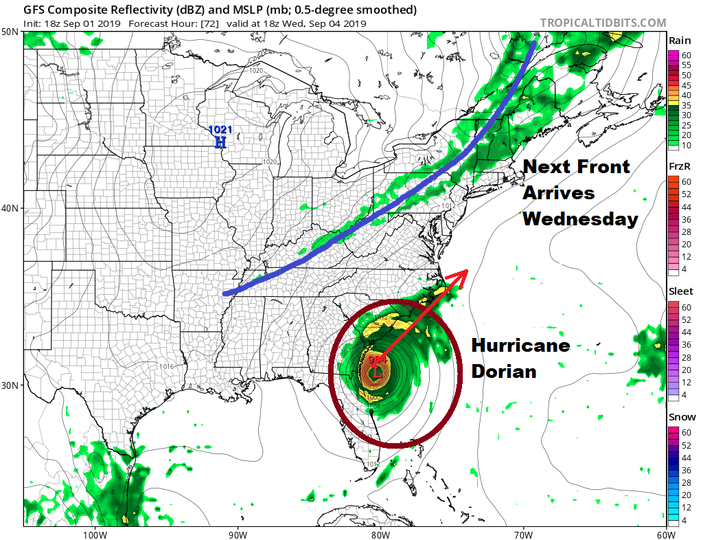
This front sets the table for Hurricane Dorian which by this time will be just off the Southeast coast and making a turn to the northeast. We will likely see tropical storm conditions spread northward from coastal Georgia through the coastal Carolinas as Dorian likely hugs the coast. For us Thursday high pressure will build in to the north setting us up in a northeast flow with clouds and some sun and temperatures in the 70s.
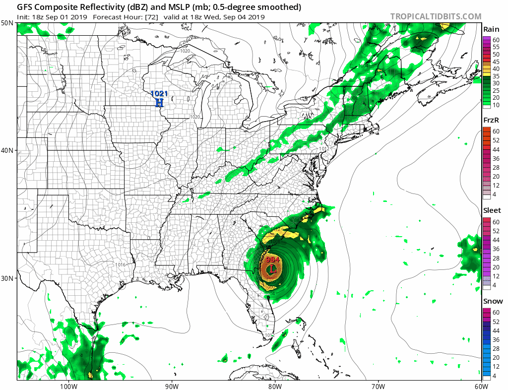
By Friday we will be watching Dorian closely. By now the hurricane will begin to morph into something that looks more like a winter time noreaster than a purely tropical system. This means that rain will be increasing on the northwest side and the wind field will continue to spread out. We will see an expanding area of gales though the highest winds will lessen though still be very strong as the hurricane passes along the North Carolina coast late Thursday or Friday. From here Dorian tracks to our south and east over the coastal waters east of Virginia and south of Long Island. The big question will be how far north the rain and wind gets. Gales could certainly be blowing over the coastal waters. Whether those winds spread inland will depend on the track. Obviously lots of uncertainty exists here until we can resolve what happens to Dorian over the next 3 days. More on this Monday.
MANY THANKS TO TROPICAL TIDBITS FOR THE USE OF MAPS
Please note that with regards to any tropical storms or hurricanes, should a storm be threatening, please consult your local National Weather Service office or your local government officials about what action you should be taking to protect life and property.


