
Hurricane Dorian Crawling Over Grand Bahama Warnings Continue Parts of Florida
Hurricane Dorian is literally crawling westward this morning at all of 1 mile an hour. Satellite loops show the impressive eye of Hurricane Dorian moving across Grand Bahama Island. Part of the eye is emerging on the north side into the Atlantic. There have been no air force recon reports overnight but is is likely that Dorian has come off slightly from its peak yesterday of 910 millibars and 185 mph winds. It is still a category 5 hurricane with max winds on the latest advisory of 165 mph.
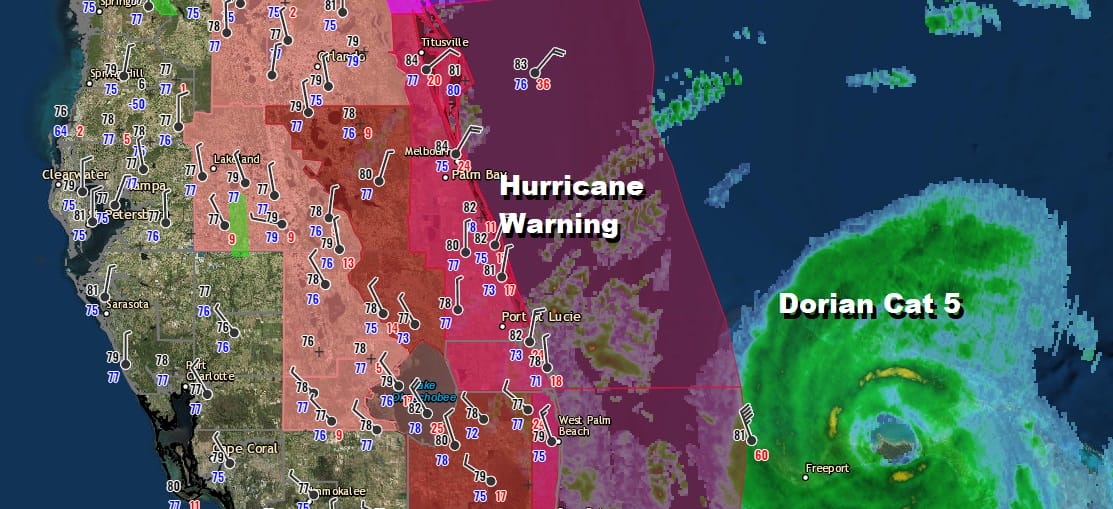
While Hurricane Warnings continue for Florida from Jupiter Inlet to Sebastian Inlet, the western edge of the rain is still offshore. The big issue for Florida will be the storm surge assuming Dorian stays offshore once it starts tracking northward. The hurricane’s eye could come inside 50 miles of the coast later Tuesday into Wednesday. The ocean winds from the east on the north side of the storm will funnel water down the coast from north to south and cause extensive tidal flooding. It could be similar to what happened back in 2016 with Hurricane Matthew.
SATELLITE

Some of the outer bands of Dorian are beginning to spiral back westward into the Florida coast and they can be seen on the Miami and Melbourne radars below. The bands are swinging in from the northeast and the core of the hurricane is offshore but becoming visible on both radar views.
LOCAL RADAR MIAMI

LOCAL RADAR MELBOURNE

There isn’t much change to the forecast logical this morning. Dorian will pass very close to the coast in the next 2 days coming to within 50 miles or slightly less than that to the shore line as it move northward. Watches and warnings of some sort will likely be extended northward at some point once a northerly track is established though that many not happen until later Tuesday.
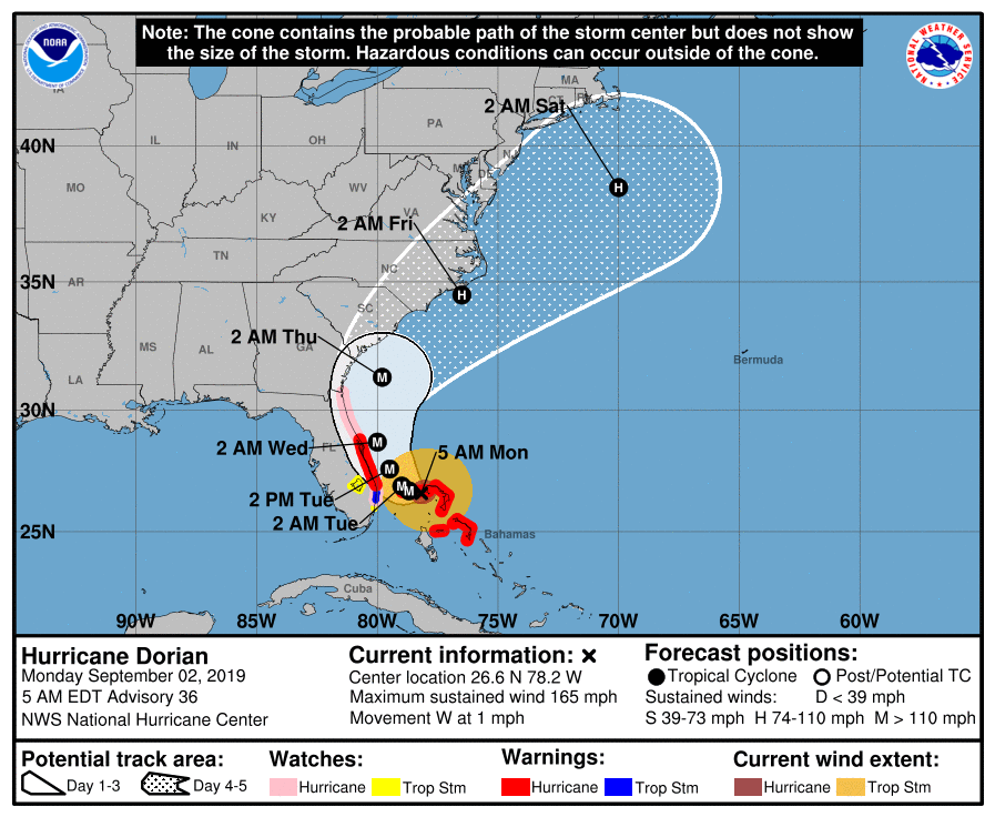
The risk is growing for Dorian to impact areas from Georgia to North Carolina beginning Wednesday and continuing into Friday. Dorian will gradually see its wind field expand as well as the rain area as it moves northward producing heavy rains of several inches or more as it heads up the coast.
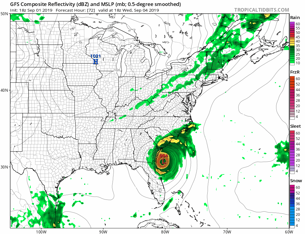
The hurricane will be tucked into the coastline much like the GFS model from last night shows. Other models are virtually the same. Dorian will pass east of Delaware and south of Long Island later Friday into Friday night bringing rain and some wind for coastal areas from New Jersey to Southern New England but the core of the storm will pass well to the south and east. We will be looking at the specifics a bit closer in the next day or two since we really need to see what happens with Dorian as it moves northward and how tucked in it is to the coast. A landfall is possible from Northeastern South Carolina to Eastern North Carolina given what we see in the upper atmosphere.
MANY THANKS TO TROPICAL TIDBITS FOR THE USE OF MAPS
Please note that with regards to any tropical storms or hurricanes, should a storm be threatening, please consult your local National Weather Service office or your local government officials about what action you should be taking to protect life and property.


