Ida Heading Northeast Flash Flood Watches Soaking Rain Wednesday

Weather in 5/Joe & Joe Weather Show Latest Podcast
Ida Heading Northeast Flash Flood Watches Soaking Rain Wednesday
We are seeing an increase in temperatures and humidity today as the weekend stalled front disappears and now we look ahead to a cold front approaching for tonight. Ahead of this it will be warm and humid today with some breaks of sunshine and highs in the 80s. Late in the day and into tonight there is the chance for scattered thunderstorms though we are not expecting any severe weather and it is quite possible that most of the area won’t see very much.
SATELLITE

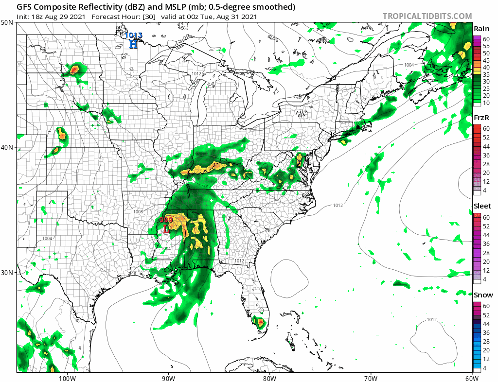
There isn’t much happening on the radars today. Some scattered showers are popping up in Western Pennsylvania and Western NY. Along the coast conditions are mostly quiet.
WEATHER RADAR

The front passes tonight and stalls offshore. This will leave us in a bit of a no mans land on Tuesday with some breaks of sun through increasing clouds. Highs will reach into the 80s in most places but clouds will cap temperatures. Then attention turns to the remnant low of Ida which will basically become a non tropical wave on a stalled cold front. Tropical moisture will be abundant and the heavy rains will shift to north and west of the low track as often happens when tropical systems reach our latitude and lose their tropical structure.
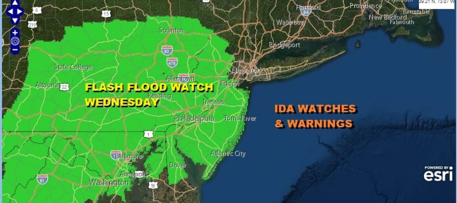
Ida has slowed since yesterday so it appears the main rain will be during Wednesday and Wednesday night and exiting Thursday morning. The first flash flood watches are up for New Jersey and Pennsylvania and points south and west. We are likely to see additional watches go up later today or Tuesday for the Hudson Valley and parts of Southern New England and Long Island.
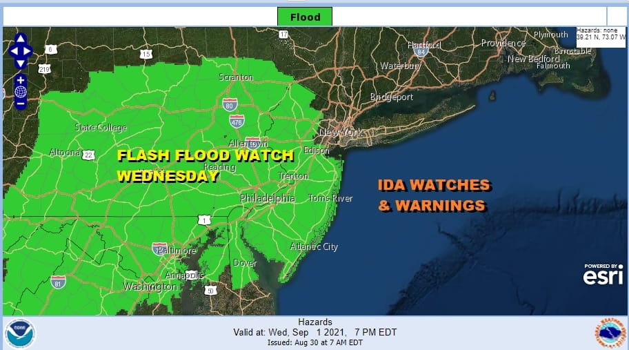
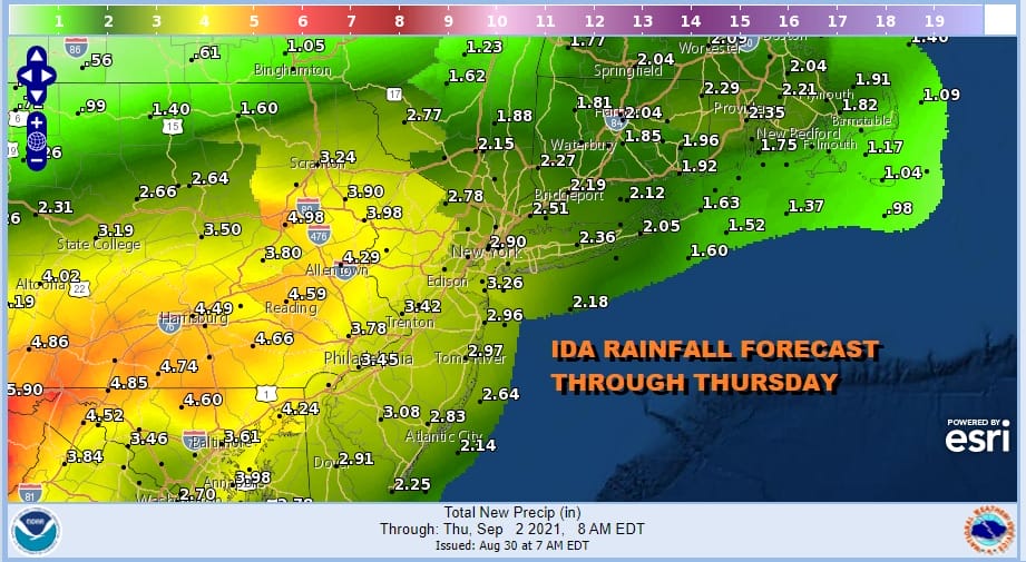
As for rainfall forecast amounts, the Weather Prediction Center is forecasting a 4 to 6 inch band of rain across much of the area. The local NWS office forecasts are a bit lower. For now I will lean to the lower end of the range rather than the high end. The bottom line is that we will get a soaking rain and some areas will see flash flooding.
Ida’s remnant low and front will slide offshore Thursday and behind it there will be beautiful dry air mass to take us into the Holiday weekend. Humidity levels will drop sharply Thursday and we will see low humidity and sunshine Friday and Saturday with highs in the 70s and nights in the 50s to near 60. We will see a solid start to the Labor Day holiday weekend.
BE SURE TO DOWNLOAD THE FREE METEOROLOGIST JOE CIOFFI WEATHER APP &
ANGRY BEN’S FREE WEATHER APP “THE ANGRY WEATHERMAN!

MANY THANKS TO TROPICAL TIDBITS & F5 WEATHER FOR THE USE OF MAPS
Please note that with regards to any severe weather, tropical storms, or hurricanes, should a storm be threatening, please consult your local National Weather Service office or your local government officials about what action you should be taking to protect life and property.


