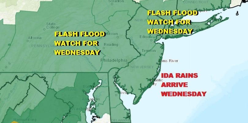
Flash Flood Watch Eastern Pa, New Jersey, Hudson Valley,
NYC, Long Island, Southern New England

Weather in 5/Joe & Joe Weather Show Latest Podcast
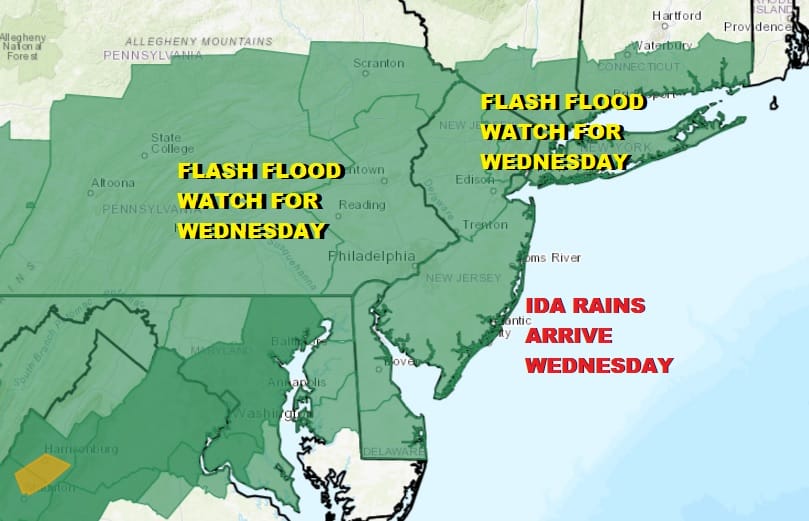
Flash Flood Watch Eastern Pa, New Jersey, Hudson Valley,
NYC, Long Island, Southern New England
Flash Flood Watches have been extended eastward and now cover all regions of the Eastern half of Pennsylvania to Southern New England southward into Maryland and Northern Virginia. Heavy rains from Ida are moving into the Tennessee Valley tonight and then will spread northward up the Appalachians Tuesday and into the Northeast and Mid Atlantic states Wednesday into early Thursday.
Ahead of all this we have a cold front coming through tonight that is going to stall just offshore on Tuesday. Ahead of it thanks to the daytime heating today, we are seeing scattered thunderstorms developing. Not everyone will see these thunderstorms but the risk is there until the front passes late tonight. Lows will be in the upper 60s and lower 70s.
SATELLITE

WEATHER RADAR

Tuesday we should see some sunshine but clouds will be moving slowly into the picture during the day. Highs will be reaching into the lower 80s with the humidity levels on the high side. Then we watch the remnant low of Hurricane Ida move northeastward into the Central Appalachians and then the low makes its way to the New Jersey coast Wednesday night into Thursday morning. It will move along the frontal boundary that will be stalled to our south.

Rain overspreads the area late Tuesday night and during Wednesday from west to east. The heaviest rains will fall along and just to the north of the low track. This system will be loaded with tropical moisture and expect rainfall amounts on average to be in the range of at least 2 to 4 inches and higher amounts are certainly possible. There might be some thunderstorms and severe weather in the mix especailly from Central New Jersey southward and we will evaluate that risk come Wednesday. This system exits Thursday morning and will be replaced by a delightful Canadian air mass to finish the week and start the Labor Day weekend. Low humidity and sunshine will be with us Friday and Saturday. We should actually start to see improvement on Thursday after the system departs. This will leave us in a world where highs will be in the 70s. Lows will be down in the 50s and the humidity will be very low. We will probably turn warmer and more humid for Sunday and Monday but the risks for any showers this weekend will be confined to Saturday night when some scattered showers are possible with a warm front going by and perhaps late Monday when a front drops southward from upstate NY.
BE SURE TO DOWNLOAD THE FREE METEOROLOGIST JOE CIOFFI WEATHER APP &
ANGRY BEN’S FREE WEATHER APP “THE ANGRY WEATHERMAN!

MANY THANKS TO TROPICAL TIDBITS & F5 WEATHER FOR THE USE OF MAPS
Please note that with regards to any severe weather, tropical storms, or hurricanes, should a storm be threatening, please consult your local National Weather Service office or your local government officials about what action you should be taking to protect life and property.


