
Flash Flood Watch Continues 2 to 5 Inches of Rain Wednesday Dry Cool Air Follows

Weather in 5/Joe & Joe Weather Show Latest Podcast
Flash Flood Watch Continues 2 to 5 Inches of Rain Wednesday Dry Cool Air Follows
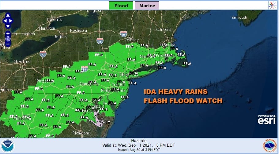
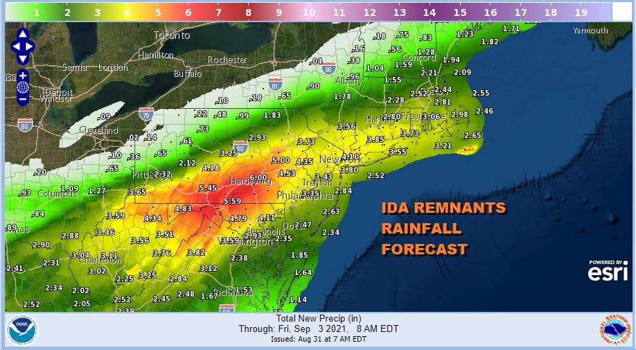
The remnant low and the rains of Ida continue to march to the northeast and we have widespread flash flood watches posted from the Central Appalachians to Southern New England. The rains will arrive Wednesday morning and last into early Thursday morning when the low moves offshore and then heads away to the northeast. Rainfall amounts will be in a range of 2 to 5 inches in most places with some locally higher amounts making flash flooding likely especially in the usual suspect spots.
Before we get to those rains we have today and clouds are overhead thanks to a stalled out frontal boundary sitting overhead. There should be some veiled sunshine before the clouds completely take over and high temperatures this afternoon with highs reaching the upper 70s and lower 80s. Humidity is on the high side as tropical air is entrenched along that boundary setting us up for heavy rains.
SATELLITE

WEATHER RADAR
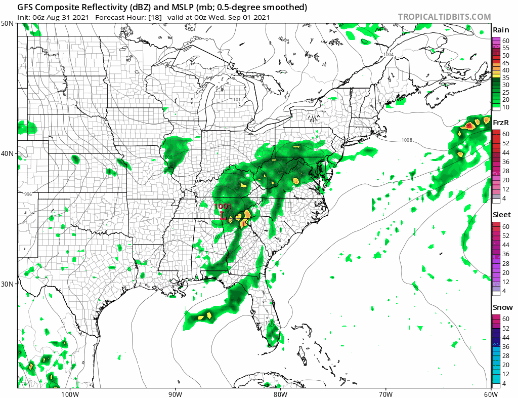
Regional radar isn’t show much at the moment but expect the rains of Ida to come into view later today to the southwest with the first echoes showing up this evening in Northern Virginia and Maryland and then coverage increases overnight. Rain should arrive in the hours before daybreak to the west and then overspread Eastern Pennsylvania to Southern New England Wednesday morning.

It seems that the remnant low is moving a little faster which means if it gets in sooner it gets out sooner. The heaviest rains will likely develop Wednesday afternoon and continue Wednesday night. The low will head offshore early Thursday morning and the rains will be ending from west to east at that point.
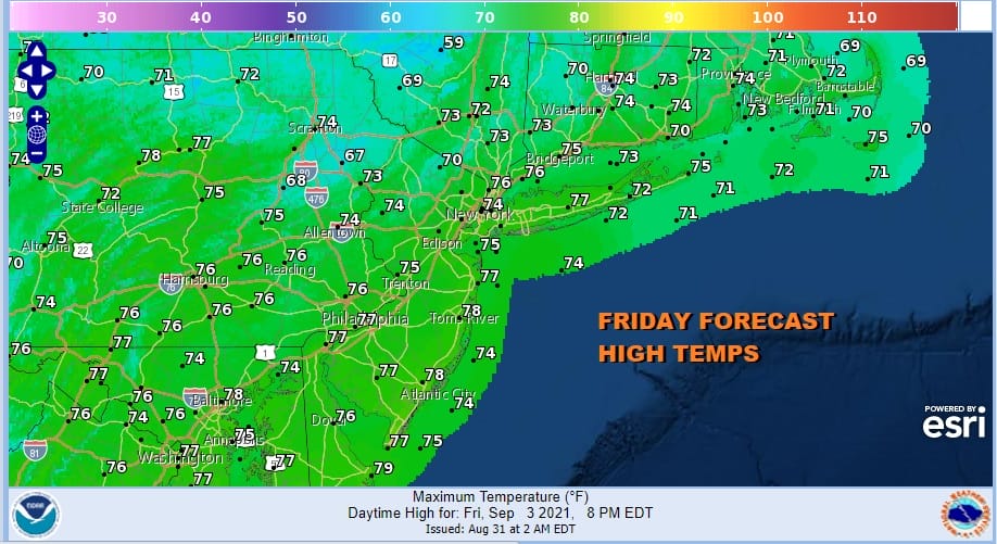
There is a positive payoff to all of this. Ida is hooking up with a trough in Eastern Canada and that will create a strong northerly flow of cooler drier air that will arrive during Thursday when temperatures will be just in the 70s. Leftover clouds will be around Thursday with perhaps some late day clearing. then it is on to a beautiful day Friday with sunshine and highs just in the 70s.
The dry air lasts into Saturday which is the start of the third and final holiday weekend of the summer. The first two had rain issues for at least parts of those weekends and we will address the Labor Day weekend in a separate post later today.
BE SURE TO DOWNLOAD THE FREE METEOROLOGIST JOE CIOFFI WEATHER APP &
ANGRY BEN’S FREE WEATHER APP “THE ANGRY WEATHERMAN!

MANY THANKS TO TROPICAL TIDBITS & F5 WEATHER FOR THE USE OF MAPS
Please note that with regards to any severe weather, tropical storms, or hurricanes, should a storm be threatening, please consult your local National Weather Service office or your local government officials about what action you should be taking to protect life and property.


