Hurricane Warnings North to Coastal North Carolina
Hurricane Matthew Along NE Florida Coast
Category 3 Winds 115 MPH
HURRICANE MATTHEW SATELLITE LOOP

Hurricane Warnings Hurricane Matthew
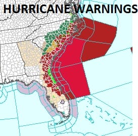
Hurricane Warnings extend northward to include all of coastal North Carolina up to the Virginia border. Hurriane Matthew continues its unrelenting march northward along the Florida coast with the eye remaining barely offshore. Winds along the coast have been 60 to 70 mph sustained with gusts past hurricane force. The strongest winds from Hurricane Matthew remain offshore
HURRICANE MATTHEW REAL TIME RADAR LOOPS


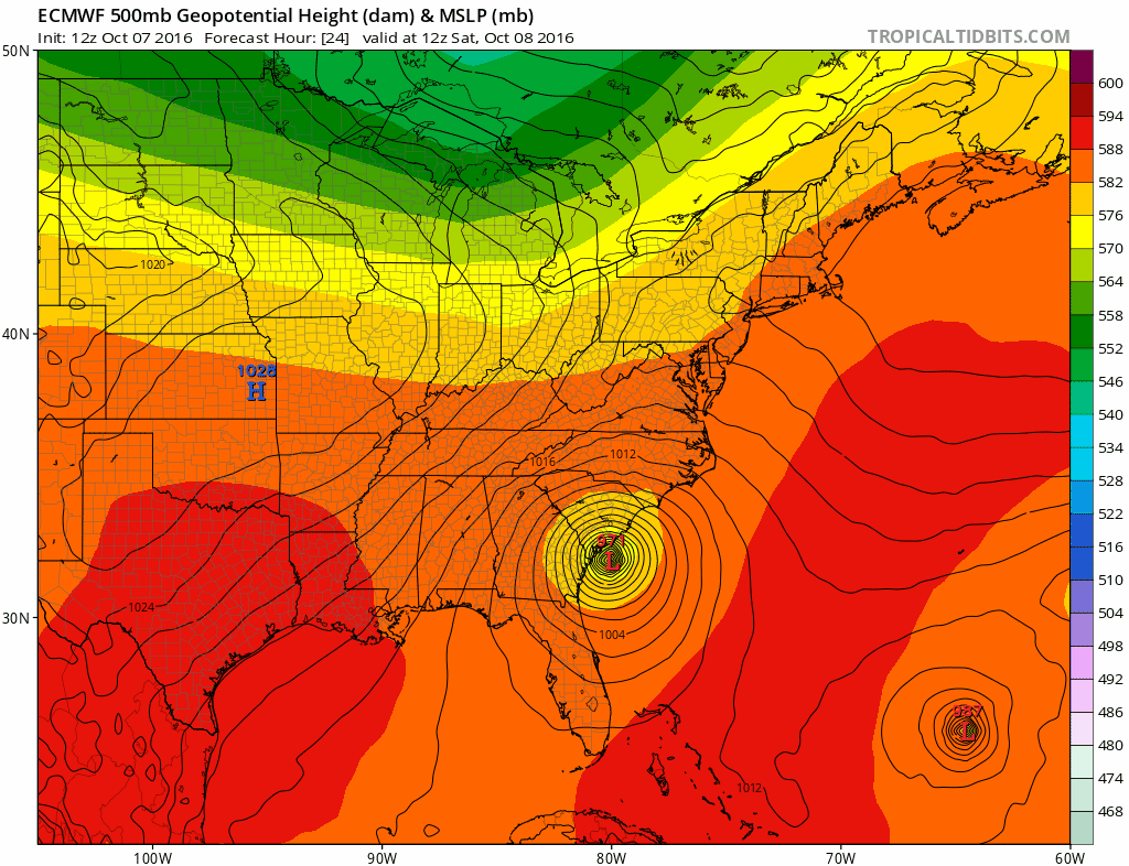
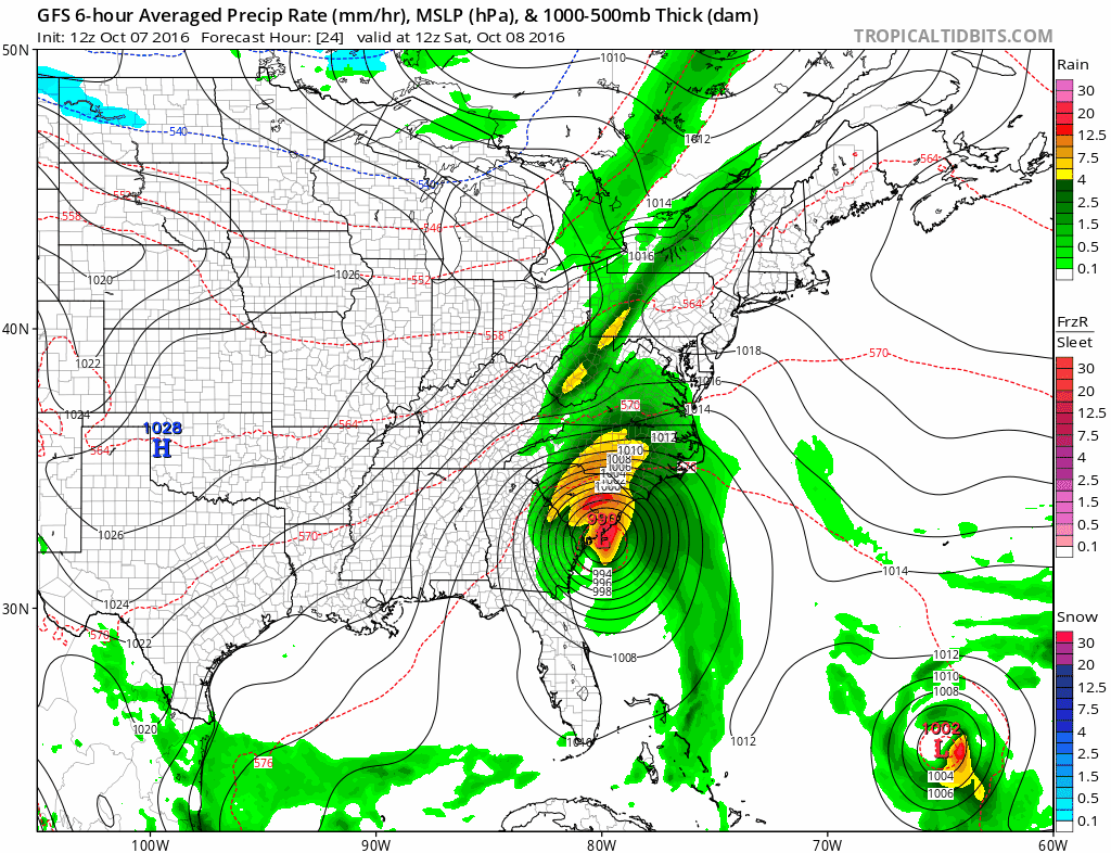
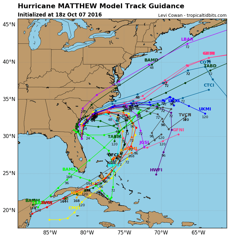
As Matthew moves northward the windfield on the west side is slowly expanding westward judging from the wind observations and this is consistent with a storm that is beginning to feel the impacts of an approaching trough to the northwest. The rain fields expand on the west side and there could be substantial flooding rains along and inland of the coast until Matthew begins the turn east. Weather models continue to show the southward loop back to the Bahamas while Tropical Storm Nicole dumbells northwestward to east of Bermuda. The two systems get very close to each other in the process.
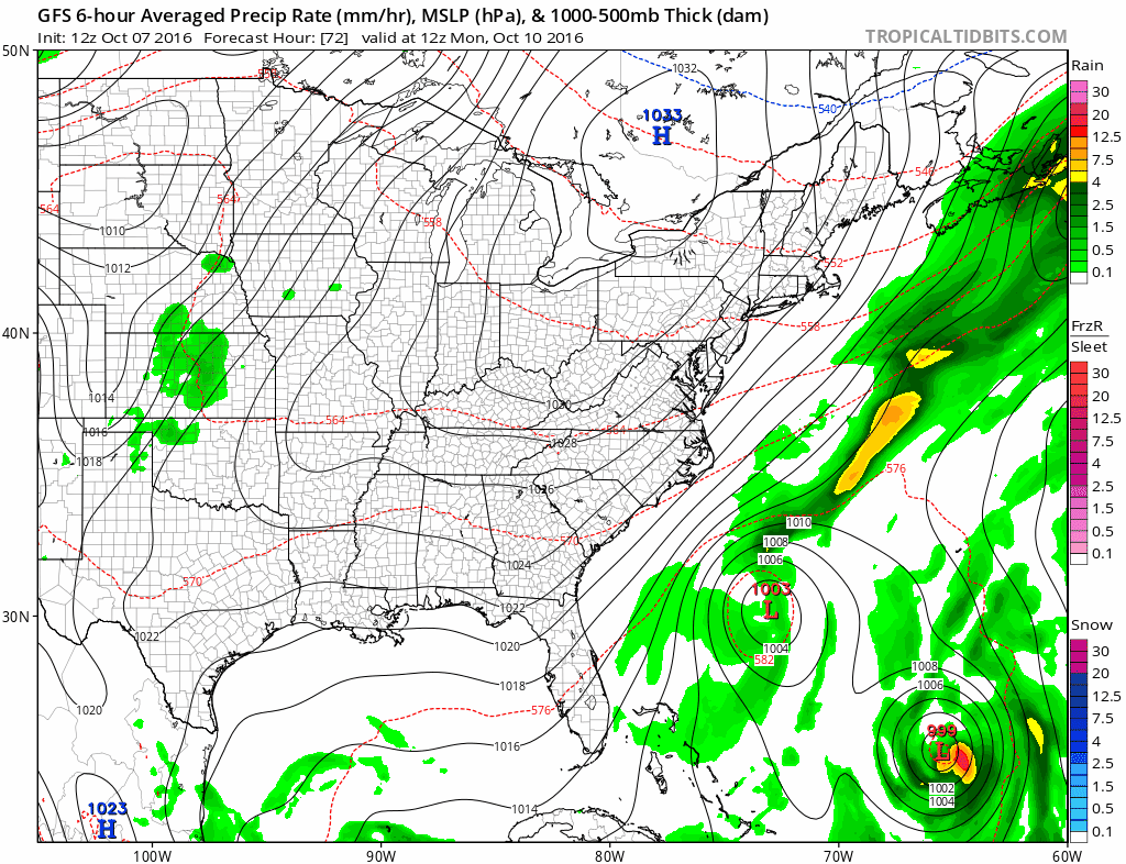
While all this is going on our weather remains relatively tranquil and cool for Sunday and the first part of next week as high pressure builds in. Showers late Saturday will occur with the approaching front and upper trough. Most hurricane models take Hurricane Matthew on the looping trip.
WINTER 2016-2017 PART 3 NEW JERSEY
WINTER 2016-2017 PART 1 OCEAN WATER TEMPERATURES
WINTER 2016-2017 PART 2 ARCTIC SEA ICE AND SIBERIAN SNOW COVER
FiOS1 News Weather Forecast For Long Island
FiOS1 News Weather Forecast For New Jersey
FiOS1 News Weather Forecast For Hudson Valley
NATIONAL WEATHER SERVICE SNOW FORECASTS
LATEST JOESTRADAMUS ON THE LONG RANGE

Weather App

Don’t be without Meteorologist Joe Cioffi’s weather app. It is really a meteorologist app because you get my forecasts and my analysis and not some automated computer generated forecast based on the GFS model. This is why your app forecast changes every 6 hours. It is model driven with no human input at all. It gives you an icon, a temperature and no insight whatsoever.
It is a complete weather app to suit your forecast needs. All the weather information you need is right on your phone. Android or I-phone, use it to keep track of all the latest weather information and forecasts. This weather app is also free of advertising so you don’t have to worry about security issues with your device. An accurate forecast and no worries that your device is being compromised.
Use it in conjunction with my website and my facebook and twitter and you have complete weather coverage of all the latest weather and the long range outlook. The website has been redone and upgraded. Its easy to use and everything is archived so you can see how well Joe does or doesn’t do when it comes to forecasts and outlooks.
Just click on the google play button or the apple store button on the sidebar for my app which is on My Weather Concierge. Download the app for free. Subscribe to my forecasts on an ad free environment for just 99 cents a month.
Get my forecasts in the palm of your hand for less than the cost of a cup of Joe!
