Humidity Rages Severe Weather Threat Friday Improving Weekend
Humidity Rages Severe Weather Threat Friday
Improving Weekend
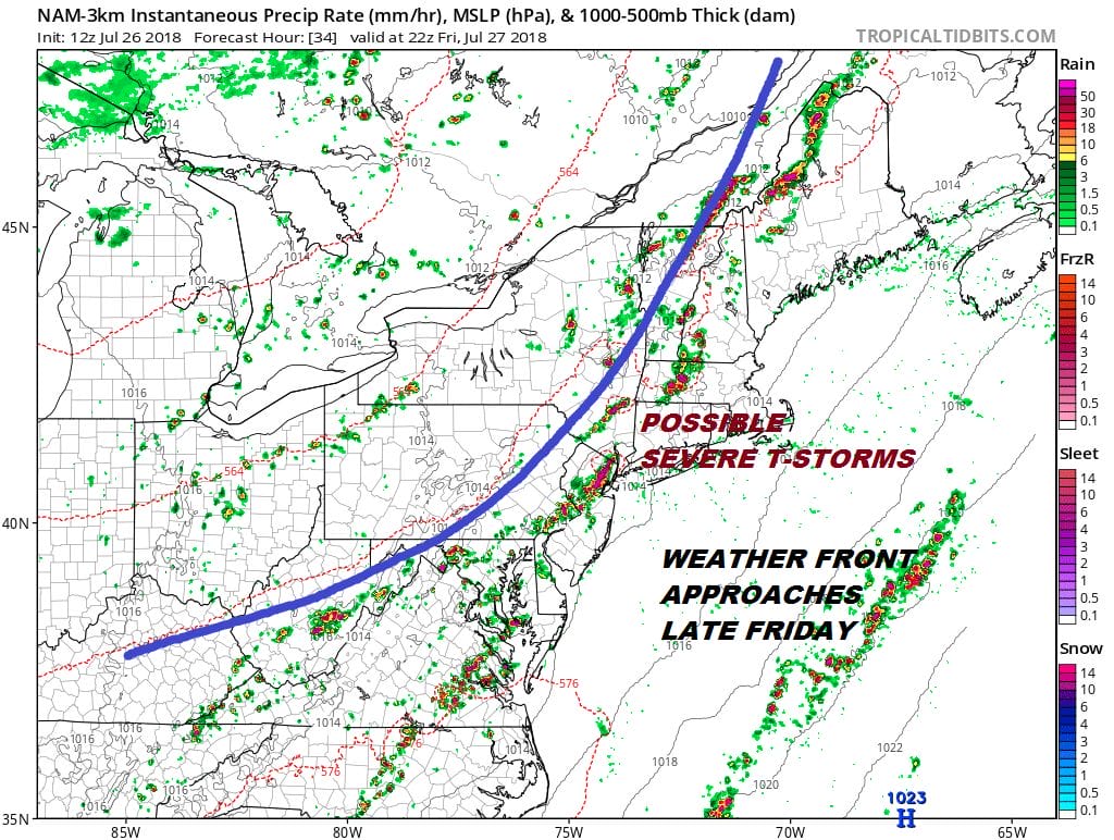
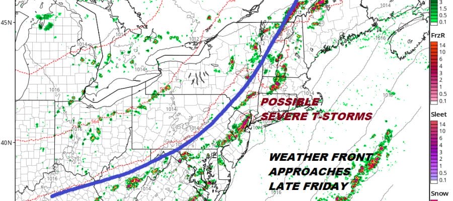
Many of the measures of the atmosphere are pointing to a risk for severe weather on Friday. Measures of instability are moderately high, dew points are off the wall (again) so we will roll the dice with this cold front and see what happens. Clearly areas in the Eastern half of Pennsylvania are on tender hooks with regards to more rain on top of the foot of rain that has fallen in some areas. Fortunately this front will be moving along so it will likely be one solid shot of thunderstorms before weather conditions improve.
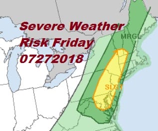
There is no change to the Storm Prediction Center’s severe weather outlook for Friday. A slight risk of severe weather covers everyone from Central Pennsylvania to Western Long Island northeast into New England including most of Connecticut.
EASTERN SATELLITE

Latest satellite and radar this afternoon would suggest that pop up downpours and thunderstorms will be minimal if at all going into this evening. Weather action today has been in New England as yesterday’s trough continues to kick away to the northeast,
REGIONAL RADAR

LOCAL RADAR NEW YORK CITY

LOCAL RADAR PHILADELPHIA


Conditions obviously remain very warm and very humid tonight and on Friday. Some sunshine should start things off on Friday as highs climb well into the 80s to near 90 before thunderstorms develop in the afternoon and move to the east. Once those storms are done we can lean on the side of optimism for the weekend. Saturday looks like sunshine will dominate though there will be clouds in areas well to the east and from Southern New Jersey southward. In these areas a shower or thunderstorm can’t be ruled out. The humidity will be lower on Saturday but it won’t exactly be dry. It will feel better by comparison.
SUNDAY FORECAST HIGH TEMPERATURES
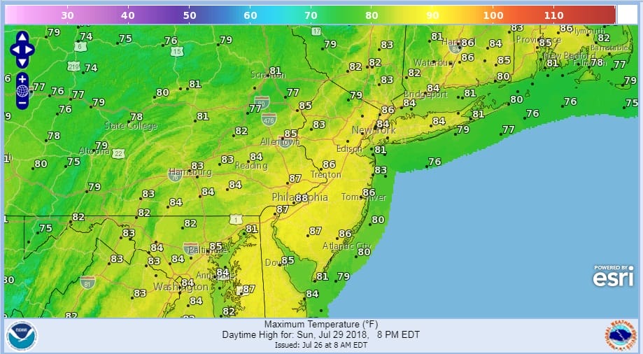
Sunday we should see dew points down in the lower 60s so it will definitely feel better but not exactly ideal. Sunday looks nice and sunny with highs in the 80s. We might be able to squeeze out Monday before humidity runs back up with the chance for showers again Tuesday and Wednesday.
 GET JOE A CIGAR IF YOU LIKE

FiOS1 News Weather Forecast For Long Island
FiOS1 News Weather Forecast For New Jersey
FiOS1 News Weather Forecast For Hudson Valley
NATIONAL WEATHER SERVICE SNOW FORECASTS
LATEST JOESTRADAMUS ON THE LONG RANGE


