
Severe Weather Risk Strong Thunderstorms Late This Afternoon Evening
Severe Weather Risk Strong Thunderstorms
Late This Afternoon Evening
The Storm Prediction Center of the National Weather Service has the a large portion of the Northeast and Northern Middle Atlantic region at risk for severe weather late this afternoon and tonight. The highest risk appears to be from the Eastern half of Maryland to Western New England including all of New Jersey and much of Eastern Pennsylvania. The risk area cuts off right along the immediate coast of Long Island and Southern New England as usual thanks to an ocean component to the wind.

There are a couple of issues here regarding anytime severe weather is forecast. First is going to be the natural variation that occurs. Thunderstorm lines are rarely even so weather is going to vary from place to place. I think this is a situation where most of you will likely see some thunderstorm activity and some (but not all) are likely to see severe thunderstorms. The other big issue is for much of Eastern & Southern Pennsylvania which is still absorbing the 1 foot plus rains of earlier this week. These thunderstorms are going to at least move along and not sit over any particular area for a long period of time. However an inch of rain in half an hour if produced will likely produce flash flooding as the threshold right now is extremely low. The ground is absolutely saturated and any rain is likely to run off rather quickly.


Above are all the local radars that will be in play later today. The risk times for areas in the Eastern Half of Pennsylvania look to be after 2-3pm, for New Jersey after 4-5pm, and for NYC, Hudson Valley, Connecticut & Long Island probably after 5pm.
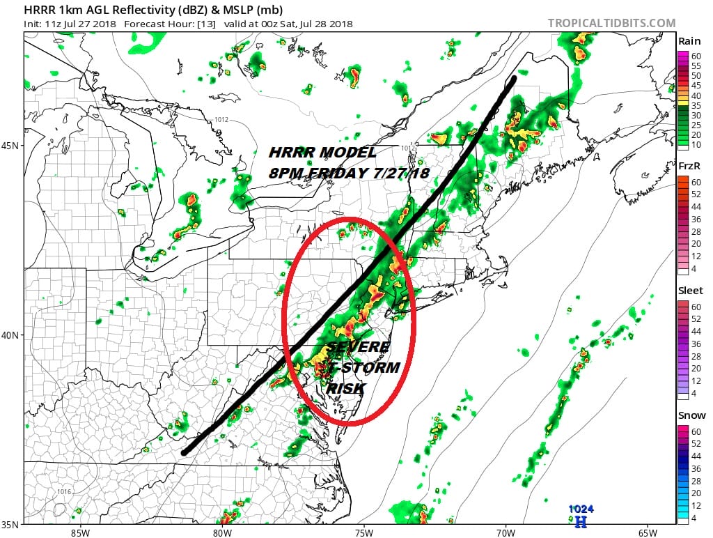
The HRRR model which lately has not been very reliable paints the grimmest picture of severe weather for tonight. The map above is what it sees for 8pm tonight. It takes longer for it to move a line across but it does show some renegade scattered thunderstorms that develop well ahead of the main line during this afternoon. Weather models are as usual all over the place regarding who gets what when and where so the best approach is to assume that the risk is there regardless.
FiOS1 News Weather Forecast For Long Island
FiOS1 News Weather Forecast For New Jersey
FiOS1 News Weather Forecast For Hudson Valley
NATIONAL WEATHER SERVICE SNOW FORECASTS
LATEST JOESTRADAMUS ON THE LONG RANGE