HRRR Model Bullish On Rain Tonight
HRRR Model Bullish On Rain Tonight
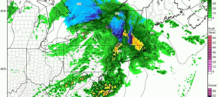
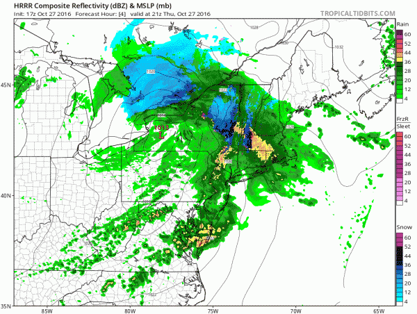
The storm system in Western New York is beginning the process of redeveloping just off our coast line. Since the redevelopment is happening on top of us we will participate in some of the convective development that is beginning to show up on satellite and radars.


Rain is building up and we should get into a good shot of it this evening and the first part of tonight. The HRRR model shows rain and some thunderstorms developing throughout the evening.
HRRR MODEL RAINFALL
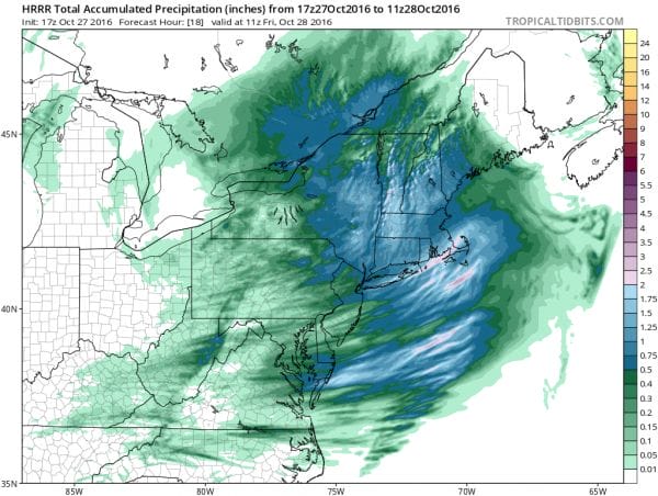
Rainfall amounts on the HRRR model range from a half inch to an inch and a half or more over parts of Long Island and Southern New England. Rain ends from west to east around 11pm in western areas of New Jersey and Eastern Pennsylvania to about 3 am over Eastern Connecticut and Long Island. Friday will be chilly with some sun and clouds. Then temperatures warm over the weekend with the next cold front arriving Sunday afternoon with a passing shower. Saturday’s highs will be in the 60s and Sunday will be in the upper 60s to lower 70s.
MANY THANKS TO TROPICAL TIDBITS FOR THE WONDERFUL USE OF THE MAPS
SNOW REMOVAL COMPANIES FOR YOUR WINTER NEEDS
LONG ISLAND ROCKLAND COUNTY Connecticut

![]()

WINTER WEATHER OUTLOOK VIDEOS
In case you missed them I’ve been previewing the upcoming winter in a series of posts and videos. Here are the first 2. More will be coming along. Links to the latest posts are below.
NEW JERSEY
LONG ISLAND AND NEARBY
WINTER 2016-2017 PART 3 NEW JERSEY
WINTER 2016-2017 PART 1 OCEAN WATER TEMPERATURES
WINTER 2016-2017 PART 2 ARCTIC SEA ICE AND SIBERIAN SNOW COVER
FiOS1 News Weather Forecast For Long Island
FiOS1 News Weather Forecast For New Jersey
FiOS1 News Weather Forecast For Hudson Valley
NATIONAL WEATHER SERVICE SNOW FORECASTS
LATEST JOESTRADAMUS ON THE LONG RANGE

Weather App

Don’t be without Meteorologist Joe Cioffi’s weather app. It is really a meteorologist app because you get my forecasts and my analysis and not some automated computer generated forecast based on the GFS model. This is why your app forecast changes every 6 hours. It is model driven with no human input at all. It gives you an icon, a temperature and no insight whatsoever.
It is a complete weather app to suit your forecast needs. All the weather information you need is right on your phone. Android or I-phone, use it to keep track of all the latest weather information and forecasts. This weather app is also free of advertising so you don’t have to worry about security issues with your device. An accurate forecast and no worries that your device is being compromised.
Use it in conjunction with my website and my facebook and twitter and you have complete weather coverage of all the latest weather and the long range outlook. The website has been redone and upgraded. Its easy to use and everything is archived so you can see how well Joe does or doesn’t do when it comes to forecasts and outlooks.
Just click on the google play button or the apple store button on the sidebar for my app which is on My Weather Concierge. Download the app for free. Subscribe to my forecasts on an ad free environment for just 99 cents a month.
Get my forecasts in the palm of your hand for less than the cost of a cup of Joe!