Hot Temperatures Begin Sunday Lasting Through Wednesday
Hot Temperatures Begin Sunday Lasting Through Wednesday
The signature all spring has been the volatile flips from very cool to hot as we saw back in May. We still have some relatively cool weather the next 2 days though the sunshine will do its job to take temperatures higher especially on Friday. Thursday is looking like an okay day overall. Low pressure developing along the East Coast will move northeast and probably bring some clouds our way during Thursday along coastal areas but less so inland. Highs should reach the 70s except perhaps areas the the east of New York City including Coastal Connecticut and Long Island where clouds may be an issue. Rain may clip Eastern Long Island briefly tomorrow night before the low moves away to the northeast.
SATELLITE LOOP

REGIONAL RADAR

LOCAL RADAR NEW YORK CITY

LOCAL RADAR PHILADELPHIA


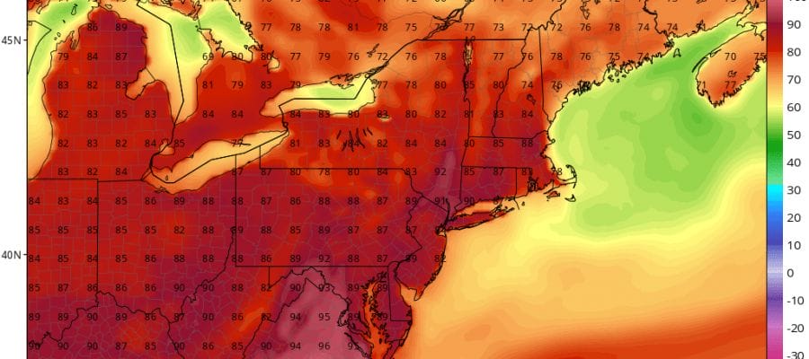
Friday should see a fair amount of sunshine with highs in the 70s to near 80. Saturday brings sunshine and warmer temperatures with highs into the 80s in most places. There might be a shower or thunderstorm Saturday night in a few spots as hot air arrives. Sunday begins the hot temperatures with highs in the 80s to near 90. Then it is hot temperatures with increasing humidity Monday and Tuesday with highs into the 90s.
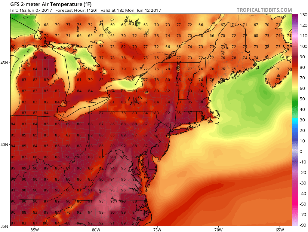 A weak backdoor cold front may try and pass through early on Wednesday. This may cool off areas north of New York City to some degree but it could still be 90 or higher in areas to the south like Southern New Jersey & Southeastern Pennsylvania.
 GET JOE A CIGAR IF YOU LIKE

LANDSCAPE COMPANIES FOR YOUR NEEDS
LONG ISLAND ROCKLAND COUNTY Connecticut

![]()

ROCKLAND COUNTY TRI STATE SNOW REMOVAL JOHNSTOWN PA


FiOS1 News Weather Forecast For Long Island
FiOS1 News Weather Forecast For New Jersey
FiOS1 News Weather Forecast For Hudson Valley
NATIONAL WEATHER SERVICE SNOW FORECASTS
LATEST JOESTRADAMUS ON THE LONG RANGE
Weather App

Don’t be without Meteorologist Joe Cioffi’s weather app. It is really a meteorologist app because you get my forecasts and my analysis and not some automated computer generated forecast based on the GFS model. This is why your app forecast changes every 6 hours. It is model driven with no human input at all. It gives you an icon, a temperature and no insight whatsoever.
It is a complete weather app to suit your forecast needs. All the weather information you need is right on your phone. Android or I-phone, use it to keep track of all the latest weather information and forecasts. This weather app is also free of advertising so you don’t have to worry about security issues with your device. An accurate forecast and no worries that your device is being compromised.
Use it in conjunction with my website and my facebook and twitter and you have complete weather coverage of all the latest weather and the long range outlook. The website has been redone and upgraded. Its easy to use and everything is archived so you can see how well Joe does or doesn’t do when it comes to forecasts and outlooks.
Just click on the google play button or the apple store button on the sidebar for my app which is on My Weather Concierge. Download the app for free. Subscribe to my forecasts on an ad free environment for just 99 cents a month.
Get my forecasts in the palm of your hand for less than the cost of a cup of Joe!


