Hot Humid Next Few Days Isolated Pop Up Showers Summery Week Ahead

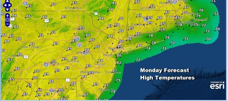
After a warm and increasingly humid weekend we have a very warm to borderline hot and humid next couple of days. Today is another day of some sunshine. There is a small chance for pop up showers or a thunderstorm but they should be few and far between. Since we keep starting each day with a higher launching pad, highs this afternoon will reach the mid 80s to around 90 degrees with cooler readings found right along the shore. There isn’t much movement in the pattern during the early part of the week. A cold front will approach for Tuesday night and Wednesday.
SATELLITE

REGIONAL RADAR

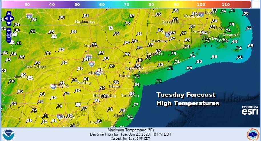
Tonight will be another warm and humid night with lows in the mid 60s to lower 70s. Sunshine Tuesday will take highs again to the upper 80s to some lower 90s though again it will be cooler at the shore.
A cold front will move slowly east across Pennsylvania and that could set off some thunderstorms Tuesday evening in Eastern Pennsylvania into Western New Jersey however most of those storms will likely weaken as they move east toward the coast. The NAM model loop below for Tuesday afternoon into Wednesday morning shows those storms approaching and then mostly weakening overnight.

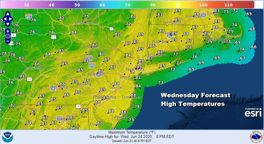
The front is going to stall out along the coast on Wednesday but it is rather weak. It will leave us in very warm and humid conditions. There will be a chance for a shower or thunderstorm popping up again with highs a shade lower than Tuesday in the mid to upper 80s.
Dew points might come down a little for Thursday and Friday leaving us in sun and clouds with highs both days in the 80s. Another front and upper trough will approach on Friday so perhaps a shower or thunderstorm is possible. The bottom line for this week is that for much of the time for most of the area it will be rain free. Next weekend brings another rise in dew points as a warm front moves through and there might be some showers and thunderstorms around at some point next weekend. On the whole it is a summery week and a good week to find relief in a pool or at the beach.
BE SURE TO DOWNLOAD THE FREE METEOROLOGIST JOE CIOFFI WEATHER APP &
ANGRY BEN’S FREE WEATHER APP “THE ANGRY WEATHERMAN!
MANY THANKS TO TROPICAL TIDBITS FOR THE USE OF MAPS
Please note that with regards to any severe weather, tropical storms, or hurricanes, should a storm be threatening, please consult your local National Weather Service office or your local government officials about what action you should be taking to protect life and property.


