DOWNLOAD MY NEW FREE JOESTRADAMUS WEATHER APP FOR ALL DEVICES
THE APP IS ABSOLUTELY FREE TO ALL BUT CONSIDERING SUBSCRIBING TO PATREON FOR A WEATHER EXPERIENCE FREE OF ADS, EXCLUSIVE VIDEOS FOR MEMBERS ONLY AND MUCH MORE…STARTS AT $2 A MONTH..MESSAGE ME AT ANY TIME
High Wind Warning Continues Winds Gusting 60 MPH
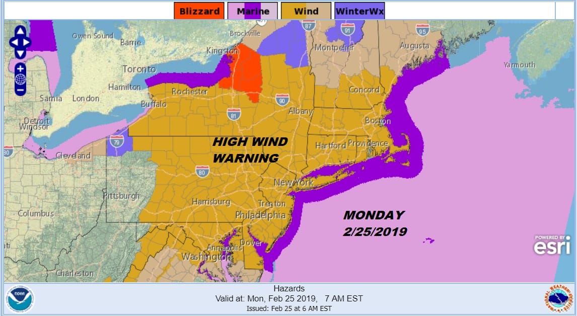
The very busy wind continues today with high wind warnings covering much of the Northeast US. Winds overnight have been gusting 50 to 60 mph and that continues today. We are going to see some sunshine but the flow off the Great Lakes is producing some snow shower activity nearby. Upstate NY near Lake Ontario we have a Blizzard Warning with heavy snows coming east of Lake Ontario.
EASTERN SATELLITE

REGIONAL RADAR

We can see the streamers of snow showers off the Great Lakes strung out from west to east across Upstate NY and across Pennsylvania. These snow showers are moving southeastward. It wouldn’t be a shocker to see a few snow flakes flying around today. Temperatures will be in the 30s to near 40 all day and wind chills will be in the teens and lower 20s.
LOCAL RADAR NEW YORK CITY

LOCAL RADAR PHILADELPHIA


Winds will very slowly start to ease overnight and Tuesday morning though they will still remain busy overnight but off the peaks of today. Lows tonight will be in the 20s to near 30. Tuesday we will see less wind and some sunshine with highs in the 30s.
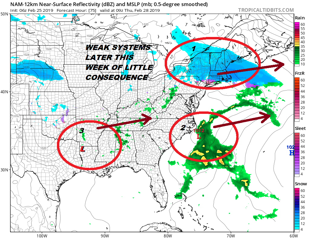
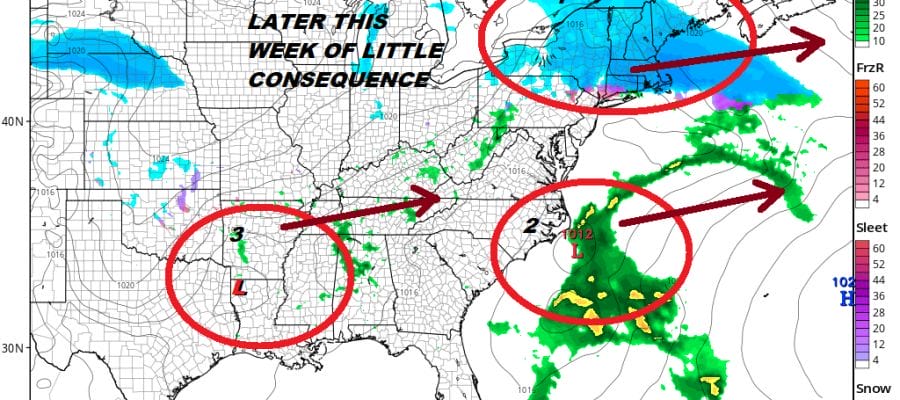
There are some storm systems on the table for later this week and they are all on the weak side. Wednesday we watch low pressure moving across the Midwest and into NY State and then eventually just offshore. This looks like it could produce a few inches in some places north of the low track. For now we will lean toward areas to the north of NYC and confine it to upstate NY and New England. There is a low coming out of the Gulf States, another weak system, that is heading east northeastward. Once again there is nothing to stop it from running out to the east. A third system will head here Friday which also looks week. Then we have another storm system this weekend that heads to the Lakes. There will probably be a secondary developing with this along the coast but there doesn’t appear to be any cold air around for serious snow issues. It is very hard for me to get worked up over what is on the weather maps this morning. The next 10 days to 2 weeks will be the last chance for snow lovers to see anything as I expect spring to arrive on time this year.
MANY THANKS TO TROPICAL TIDBITS FOR THE USE OF MAPS
Please note that with regards to any tropical storms or hurricanes, should a storm be threatening, please consult your local National Weather Service office or your local government officials about what action you should be taking to protect life and property.


