Heatwave Breaks Soaking Rain Iffy Weekend
Heatwave Breaks Soaking Rain Iffy Weekend
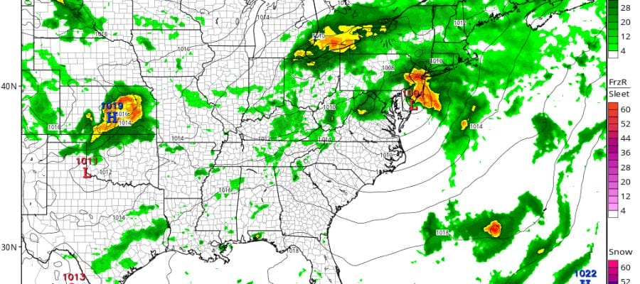
We have 2 more hot days to deal with as this heatwave runs its course. It will break on Friday. How it breaks will be key because we have a shot for some widespread rain in what will be a rather unusual set up. You usually don’t get waves that go by to our south this time of year. However there is going to be a decent set up for an onshore flow of moisture and low pressure coming out of the Tennessee Valley and passing just offshore. These kind of systems this time of year can be big rain producers. The drought pattern would suggest otherwise but some models are bullish on the idea of a 1 to 2 inch general rainfall for most of the area beginning late Thursday night and ending late in the day Friday or Friday evening.
HEATWAVE BREAKS GFS UPPER AIR FORECAST THURSDAY
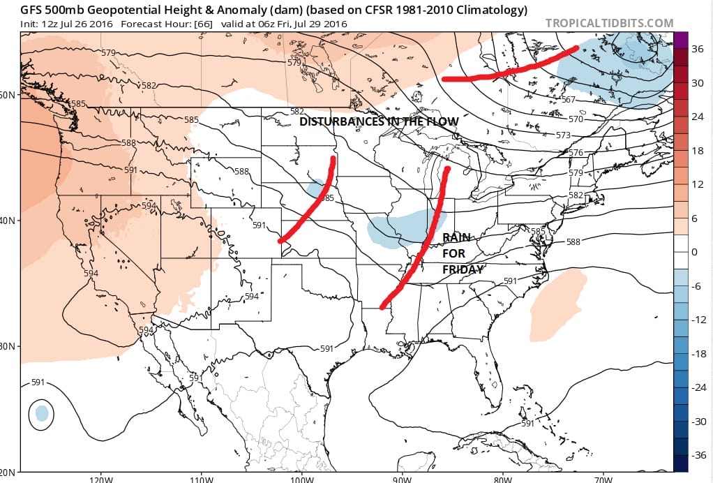
The upper air flow shows disturbances moving along in the flow. Under the right circumstances you can do pretty well with rainfall from these things as the upper support lifts up and squeezes all the tropical air out of the atmosphere. However I would caution that given the overall drought pattern, every drop of rain seems to be a battle.
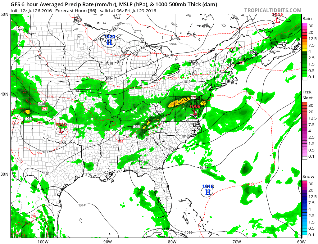
HEATWAVE BREAKS GFS SURFACE FRIDAY MORNING
HEATWAVE BREAKS GFS FORECAST FRIDAY AFTERNOON

Already the GFS seems to be backing off a little from prior runs showing a less deep surface low moving by with less rainfall being produced. The NAM is more bullish on rainfall but it has a way overdeveloped surface low to our south Friday afternoon. This seems unrealistic.
HEATWAVE BREAKS NAM MODEL FRIDAY AFTERNOON

The other issue is what happens after this goes by. The European model has a second low coming in with a soaking rain for later Saturday night and Sunday while keeping Saturday dry. The GFS is weaker and would have a more optimistic view for the weekend. I’ve decided that for now to mention the chance for showers on both weekend days but favoring Saturday to be more dry than not. Right now the weekend is in question. Needless to say that after Thursday the 90s are done for awhile. Friday could be a struggle getting into the 80s depending on cloud cover, rain and wind. Saturday should be in the 80s and then the same question holds for Sunday depending on clouds and rain.

MENTION JOE CIOFFI AND GET A 5% DISCOUNT
FiOS1 News Weather Forecast For Long Island
FiOS1 News Weather Forecast For New Jersey
FiOS1 News Weather Forecast For Hudson Valley
NATIONAL WEATHER SERVICE SNOW FORECASTS
LATEST JOESTRADAMUS ON THE LONG RANGE
Weather App

Don’t be without Meteorologist Joe Cioffi’s weather app. It is really a meteorologist app because you get my forecasts and my analysis and not some automated computer generated forecast based on the GFS model. This is why your app forecast changes every 6 hours. It is model driven with no human input at all. It gives you an icon, a temperature and no insight whatsoever.
It is a complete weather app to suit your forecast needs. All the weather information you need is right on your phone. Android or I-phone, use it to keep track of all the latest weather information and forecasts. This weather app is also free of advertising so you don’t have to worry about security issues with your device. An accurate forecast and no worries that your device is being compromised.
Use it in conjunction with my website and my facebook and twitter and you have complete weather coverage of all the latest weather and the long range outlook. The website has been redone and upgraded. Its easy to use and everything is archived so you can see how well Joe does or doesn’t do when it comes to forecasts and outlooks.
Just click on the google play button or the apple store button on the sidebar for my app which is on My Weather Concierge. Download the app for free. Subscribe to my forecasts on an ad free environment for just 99 cents a month.
Get my forecasts in the palm of your hand for less than the cost of a cup of Joe!

