
Harvey Remnants Moving Slowly Northeast
Harvey Remnants Moving Slowly Northeast
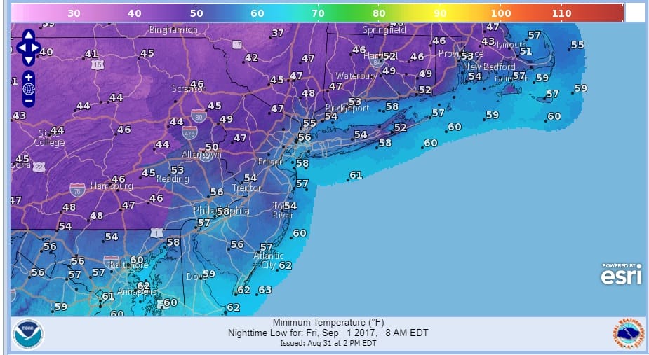
The satellite loop is rather busy looking with the remnants of Harvey moving very very slowly northeastward toward Western Tennessee. Over us a cold front is moving through and behind it is a shot of very cool air that will move in tonight and it will be with us into Saturday. Temperatures reached the 80s this afternoon but tomorrow morning we will be down in the 50s and cold spots north and west of the coast will be in the mid to upper 40s. It is a great way to usher in the first of September which is the first day of meteorological fall.
As far as the front goes it doesn’t have much to work with so there could be the odd shower or thunderstorm this evening scattered around on the radar but they should come and go quickly and skies will clear out overnight.
SATELLITE LOOP

REGIONAL RADAR

LOCAL RADAR NEW YORK CITY

LOCAL RADAR PHILADELPHIA


Friday will be a cool autumn like day with sunshine and some patchy clouds. Highs will just be in the upper 60s and lower 70s at best followed by another very cool night. Saturday morning lows are still in course to be in the 40s except in the warmer urban areas.
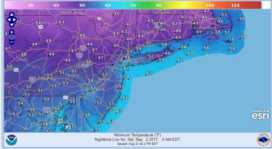
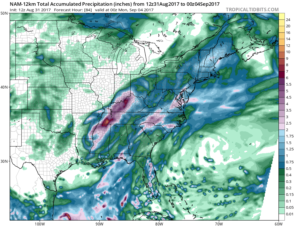
Since the remnants of Harvey are moving so slowly it appears that much of Saturday will be okay with sunshine giving way to some clouds later in the day and there should be no rain on Saturday during the day. I like the NAM model’s view of the rain which moves through Saturday night and it ends during Sunday morning. In places south and west of New York City it could be done before day break. Rainfall amounts look to be in the 1/2 inch to an inch range in most places with more as you go south.
HARVEY RAINFALL FORECAST NAM MODEL
After the rain is done weather conditions should improve Sunday afternoon with highs in the 70s. Monday Labor Day looks warm and summery and moderately humid with sunshine and highs back into the 80s.
Hurricane Irma is a category 2 hurricane out in the tropical Atlantic. We will update the latest on Irma and what weather models have to say later this evening. In the meantime here is the latest Joestradamus post from this morning regarding Irma and the overnight weather models.
 GET JOE A CIGAR IF YOU LIKE

FiOS1 News Weather Forecast For Long Island
FiOS1 News Weather Forecast For New Jersey
FiOS1 News Weather Forecast For Hudson Valley


