Gusty Winds Slow Improvement More Showers Weekend
SHOP THE JOESTRADAMUS STORE
Gusty Winds Slow Improvement More Showers Weekend
A weak weather front is moving through today and we did have a small band of showers move through this morning. The last of those showers are now exiting the coast. We may begin to see some slow improvement as we go through the rest of the day but we emphasize slow. There might be another passing shower or two this afternoon as gusty northwest winds develop. Temperatures at least for today will settle in the 50s and then drop to the upper 20s to mid 30s tonight under clearing skies.
SATELLITE LOOP

REGIONAL RADAR

LOCAL RADAR NEW YORK CITY

LOCAL RADAR PHILADELPHIA


Friday will be the best day of this week with plenty of sunshine and temperatures head into the 50s. Skies will be clear Friday night into Saturday morning before the next cold front approaches. It appears to me that a good chunk of Saturday during the day will be dry and showers with the cold front will likely hold off until late afternoon or evening with highs in the 50s. We will see some showers Saturday night but they should be done by daybreak Sunday. Sunday will be windy and colder with clouds and some sun. Highs will just be in the 40s.
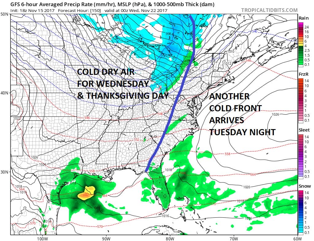
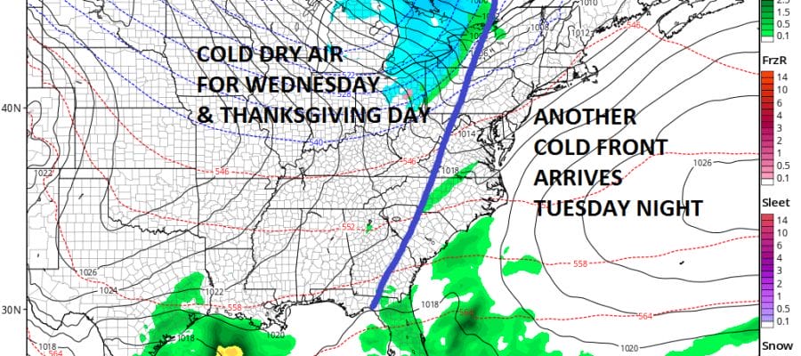
Right now Thanksgiving week looks dry through Thursday with no major storms to worry about. Other than a cold front late Tuesday which will be weak and another one Thursday night or Friday morning, we should be in good shape most of the time and no weather related travel headaches to speak of.
 GET JOE A CIGAR IF YOU LIKE

FiOS1 News Weather Forecast For Long Island
FiOS1 News Weather Forecast For New Jersey
FiOS1 News Weather Forecast For Hudson Valley


