
Gradual Cooling Continues Into The Weekend
SHOP THE JOESTRADAMUS STORE

Gradual Cooling Continues Into The Weekend
The gradual cooling continues across the Northeast and Middle Atlantic States and over the next few days it will feel more and more like fall should feel. Dry air will make for clear skies tonight with most lows in the low to mid 50s in the warmer urban areas with some 40s in cold spots. Friday is looking like a good day though there will be some clouds around mixed with some sunshine. Highs will be in the upper 60s to lower 70s. Tropical Storm Maria and a weakening Hurricane Lee are moving out to the northeast as they will eventually merge with a large North Atlantic storm in a few days.
SATELLITE LOOP

REGIONAL RADAR

Radars are nice and quiet and should remain so through Friday. Friday night a secondary cold front will approach with the chance for passing showers into Saturday morning. Otherwise we are looking at a fairly nice weekend with some sunshine and clouds Saturday and sunshine on Sunday with highs both days mostly in the 60s.
LONGER RANGE WEATHER OUTLOOK WARM WEATHER RETURNS
UPPER AIR JET STREAM NEXT WEEK CLICK TO ANIMATE
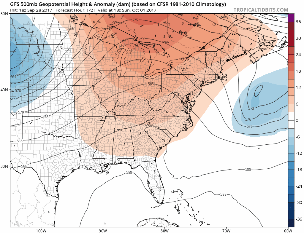
Next week another strong upper high will be building into the Eastern States which means another round of very warm weather is in store for us. We could see temperatures back into the 80s later next week. There is no sign of any important rain next week as long as this large ridge is under control. We also could see the tropics rev up a bit after a brief break. Low pressure east of the Florida east coast could develop into something early next week though it should not amount to much given borderline conducive weather conditions a loft. Weather models still seem to show the possibility of something more important developing in the Caribbean or Gulf of Mexico later next week.
 GET JOE A CIGAR IF YOU LIKE

FiOS1 News Weather Forecast For Long Island
FiOS1 News Weather Forecast For New Jersey
FiOS1 News Weather Forecast For Hudson Valley


