
Gloom Gives Way To A Better Sunday, Snow Showers Sunday Night Chance Snow Inland Tuesday
There is still some more work to do this afternoon regarding the cloudy gloomy dreary conditions that cover us this afteroon. Not only do we have a solid low overcast but we also have patchy dense fog around as well. This will continue until we get a wind shift to the northwest and low pressure offshore begins to strengthen and pull away to the northeast. Temperatures are in the upper 40s and lower 50s except in South Jersey and Southeastern Pennsylvania where winds have shifted to the west and temperatures are in the mid to upper 50s.
SATELLITE

REGIONAL RADAR

Steady rain has moved offshore but here too we will see some rain develop this evening mainly along the immediate coast and offshore. It should move out rather quickly and once it does, weather conditions should improve overnight with a gusty northwest wind developing and a partial clearing of skies. Lows by morning will be down in the 30s.
LOCAL RADAR NEW YORK CITY

LOCAL RADAR PHILADELPHIA


We should squeeze in a decent Sunday with some sunshine but there will be a gusty wind up to 25 mph or so. Temperatures won’t be going far on Sunday with most highs just into the 40s and inland areas will be in the upper 30s to around. 40. Sunday night an upper trough extending from the Great Lakes southeastward will probably have some snow showers associated with that.
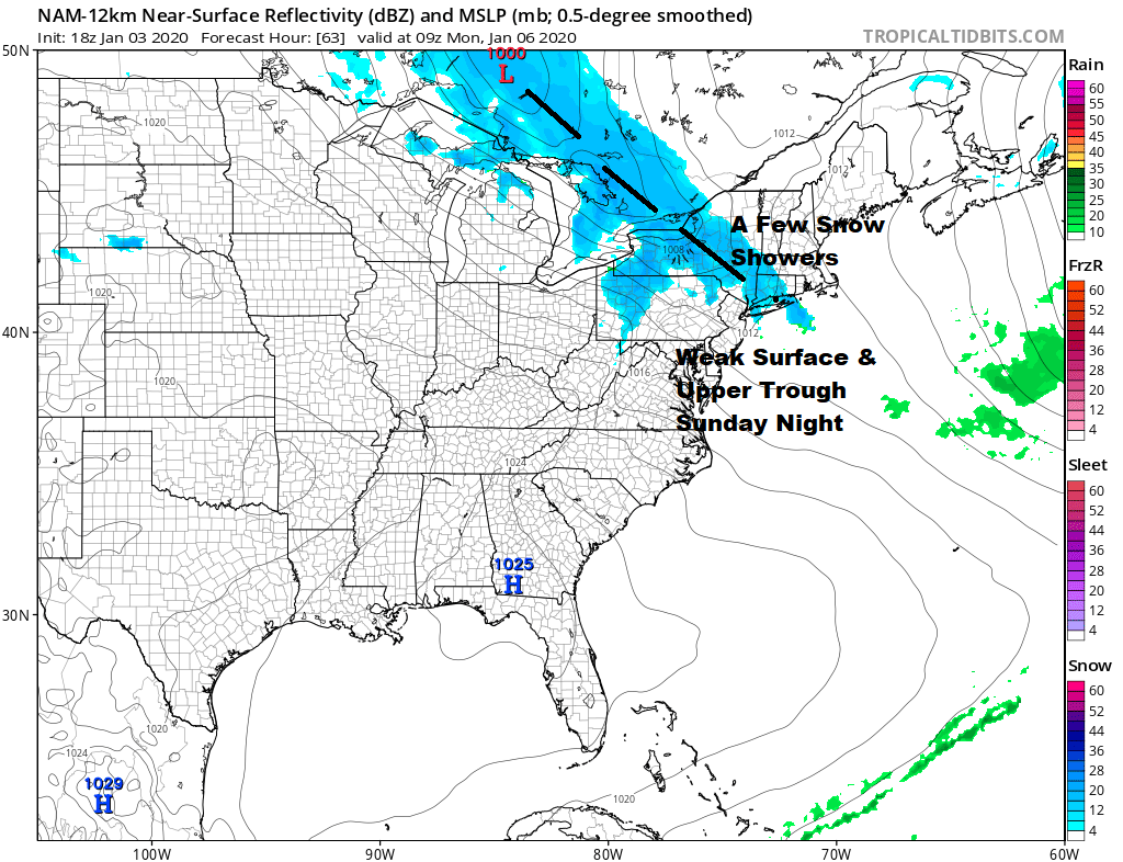
Most of those snow showers will be scattered in nature, primarily inland and they won’t amount to much. This takes us into Monday which should be a nice day of sunshine and reasonalbe conditions with highs back into the 40s.

Tuesday brings the next round of changes as we have a low that forms in Central Tennessee and moves northeast to off the Delaware coast Tuesday evening. There is also energy swinging across the Great Lakes at the same time. There is actually a fair amount of cold air aloft and the ground temperatures are going to be borderline at the coast but may wind up getting below freezing inland as the precipitation develops.

The cold air aloft is actually rather impressive with the freezing line well offshore at the 5000 ft level which is normally a reliable indicator for snow vs rain. The bottom of the atmosphere however will be warmer and rather tenuous with regards to the 32 degree line. The key lies in the intensity of the precipitation which could help to cool the lower atmosphere down more. Here is where it may be a bit lacking as the low starts to get going when it is close by. It is something to watch even in an overall pattern which is unfavorable for snow in general. It is not impossible however as it has to do with perfect timing of cold air and a wave going by to our south. The system moves quickly. Weather conditions improve for Wedensday and Thursday with some sunshine both days though temperatures probably won’t be getting out of the 30s.
BE SURE TO DOWNLOAD THE FREE METEOROLOGIST JOE CIOFFI WEATHER APP &
ANGRY BEN’S FREE WEATHER APP “THE ANGRY WEATHERMAN!
MANY THANKS TO TROPICAL TIDBITS FOR THE USE OF MAPS
Please note that with regards to any severe weather, tropical storms, or hurricanes, should a storm be threatening, please consult your local National Weather Service office or your local government officials about what action you should be taking to protect life and property.


