
GFS Long Range Major Storm For Eastern US BUT???

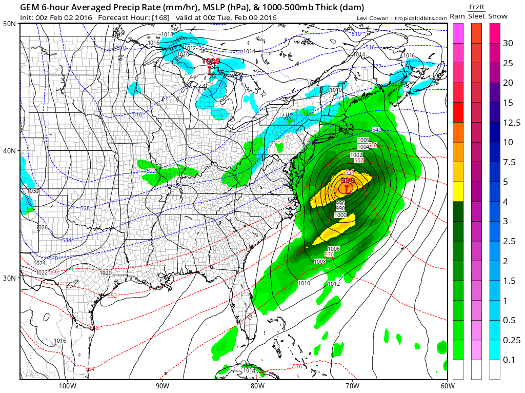
Overnight GFS long range model seems to be keying on one strong disturbance coming out of the Gulf States and riding up the Eastern Seaboard as energy strengthens in the Great Lakes lending support to this idea. The “BUT” in the headline is that I still don’t think this has been totally resolved yet. There continue to be model changes in how it is handling the northern stream feature in all this and there will probably lie the key to all this as it plays out over the next 7 days.
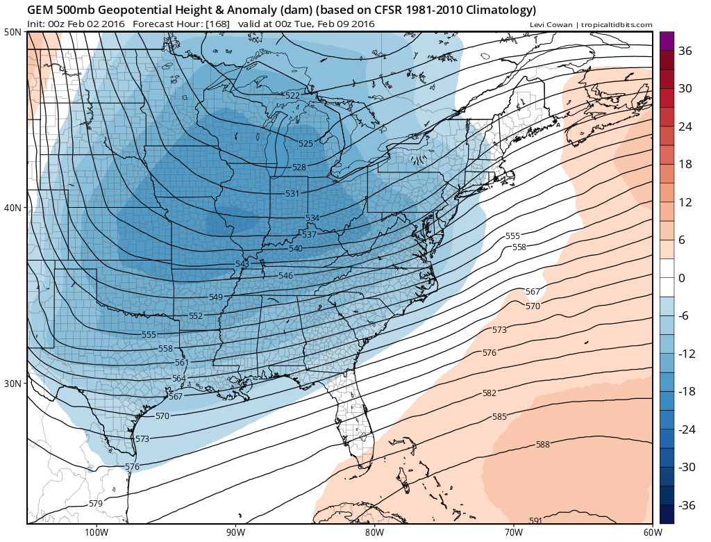
GFS Long Range Surface Day 6 & Day 7
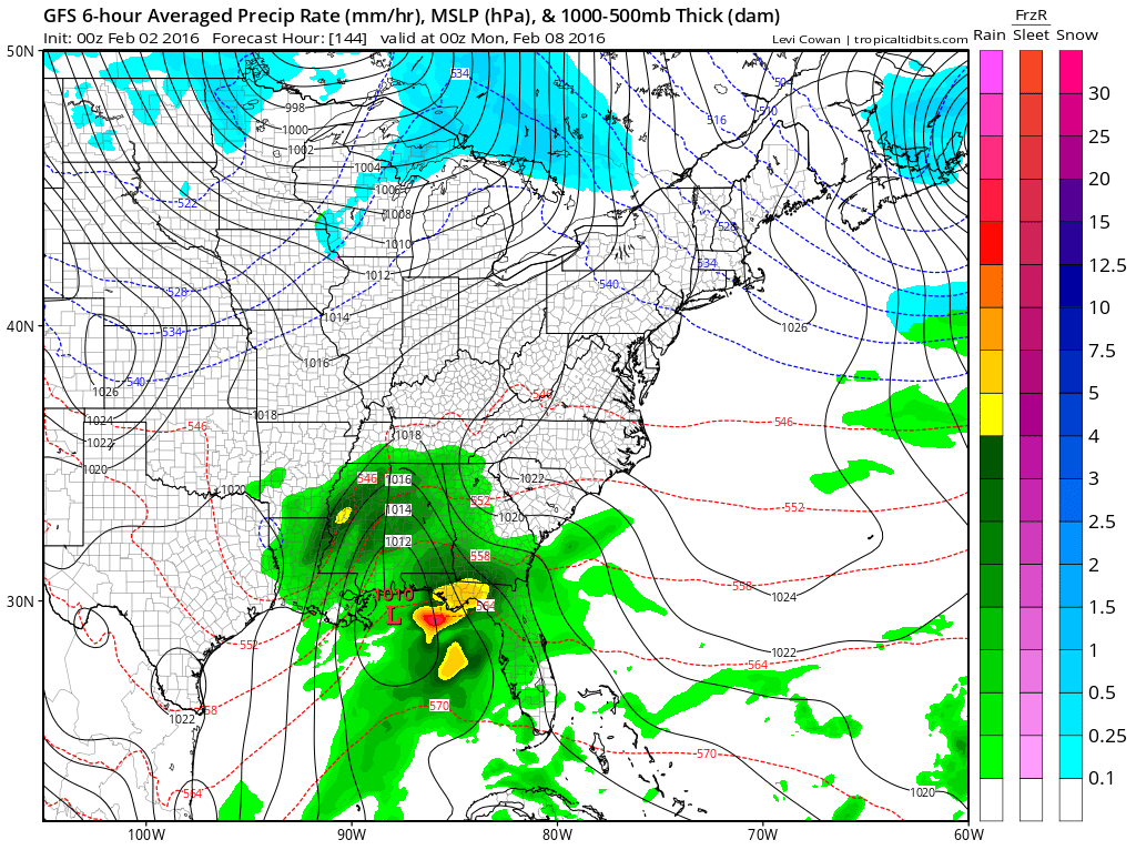
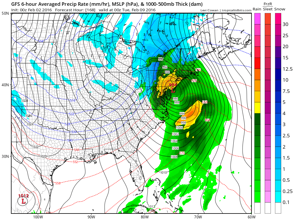
The surface low above is well developed as it exits the the Gulf States and rides up the coast. On the maps below you can see the distinct southern stream energy that rides around the deeening trough over the Northern Great Lakes. This particular run is extremely dynamic in developing that trough and there in lies the big question mark in all this. How well developed that Great Lakes trough is will effect the track and depth of the coastal low.
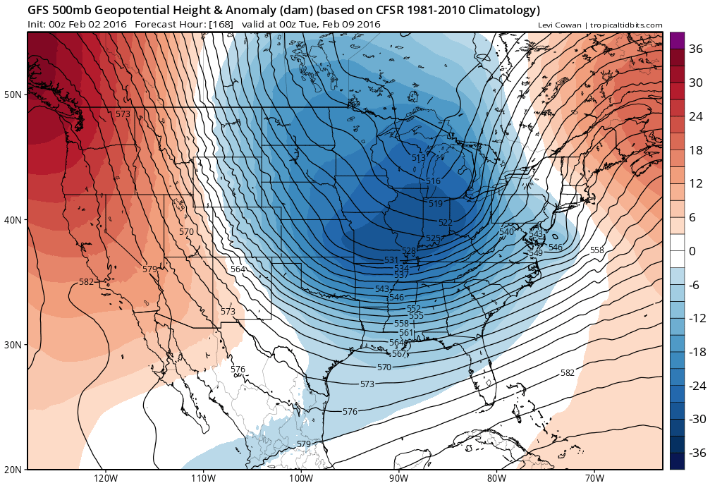
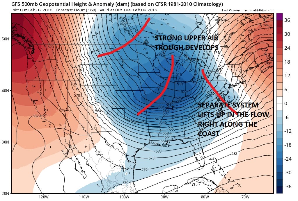
GFS LONG RANGE UPPER AIR DAY 7
Now for comparison take a look at the Canadian which has a much less developed trough in the Great Lakes and it is further west.
CANADIAN MODEL LONG RANGE UPPER AIR AND SURFACE DAY 7
What the Canadian does is essentially hang the upper energy back to the west and hangs on to the 2 storm idea. It also would delay the arrival of the bitter cold air until after the second low goes by a few days later. This to me seems a bit unrealistic given what is going on in the atmosphere. This is a classic situation of trying to have it both ways. You need just enough northern energy to bring the storm up but too much and you get a low that hugs the coast or goes just inland. Too little and you have the Canadian idea where it winds up being further east but not enough cold air.
Now we wait for the European to see what it does. My guess is that it may be more like the GFS and further west and show a deep inland low going up the East side of the Appalachians but this is strictly a guess on my part. Let’s see later this morning what it does and we will go through it line by line.
LATEST VIDEO ANALYSIS OF THE GFS LONG RANGE MODEL OVERNIGHT RUN AND HOW IT COMPARES WITH THE LAST TWO RUNS.
NATIONAL WEATHER SERVICE SNOW FORECASTS
LATEST JOESTRADAMUS ON THE LONG RANGE
Weather App

Winter is here! Don’t be without Meteorologist Joe Cioffi’s weather app. It is a complete weather app to suit your forecast needs. All the weather information you need is right on your phone. Android or I-phone, use it to keep track of all the latest weather information and forecasts. This weather app is also free of advertising so you don’t have to worry about security issues with your device. An accurate forecast and no worries that your device is being compromised.
Use it in conjunction with my website and my facebook and twitterand you have complete weather coverage of all the latest weather and the long range outlook. The website has been redone and upgraded. Its easy to use and everything is archived so you can see how well Joe does or doesn’t do when it comes to forecasts and outlooks.
Just click on the google play button or the apple store button on the sidebar for my app which is onMy Weather Concierge. Download the app for free. Subscribe to my forecasts on an ad free environment for just 99 cents a month.
Get my forecasts in the palm of your hand for less than the cost of a cup of Joe!

![]()