
Flood Watch Central NJ SE Pennsylvania

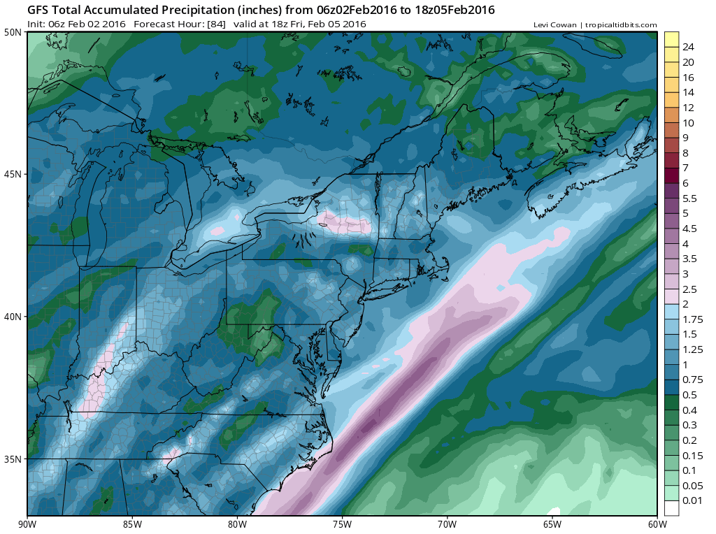
Flood Watch Central NJ SE Pennsylvania continues for Wednesday. You can see on the satellite loop the developing storm in the Plains which is producing heavy snows and blizzard conditions over Eastern Nebraska, Northwest Iowa, and Parts of South Dakota. A strong cold front is developing out of this storm and it will approach us and move through here later Wednesday and Wednsday evening.


It is not the amount of rain that is a problem so much as it is a combination of 1 to 2 inches of rain on top of 2 to 3 feet of snow melt that has occurred which is the equivalent of another 2 to 3 inches of rain. The ground is soaked so it won’t take much to cause some localized flooding in the flood watch area.
Flood Watch Central NJ SE Pennsylvania GFS Rainfall Forecast
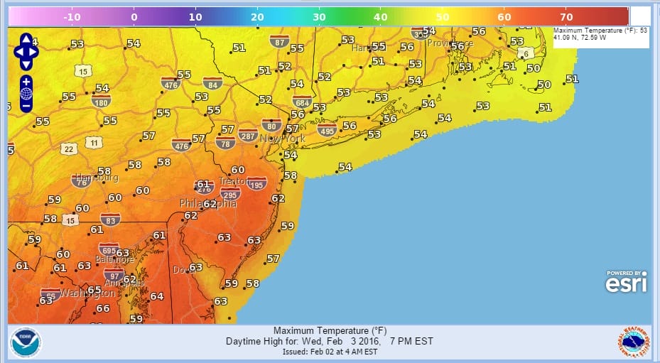
Meanwhile for today it is sunshine mixing with some arriving clouds later today as an onshore flow develops. Temperatures today will be 10 to 15 degrees lower than yesterday when we say many areas reach into the 60s. Temperatures will be in the mid 40s to near 50 today and temperatures will hold at these levels or even rise overnight.
Flood Watch Central NJ SE Pennsylvania Wednesday High Temperature Forecast & Rainfall Forecast

Watch for thunderstorms on Wednesday which could produce some locally heavy downpours. Once the front goes by we will see slow improvement on Thursday though there may be a lot of leftover clouds around especially at the coast. Then we should dry out and slowly trend colder into the weekend.
Longer range lots of model chaos trying to figure out just exactly what might happen next week regarding storm threats. Here is my latest JOESTRADAMUS post regarding last night’s GFS and Canadian runs.
Here is my latest video regarding the overnight GFS which shows a major storm along the east coast.
NATIONAL WEATHER SERVICE SNOW FORECASTS
LATEST JOESTRADAMUS ON THE LONG RANGE
Weather App

Winter is here! Don’t be without Meteorologist Joe Cioffi’s weather app. It is a complete weather app to suit your forecast needs. All the weather information you need is right on your phone. Android or I-phone, use it to keep track of all the latest weather information and forecasts. This weather app is also free of advertising so you don’t have to worry about security issues with your device. An accurate forecast and no worries that your device is being compromised.
Use it in conjunction with my website and my facebook and twitterand you have complete weather coverage of all the latest weather and the long range outlook. The website has been redone and upgraded. Its easy to use and everything is archived so you can see how well Joe does or doesn’t do when it comes to forecasts and outlooks.
Just click on the google play button or the apple store button on the sidebar for my app which is onMy Weather Concierge. Download the app for free. Subscribe to my forecasts on an ad free environment for just 99 cents a month.
Get my forecasts in the palm of your hand for less than the cost of a cup of Joe!

![]()


