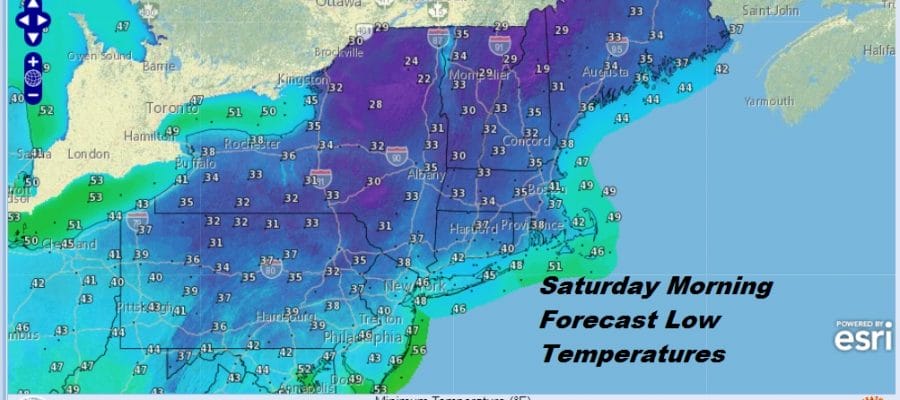
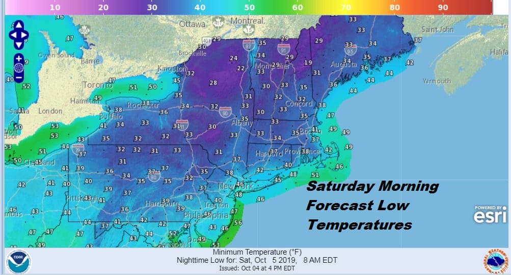
Frosty Weather Night Ahead Inland Good Looking Weekend Showers Late Monday
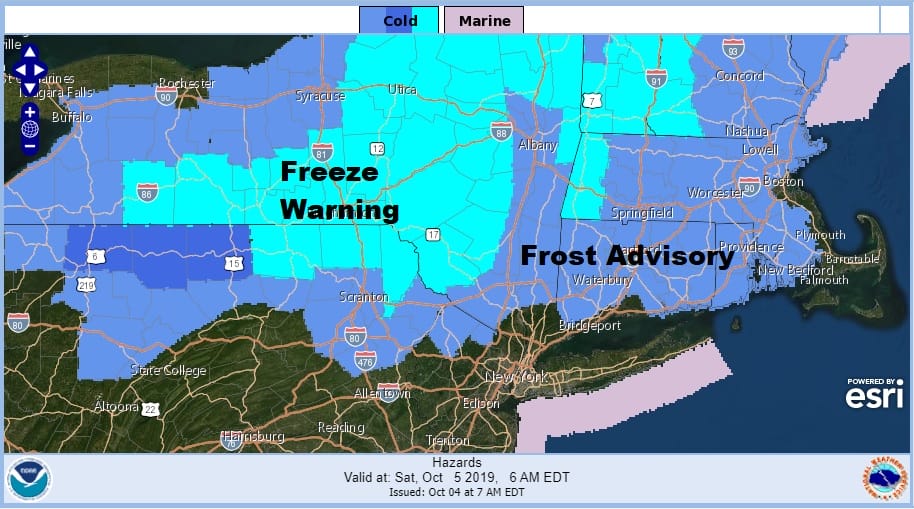
There are no additional counties added to the front advisory or the freeze warning that is up of early Saturday morning. The counties in Northwest New Jersey from Warren Sussex & West Passaic northeast to Orange, and Dutchess Counties in the Hudson Valley and virtually all of Connecticut are in a frost advisory. Sullivan and Ulster counties north into the Catskills are in a freeze warning with lows dropping into the 20s in those areas. It is the first frost on the pumpkin! The satellite picture is clear in most areas and the clouds to the northwest will disappear quickly later this evening.
SATELLITE

REGIONAL RADAR

If you are headed out this evening take a sweater or jacket with you. Winds are still a bit busy from the north northwest at 20 mph or so but they should drop off quickly overnight. Frost will hinge on how fast the winds drop off and in some areas they will drop off faster than others. The chill bleeds southward into the Middle Atlantic States in areas that were in the 90s just 2 days ago.
There are no changes regarding the outlook for the weekend. My earlier concern was for Sunday but the next cold front is delayed and won’t get here until Monday night which leaves us more optimistic for Sunday. Before Sunday we have Saturday with sunshine forecast from start to finish and highs will be in the upper 50s to lower 60s. Saturday night won’t be as cool with winds going around to the south. Also by Sunday morning some clouds will come into the mix.
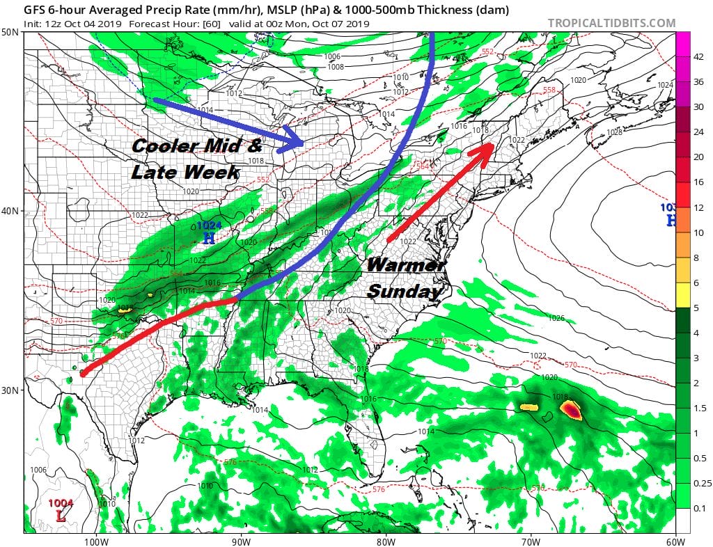
Sunday to me looks like a mix of clouds and sun with highs reaching the upper 60s to lower 70s if we get enough sunshine. Winds will be turning southwest which will warm things up nicely but it won’t get out of hand. Monday brings that front to the west close enough to produce an increasing chance for some showers later in the day into Monday night with highs reaching the middle to upper 70s. With a little luck we could see a half to three quarters of an inch of rain with this front.

Another big high builds into New England Tuesday through Thursday of next week which will bring beautiful October weather with sunshine and temperatures in the 60s by day and 40s to lower 50s at night. The next front will approach with a chance for showers perhaps next Friday into early Saturday (depending on timing) and then another high builds in for a nice stretch of weather for a few days. The upper air flow is progressive…everything progresses from west to east with no hangups stalls or blocking. That gives us nice days and the occasional day for some much needed showers. No major storms are in the cards and the tropics are quiet right now.
MANY THANKS TO TROPICAL TIDBITS FOR THE USE OF MAPS
Please note that with regards to any tropical storms or hurricanes, should a storm be threatening, please consult your local National Weather Service office or your local government officials about what action you should be taking to protect life and property.


