
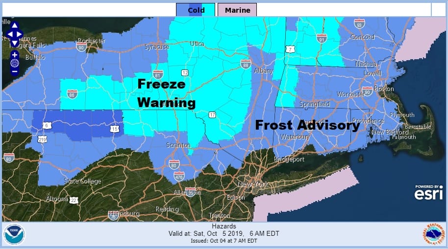
Frost Advisory Northwest New Jersey Hudson Valley
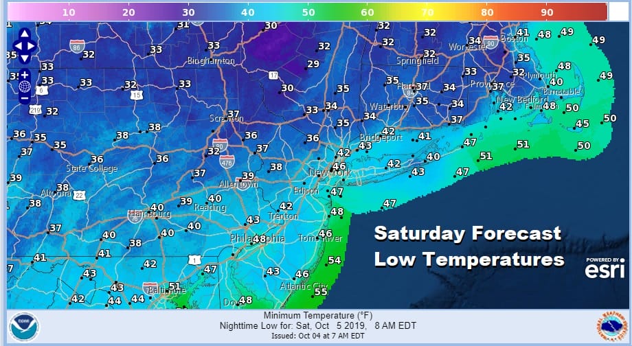
We are now on the other side of the cold front and the record heat of Wednesday and the raw onshore conditions of yesterday. The rain and drizzle are gone we are going to see sunshine today but we will also see a gusty north northwest wind and temperatures that will settle in the 60s all day. This is going to set us up for a cold night ahead with Saturday morning lows that will be in the lower 40s in most of the warmer urban centers but just inland and as you head north west and northeast of the coastal areas we will see lows in the 30s and even some 20s are possible.
The satellite picture this morning show that skies have mostly cleared out and most of the clouds are in upstate New York and interior New England. Other clouds are offshore. All the rain is gone and the regional and local radars are nice and quiet today and really won’t be active again until late Sunday when the first showers will appear from the next approaching cold front.
SATELLITE

REGIONAL RADAR

After Saturday morning’s chill we will see lots of sunshine to start the weekend with highs Saturday back to the upper 50s and lower 60s. This high to the north will move out to the east Saturday night which will start clear but finish with arriving clouds. Lows will be in the 40s and 50s so it won’t be as cold as Friday night/Saturday morning.

The next cold front is slowing down which means that Sunday may not be too bad with clouds and some sunshine. Highs will be in the mid 60s to lower 70s. It looks like showers will hold off until later in the day Monday as that cold front gets closer. Monday’s highs will be in the low to mid 70s. The front hopefully can squeeze out another quarter to a half inch of rain but in a dry pattern you sometimes have to fight for every rain drop.
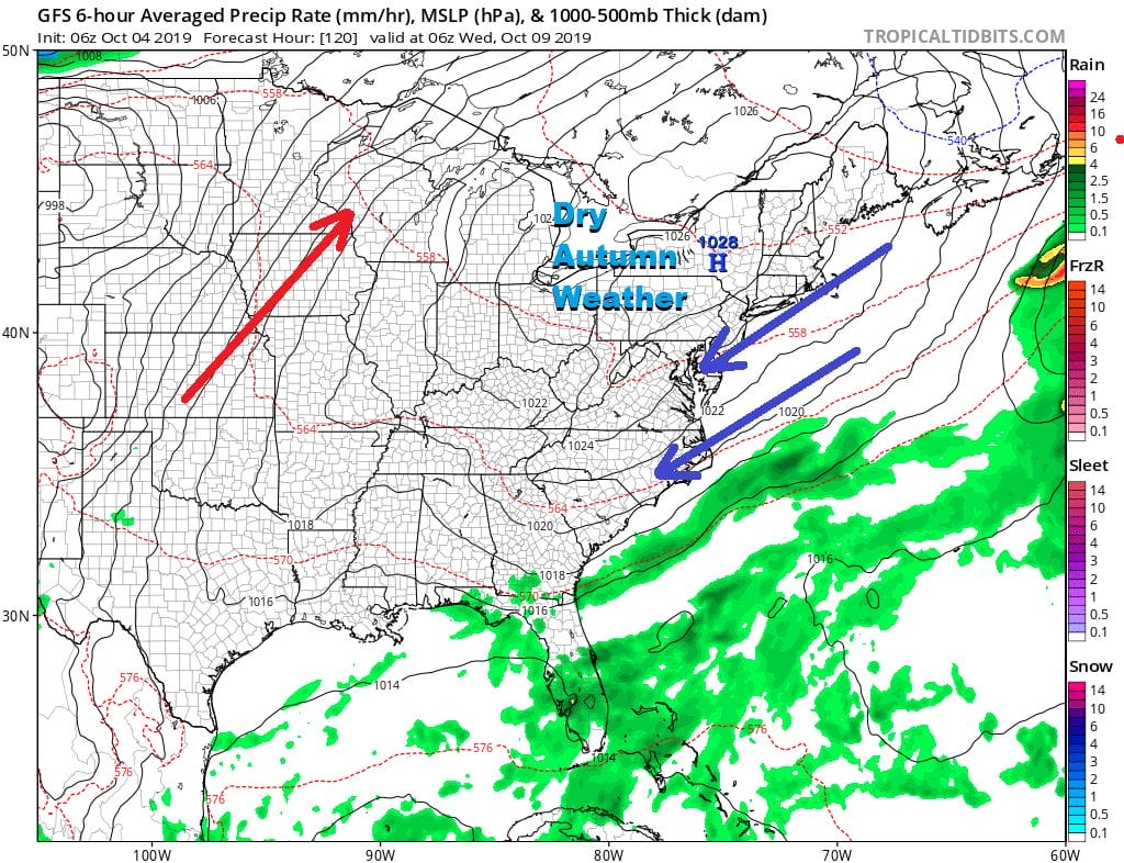
Behind the front that moves off Tuesday morning much of next week will be about high pressure building to the north of us which should keep us dry and for the most part sunny or no worse than partly sunny for most of next week. No major storms are on the horizon as the overall pattern is going to be quiet. Temperatures next week will be seasonal or a bit below average.
MANY THANKS TO TROPICAL TIDBITS FOR THE USE OF MAPS
Please note that with regards to any tropical storms or hurricanes, should a storm be threatening, please consult your local National Weather Service office or your local government officials about what action you should be taking to protect life and property.


