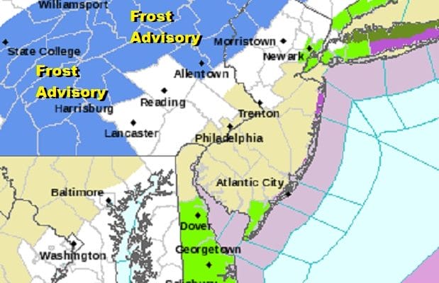
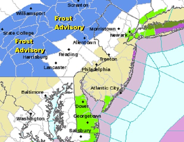
FROST ADVISORY TONIGHT NORTHWEST NEW JERSEY HUDSON VALLEY NORTH OF ROUTE 84
JOE & JOE WEATHER SHOW PODCAST 9/19/2020
A clear cold night with light winds and high pressure sitting over upstate NY and New England have set some parts of the area up for the first frosts of the still not autumn season (Autumn arrives Tuesday). The advisory covers Warren & Morris counties in New Jersey as well as Orange, Sullivan, Putnam and Dutchess Counties in the Hudson Valley and Litchfied County in Connecticut and points northward.
The satellite view shows clear skies up and down the Northeast into the Middle Atlantic states with high clouds well to the south. We also see nothing on the regional radar and rain will be out of the range of our areas for much of this week.
SATELLITE

REGIONAL RADAR

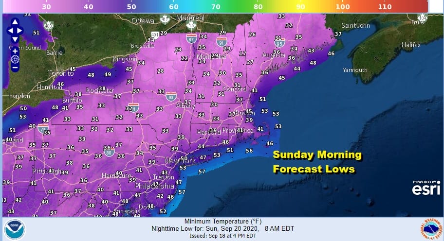
Tonight is going to be a chilly night for mid September with clear skies and diminishing winds. Temperatures by morning will settle in the 40s to around 50s but there will be 30s as you head inland into Northern Pennsylvania, Northwest New Jersey and the Hudson Valley north of Route 84. Also Northwest Connecticut is at risk for the first frost. This will also bring the first frosts across much of Upstate NY and interior New England.
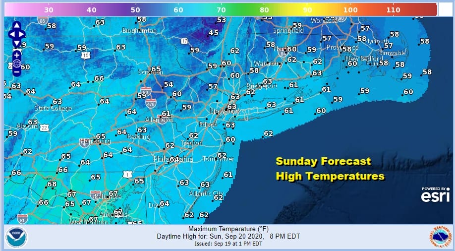
Sunday looks to be a nice day but as we mentioned earlier an upper trough moving through will probably put some fair weather clouds in the mix. It will be another cool day across the Northeast with highs mostly in the low to mid 60s. Areas north and west of NYC where there may be more clouds than sun will struggle to get above the 60 degree mark.
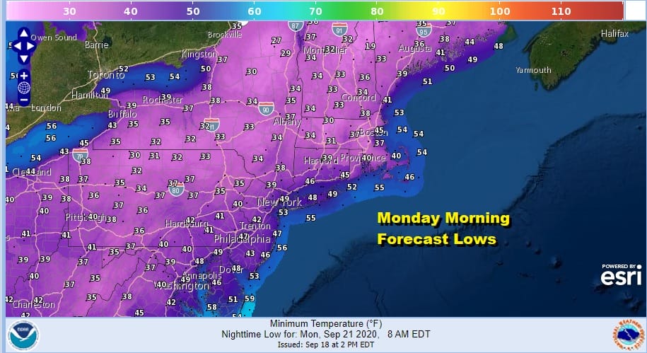
Another cold night is in store for Sunday night into Monday morning under clear skies. Again lows will be in the 40s to near 50 in the warmer urban settings with 30s likely inland and not too far north and west of the major cities.
Monday the upper trough will be to the east and offshore. This will bring us another day of sunshine with fewer if any clouds. Highs will be in the 60s. That upper trough is also going to be the driver for Hurricane Teddy as it passes Bermuda early Monday morning and takes aim for Nova Scotia on Tuesday.

Hurricane Teddy will turn the winds here to northwest Monday night and Tuesday leaving us Tuesday in lots of sunshine with highs in the 60s to near 70 degrees. The high settles in the southeast US for the rest of the week putting us in a warmer flow with sunshine. Highs Wednesday will be back into the 70s and we should be in the 70s to near 80 Thursday. A weak front will pass early Friday with little fan fare other than clouds and the outside chance for a passing shower. Highs will be in the low to mid 70s. No substantial rain is in the cards in the long range.
BE SURE TO DOWNLOAD THE FREE METEOROLOGIST JOE CIOFFI WEATHER APP &
ANGRY BEN’S FREE WEATHER APP “THE ANGRY WEATHERMAN!
MANY THANKS TO TROPICAL TIDBITS FOR THE USE OF MAPS
Please note that with regards to any severe weather, tropical storms, or hurricanes, should a storm be threatening, please consult your local National Weather Service office or your local government officials about what action you should be taking to protect life and property.


