
DOWNLOAD MY NEW FREE JOESTRADAMUS WEATHER APP FOR ALL DEVICES
Front Buckles 80 Jersey 60 Long Island Southern New England Rain Weekend
We were back in the onshore flow today with a warm front setting up to our south. From the satellite picture you can see skies cleared out across Southern Virginia and the Delmarva Peninsula southward while we sat in clouds all day and temperatures in the 50s. The warm front will start to move northward tonight keeping us in clouds. The radars so far are rather quiet and other than the odd spot shower or downpour overnight or some patchy drizzle, much of the night will be cloudy but rain free.
SATELLITE

REGIONAL RADAR

Thursday is the day where if the sun comes out we will see temperatures move sharply higher. The front should move north of New Jersey and Eastern Pennsylvania. For these areas highs in the 70s to near 80 are certainly doable. The front may wind up lying right across NYC or Western Long Island and into the Lower Hudson Valley. On the other side of this front (Eastern areas of the Hudson Valley, Connecticut and Long Island) temperatures will probably make a run for the 60s. There could be some upside surprises in the high temperatures if the front can push a few extra miles further north and east.
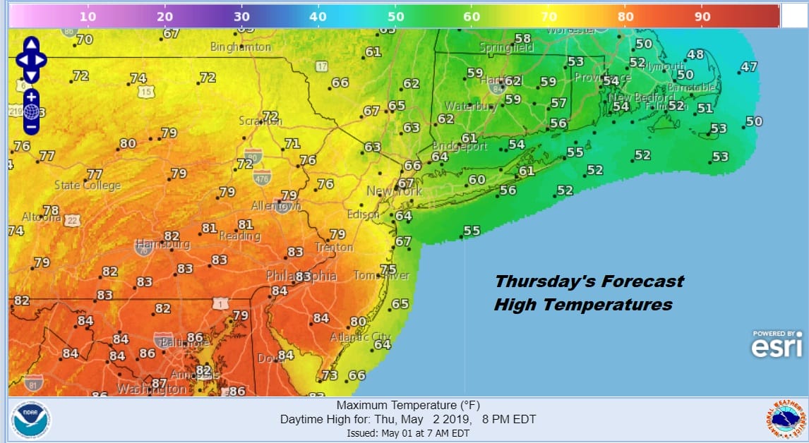
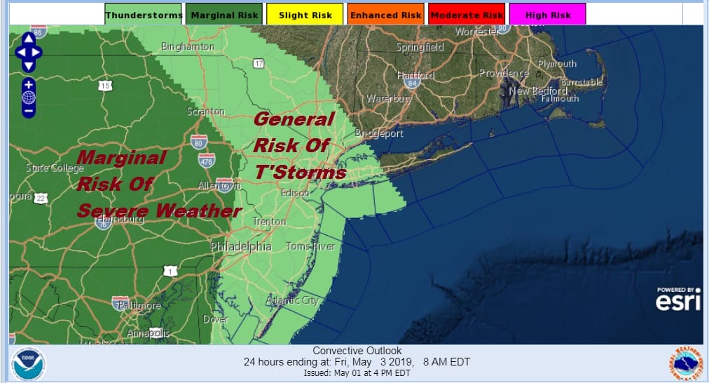
Late Thursday afternoon and evening a cold front will drop in from the northwest and this could put some areas at risk for evening downpours or a thunderstorm. The risk isn’t large but it is worth mentioning in the forecast. The Storm Prediction Center has the area of marginal risk across Pennsylvania and touching Western New Jersey. If the warm front is more successful at pushing northeastward that risk area could get expanded to the east.
On to Friday where we are back in an onshore flow with a warm front to the south of us again so it is back to clouds and temperatures in the 60s…cooler at the coast. Then a cold front comes through late in the day with another chance for showers or a thunderstorm. This front sets us up for another gloomy weekend.
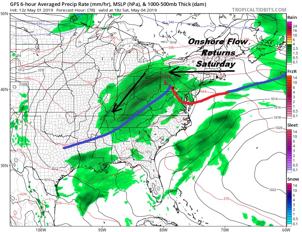
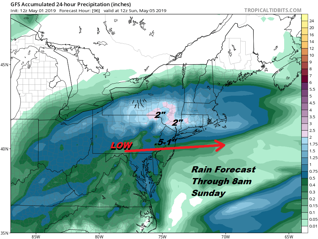
There is seemingly no end to this pattern. This time around the wave of low pressure has a bit more punch to it. Saturday will be cloudy with rain developing from west to east during the afternoon and lasting into at least the first half of Sunday. Even if the rain ends Sunday morning clouds are likely to linger around into the evening before skies clear out. The low is passing south of NYC so that means onshore flow develops and temperatures will be in the 60s on Saturday but likely in the raw low and mid 50s at best for Sunday.
Even though the blocking pattern in the North Atlantic remains in place early next week we may get a break Monday into Tuesday with some dry weather and some sunshine for Monday. Clouds will arrive on Tuesday. More wet weather is likely later next week.
MANY THANKS TO TROPICAL TIDBITS FOR THE USE OF MAPS
Please note that with regards to any tropical storms or hurricanes, should a storm be threatening, please consult your local National Weather Service office or your local government officials about what action you should be taking to protect life and property.


