
Frigid Less Wind Snow Ice Late Monday Milder Tuesday
Frigid Less Wind Snow Ice Late Monday Milder Tuesday
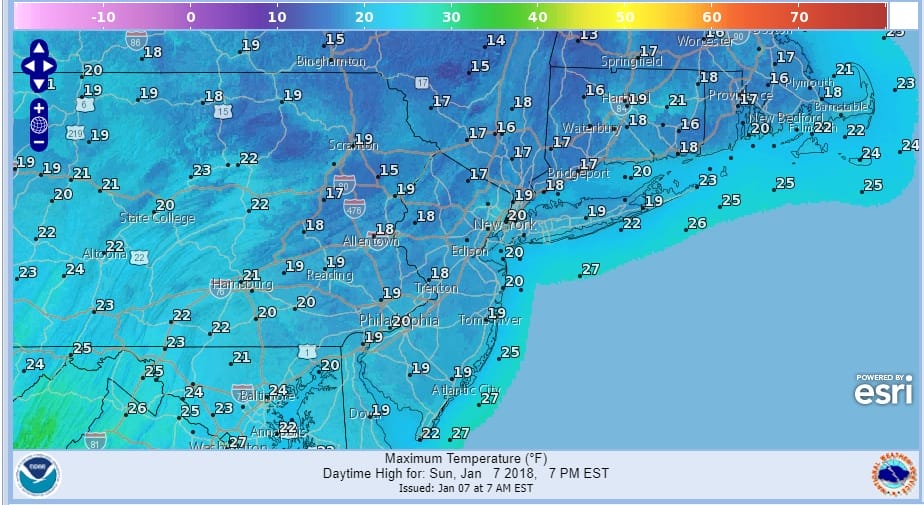
We begin the day with temperatures that bottomed in the low single digits to as low as 10 to 15 below zero in some inland areas of the Hudson Valley. In some places the wind dropped off at the last minute to allow temperatures to go below zero over parts of Long Island as well as in New Jersey up and down the state and in Eastern Pennsylvania. At least we will see plenty of sunshine today and that will take temperatures back to the upper teens to near 20 in some spots. For many areas today will be the 8th or 9th time that temperatures stay under 20 degrees this winter. For many areas the records sit somewhere between 10 and 12 days. For some with shorter data sets, the records have been already taken out.
SATELLITE LOOP

REGIONAL RADAR

Satellite loops show the next weather front approaching which is a weak one. There is a southerly component to this system which has some moisture with it but ultimately that system will separate and remain to the south while the weaker weather front with limited moisture will approach from the west. Clouds will increase tonight with temperatures probably holding in the teens to near 20.
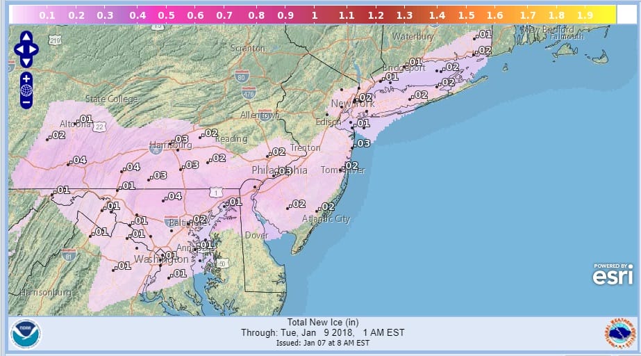
ICE ACCUMULATION FORECAST LATE MONDAY INTO MONDAY EVENING
SNOW ACCUMULATION FORECAST LATE MONDAY INTO MONDAY EVENING
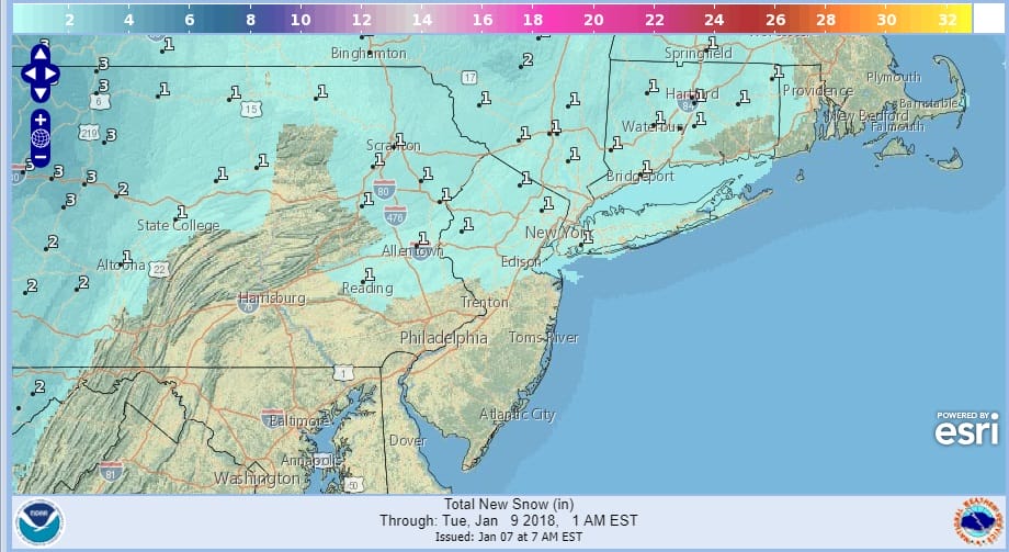
Monday the issue will be some light snow and ice later in the afternoon and evening. This is not going to be a big event however I am always a little concerned when ice gets involved since even the slightest amount of glaze can create chaos especially during an evening commute. Amounts will be light of either snow or ice or both but do pay attention to the weather later Monday afternoon and evening. Temperatures Monday will rise toward the freezing mark but the ground is so cold it may take many additional hours for surfaces to warm up above freezing…if at all.
TUESDAY FORECAST HIGH TEMPERATURES
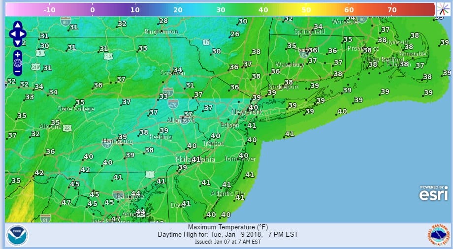
Tuesday looks better with some sunshine and highs in the upper 30s & lower 40s. Colder air comes in Wednesday and then we should warm up Thursday & Friday and make a run for 50 at some point late this week.
 GET JOE A CIGAR IF YOU LIKE

FiOS1 News Weather Forecast For Long Island
FiOS1 News Weather Forecast For New Jersey
FiOS1 News Weather Forecast For Hudson Valley


