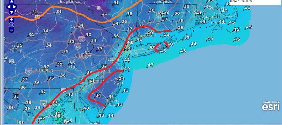
Freeze Watch NE Pennsylvania

Freeze Watch NE Pennsylvania
No Freeze or Frost Issues Elsewhere
Cool Week Ahead Rain Tuesday Night Into Wednesday
Freeze Watch NE Pennsylvania is the only area where temperatures will drop below 32 degrees by Monday morning. Elsewhere across the area from Southeastern Pennsylvania northeastward through New Jersey, Southeast NY, Connecticut & Long Island, wind and clouds will help to keep temperatures in the upper 30s to lower 40s with no frost or freeze issues.
Freeze Watch NE Pennsylvania
Monday Morning Forecast Low Temperatures
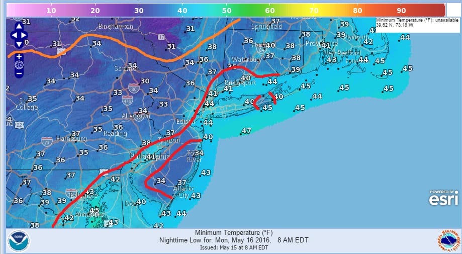
There will be pockets of upper 30s in interior Southern New Jersey and Long Island but most lows along the coast will be in the lower 40s. Satellite loops show clouds rotating around a storm in Eastern Canada. Look for breezy to windy conditiions this afternoon and tonight. Gale Warnings are in effect for the coastal waters.

Radar is showing some showers developing in the cold unstable air. A shower or two could pass through this afternoon but any rain will be light. Clouds will be blocking out the sun in what looks like a turbulent sky out there. It looks like something you would see in early spring or mid to late fall when a cold air mass comes in. No rain is forecast overnight and Monday. Temperatures this afternoon will be in the mid 50s to low 60s and Monday’s highs will be in the low to mid 60s.


On Tuesday clouds will be increasing with an onshore flow and low pressure developing to the south. Models have some rain indicated Tuesday afternoon however with the dry air I wonder how much if any of that will reach the ground. Tuesday night into Early Wednesday we could see a period of light rain as low pressure goes by to our south.
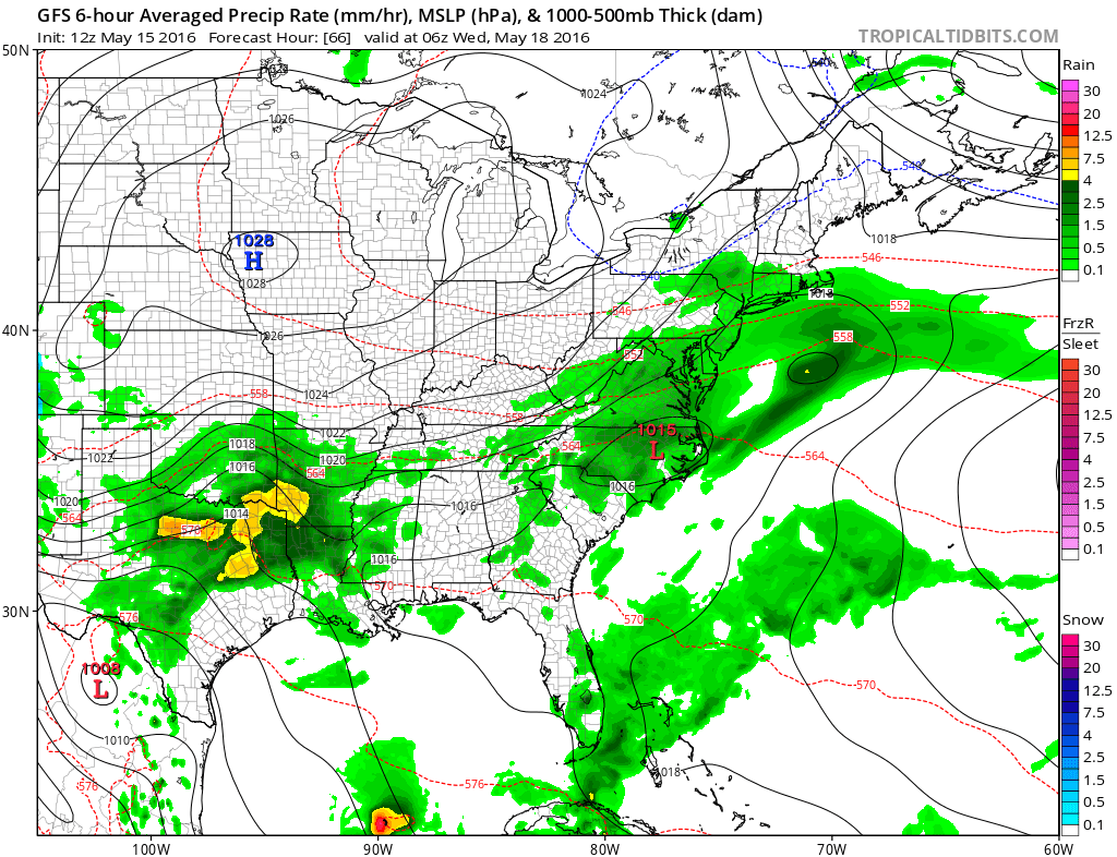
Once this little wave goes by high pressure to the west and north will build in keeping things dry and on the cool side of normal for the rest of the week. Still no big storms are on the horizon and it is possible we might be able to keep things dry through next week.
Hurricane Season 2016 begins in the Eastern Pacific today and JOESTRADAMUS has an early outlook and a look at the El Nino La Nina transition that is underway.
FiOS1 News Weather Forecast For Long Island
FiOS1 News Weather Forecast For New Jersey
FiOS1 News Weather Forecast For Hudson Valley
NATIONAL WEATHER SERVICE SNOW FORECASTS
LATEST JOESTRADAMUS ON THE LONG RANGE
Weather App

Don’t be without Meteorologist Joe Cioffi’s weather app. It is really a meteorologist app because you get my forecasts and my analysis and not some automated computer generated forecast based on the GFS model. This is why your app forecast changes every 6 hours. It is model driven with no human input at all. It gives you an icon, a temperature and no insight whatsoever.
It is a complete weather app to suit your forecast needs. All the weather information you need is right on your phone. Android or I-phone, use it to keep track of all the latest weather information and forecasts. This weather app is also free of advertising so you don’t have to worry about security issues with your device. An accurate forecast and no worries that your device is being compromised.
Use it in conjunction with my website and my facebook and twitter and you have complete weather coverage of all the latest weather and the long range outlook. The website has been redone and upgraded. Its easy to use and everything is archived so you can see how well Joe does or doesn’t do when it comes to forecasts and outlooks.
Just click on the google play button or the apple store button on the sidebar for my app which is on My Weather Concierge. Download the app for free. Subscribe to my forecasts on an ad free environment for just 99 cents a month.
Get my forecasts in the palm of your hand for less than the cost of a cup of Joe!
![]()
![]()

MENTION JOE CIOFFI AND GET A 5% DISCOUNT


