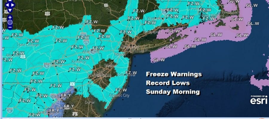
Freeze Warnings Tonight Inland Record Lows Possible Sunday Morning
We had a record breaking morning Saturday in two respects. Record lows were set in many locations for the date. For some it was the latest 32 degree low ever seen. We also had snow during the early morning hours of Saturday. You had to be up between 1am and 3am to see it but it did happen and it even whitened up some colder surfaces. Snow was record at all the reporting stations around NYC including Long Island. Snow was also observed across Northern New Jersey, Eastern Pennsylvania, the Hudson Valley and Southern New England. A trace of snow for some places was more than what was seen back in February where many areas were completely shut out of snow!
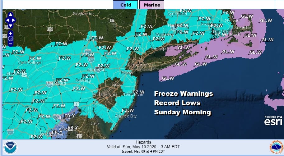
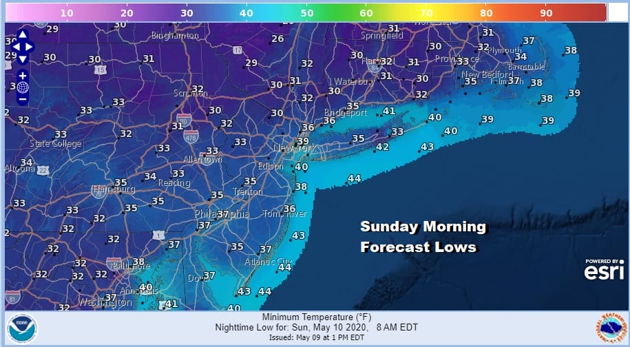
Tonight we have more record lows possible as the map above shows with lows forecast to drop to near or below freezing just north and west of the warmer urban centers. This is going to be a widespread freeze from Southern New England south to the Carolinas and west to the Appalachians.
SATELLITE

REGIONAL RADAR

Meanwhile the radars show much of the area is getting pummelled by snow showers and snow squalls along with graupel which is a snowflake that has not fully formed. Some rain showers are also in the mix. These snow showers should die off after sunset as skies clear out.
LOCAL RADAR NEW YORK CITY

LOCAL RADAR PHILADELPHIA


Sunday Mother’s day will start out very cold and still a bit on the breezy side but we will see sunshine for most of the day. Temperatures will rebound with highs reaching the 50s to near 60. This is still going to be well below the average highs this time of year which are beginning to approach 70 in some areas. Clouds will move in Sunday night ahead of low pressure dropping southeast from the Great Lakes and headed into the Northeast on Monday with a trailing cold front.

This system shouldn’t be a big deal but it will produce a few scattered showers and possibly a thunderstorm. Otherwise Monday we will be sitting in clouds with highs in the upper 50s and lower 60s. Dry cool air takes over for Tuesday and Wednesday with sunshine both days. Highs will likely be in the 50s Tuesday and back into the 60s on Wednesday.
BE SURE TO DOWNLOAD THE FREE METEOROLOGIST JOE CIOFFI WEATHER APP &
ANGRY BEN’S FREE WEATHER APP “THE ANGRY WEATHERMAN!
MANY THANKS TO TROPICAL TIDBITS FOR THE USE OF MAPS
Please note that with regards to any severe weather, tropical storms, or hurricanes, should a storm be threatening, please consult your local National Weather Service office or your local government officials about what action you should be taking to protect life and property.


