
Mothers Day May Winter Weather Eases This Afternoon Week Ahead Outlook
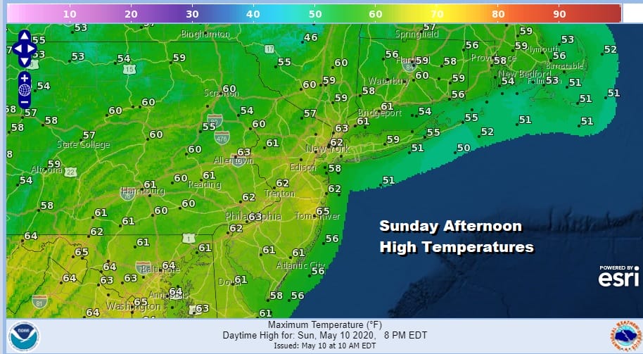
After yesterday’s version of May winter with record lows, record low highs, record snow falls (even if it was just a trace).we are at least seeing those brutal conditions ease today. It is still breezy but the wind has come off yesterdays gusts of 30 to 40 mph at times. We are enjoying sunshine which is helping temperatures to bounce higher and we should reach the mid 50s to near 60 this afternoon. This however is still some 10 degrees below where we should be for this time of year. At least we aren’t experiencing a soaking rain today so there are some positives. The radar is quiet as well as we will not have any precipitation issues to deal with.
SATELLITE

REGIONAL RADAR

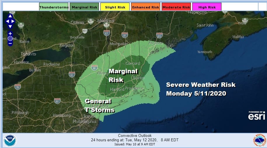
The next weather system is already moving through the Great Lakes and will swing through late tonight and on Monday. We are dealing with low pressure and a cold front moving east. It will try and warm ahead of the front and there will be a few showers to deal with late tonight into late Monday. It doesn’t rain all day. It will be more of the on and off variety type showers and thunderstorms. In fact the Storm Prediction Center has Southern New England at a marginal risk for severe weather on Monday. Highs Monday should reach into the 60s in most places.
It seems that Tuesday through Thursday should be dry. We do have cool high pressure building in from Canada on Tuesday which will likely keep temperatures in the 50s. However we should see sunshine for much of the day. Wednesday should be a nice day of sunshine with highs reaching back into the 60s. Thursday looks like we could see highs in the 60s to near 70 with some sunshine though we will be watching the next weather front. That will bring a chance for showers Thursday night into Friday. All in all it looks like a much calmer and more normal weather week ahead.
BE SURE TO DOWNLOAD THE FREE METEOROLOGIST JOE CIOFFI WEATHER APP &
ANGRY BEN’S FREE WEATHER APP “THE ANGRY WEATHERMAN!
MANY THANKS TO TROPICAL TIDBITS FOR THE USE OF MAPS
Please note that with regards to any severe weather, tropical storms, or hurricanes, should a storm be threatening, please consult your local National Weather Service office or your local government officials about what action you should be taking to protect life and property.


