Freeze Warnings Overnight Rain Saturday Night Into Sunday Next Week Warmer Dry

Weather in 5/Joe & Joe Weather Show Latest Podcast
Freeze Warnings Overnight Rain Saturday Night Into Sunday Next Week Warmer Dry
It was a very cold mid April Day obviously. Just for some perspective highs in the 40s this time of year would be the equivalent of highs just in the teens in January when you seasonally adjust it. Snow showers were scattered around as well. And we have clouds around thanks to a very cold upper atmosphere which is keeping things unstable. Throw in the wind and it was a day that you probably wish would go away soon. Thankfully it will. Skies should partially clear tonight but there still will be some clouds around from time to time and from place to place.
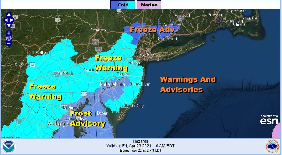
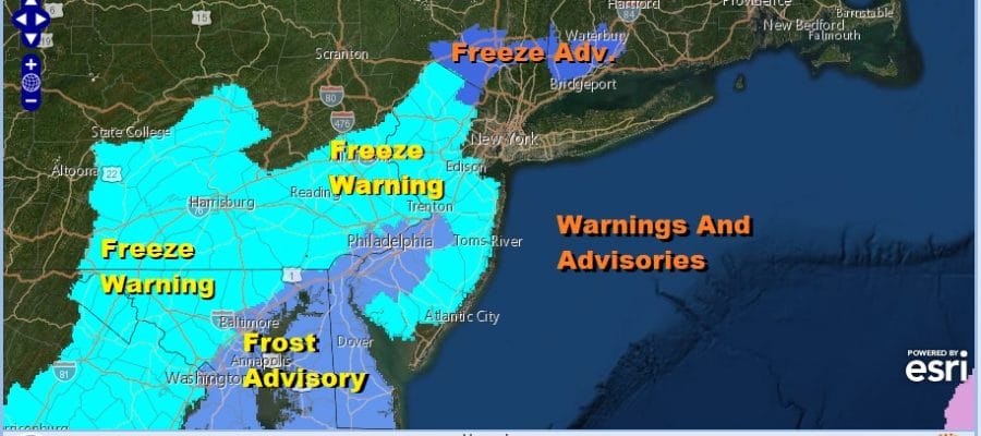
Freeze Advisories are up for parts of the Hudson Valley. Freeze Warnings are up for most of New Jersey, Eastern and South Central Pennsylvania southward into Maryland and Virginia. There should be enough of a wind in the freeze warning and freeze advisory area to prevent a frost but some areas to the south will see winds drop off enough that frost advisories are up for Southwestern New Jersey into Delaware and Eastern Maryland.

Friday morning forecast lows will be in the 30s in most areas along the coast as well as in the urban areas but upper 20s and lower 30s will be common inland. Friday look for a mix of sun and clouds. Highs will be higher than today (no brainer there) with temperatures reaching into the 60s in most places. There still will be a bit of a breeze but this time it will be from the west which should help to warm things up.
SATELLITE

There are no changes in the outlook for the weekend. Saturday remains the better of the two weekend days with sunshine giving way to arriving clouds. Highs will be in the 60s to near 70. Rain comes in Saturday overnight and lasts into Sunday morning before ending from west to east. Rainfall amounts should be on the order of a half to three quarters of an inch. Leftover clouds will be around for the afternoon with highs in the upper 50s to mid 60s.
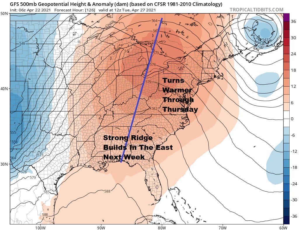
Next week is all about the ridge of high pressure aloft building into the Eastern US which signals dry and warm conditions provided we don’t get any kind of ocean wind issues. This is becoming increasingly less likely. We will start with Monday which will be the coolest day with highs in the 60s and then temperatures sure rise into the 70s Tuesday. If we can get a southwest wind to dominate the flow, temperatures could reach 80 degrees Wednesday and Thursday. No rain is forecast and we should have some sunshine for the first four days of next week. The next chance for any showers may not come until next Friday as a weak cold front approaches from the west.

BE SURE TO DOWNLOAD THE FREE METEOROLOGIST JOE CIOFFI WEATHER APP &
ANGRY BEN’S FREE WEATHER APP “THE ANGRY WEATHERMAN!
MANY THANKS TO TROPICAL TIDBITS FOR THE USE OF MAPS
Please note that with regards to any severe weather, tropical storms, or hurricanes, should a storm be threatening, please consult your local National Weather Service office or your local government officials about what action you should be taking to protect life and property.


