Cold Windy Day Ahead Rain Saturday Night Into Sunday Warmer Next Week

Weather in 5/Joe & Joe Weather Show Latest Podcast
Cold Windy Day Ahead Rain Saturday Night Into Sunday Warmer Next Week
In the aftermath of yesterday’s severe weather we are sitting in a cold air mass today into tonight. Low pressure is in Eastern Canada spinning away and the tight pressure gradient will leave us with gusty winds. We will see some sunshine today but there is also instability cloud cover to the north that will sneak in from time to time. A few scattered snow showers have been dotting the radar and don’t be shocked if you see a snow or rain shower around or even a little graupel. Temperatures today will be no higher than the upper 40s to lower 50s and 30 mph wind gusts will make it feel like it’s in the 30s.
SATELLITE

Tonight will be cold but the core of the cold air moves out so skies should be at least partially clear. There are a couple of weak upper air troughs that will move through from time to time overnight into Friday morning with some patchy clouds. Winds will still be on the gusty side so we won’t see frost. Most lows by morning will be in the 30s to near 40 degrees.

Friday will still be on the breezy side but with some sunshine and the core of the cold air gone temperatures should bounce nicely into the low and mid 60s inland and 50s to near 60 along south and east facing shorelines.
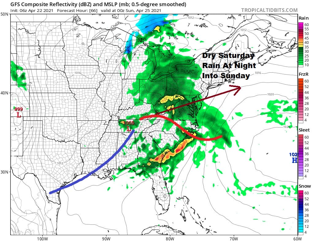
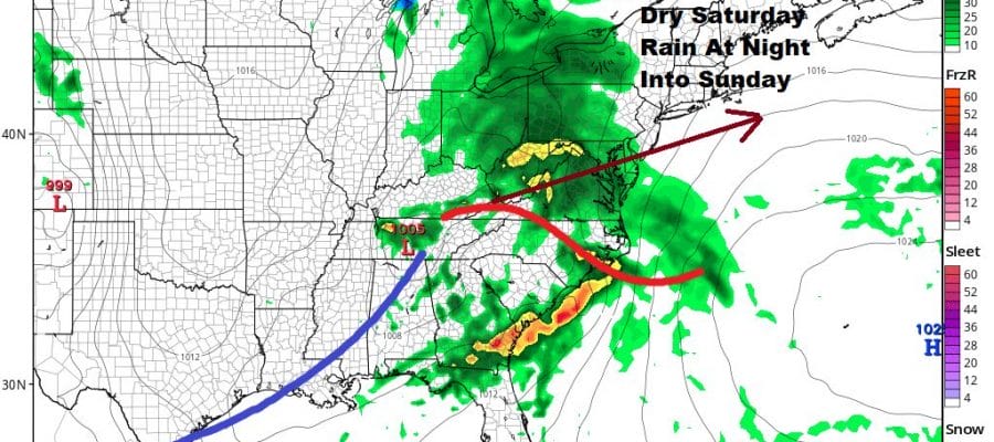
On to the weekend and there are no changes in the outlook. Saturday will be the better of the two weekend days with sunshine giving way to arriving clouds in the afternoon. Highs will be in the 60s to near 70. Low pressure heads out of the Southern Plains to the Delaware New Jersey coast. Rain will develop overnight from south to north and then end during Sunday from southwest to northeast. It seems that the system is moving along at a decent clip and most of the rain should end during the morning hours into midday with leftover clouds to follow in the afternoon. Highs could make it back into the 60s during the afternoon.
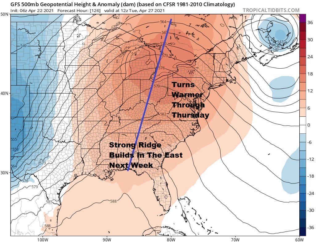
Next week finishes off the month of April and it appears we will be going out in warm dry style. A strong ridge is forecast to build in the Eastern US keeping low pressure well to the east and also well to the west. As long as we don’t get a back door front to sneak southward we should warm up nicely with temperatures in the 70s Monday and Tuesday and we might even see a few 80 degree highs at some point. The next cold front won’t arrive until late in the week so it looks like we may actually string together several nice days in a row.

BE SURE TO DOWNLOAD THE FREE METEOROLOGIST JOE CIOFFI WEATHER APP &
ANGRY BEN’S FREE WEATHER APP “THE ANGRY WEATHERMAN!
MANY THANKS TO TROPICAL TIDBITS FOR THE USE OF MAPS
Please note that with regards to any severe weather, tropical storms, or hurricanes, should a storm be threatening, please consult your local National Weather Service office or your local government officials about what action you should be taking to protect life and property.


