FLORENCE REMNANTS MOVE THROUGH TODAY WITH COLD FRONT
BANDS OF DOWNPOURS 1-2 INCHES
DRY WEATHER LOWER HUMIDITY WEDNESDAY THURSDAY
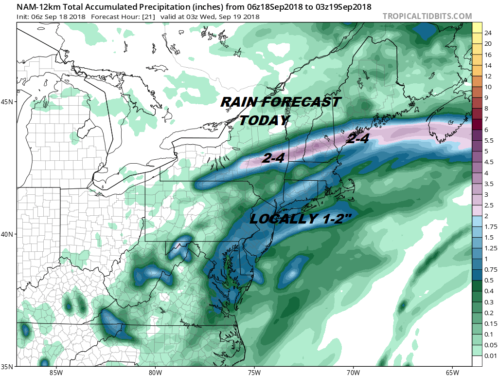
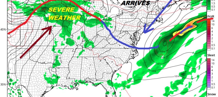
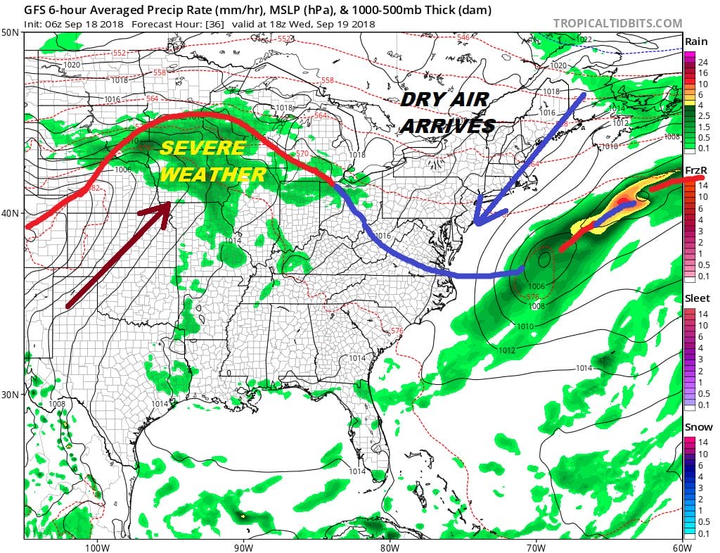
The remnant low of Florence is now moving along through upstate NY and into New England. The circulation is very hard to see at this point so we really don’t have much left from the tropical system at this point other than some waves of rain. A cold front will be approaching the coast and we are fairly deep into this tropical air mass so there will be bands of downpours and thunderstorms moving through today. Some of the rain could be heavy and some of the storms could be strong. The main area of rain probably comes this afternoon and evening. Temperatures will be in the 70s to near 80 today. Though the Storm Prediction Center is not indicating a risk for severe weather this morning but I would not be surprised to see a few severe thunderstorms popping up in the mix.
EASTERN SATELLITE

REGIONAL RADAR

The regional radar shows bands of downpours across Central Pennsylvania. The rains overall have produced some floodnig issues but they have not been widespread and have tended to be more localized. Keep an eye on the strength of the cells as that could produce some localized flooding today.
LOCAL RADAR NEW YORK CITY

LOCAL RADAR PHILADELPHIA


Once the front passes later this evening the downpours end and we will start to see improvement on Wednesday. Clouds may be a bit stubborn at first but we should go partly sunny before too long from west to east. It might take a little longer to clear out along the immediate coast but this too shall happen. Highs will be in the 70s to near 80 with lower humidity.
Thursday with high pressure to the northeast we will see sunshine and a northeast wind with highs in the 70s. The next warm front/cold front combination arrives Friday but the showers with the warm front look to pass well north. The showers will the cold front will fall apart before it gets here because of the lack of moisture. Friday we will see some sunshine with highs in the upper 70s to lower 80s. Then another cool high builds to our north for the weekend. We should see some sunshine for the first weekend of fall with highs both days in the low to mid 70s and nights in the 50s to near 60. I’m a little concerned with the cold front stalling to the south and creagint clo
MANY THANKS TO TROPICAL TIDBITS FOR THE USE OF MAPS
Please note that with regards to any tropical storms or hurricanes, should a storm be threatening, please consult your local National Weather Service office or your local government officials about what action you should be taking to protect life and property.
LATEST JOESTRADAMUS ON THE LONG RANGE


