
Flood Watch NE Pennsylvania, Hudson Valley Connecticut Friday
Flood Watch NE Pennsylvania, Hudson Valley Connecticut Friday
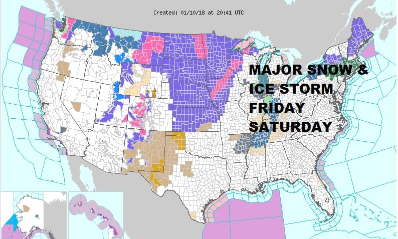
Volatility will be the name of the game over the next 4 days as a major snow and ice storm will be impacting much of the Ohio Valley and the interior Northeast. For our area the impact will be in the form of rains of 1 to 2 inches on top of deep melting snow pack. Flooding is a possibility and a flood watch is posted for a large area as temperatures rise into Friday night.
FLOOD WATCH GFS RAINFALL FORECAST
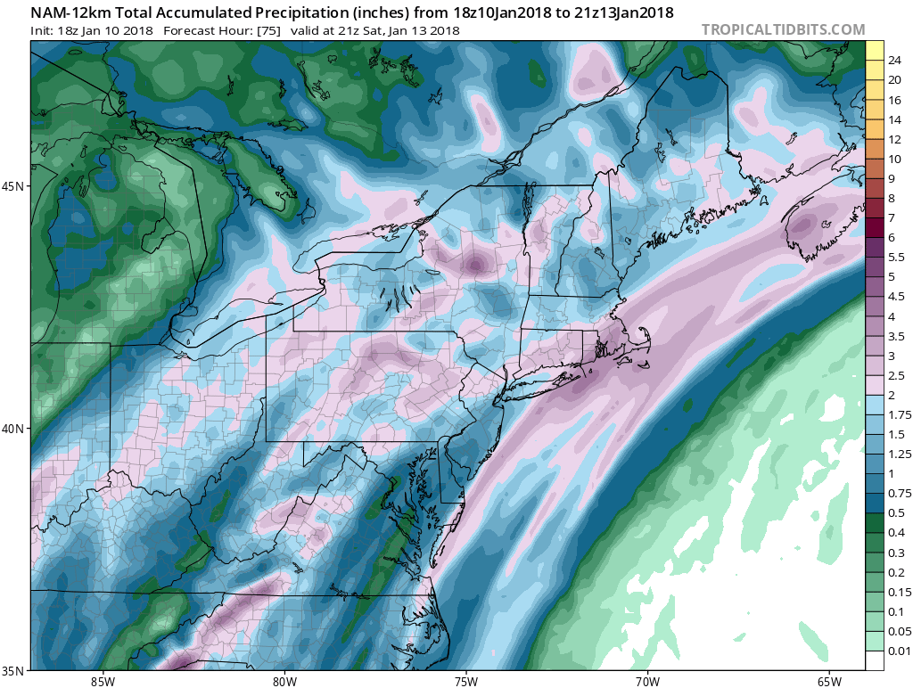
Weather models all show the potential for a couple of inches of rain and the GFS is especially generous with 2 to 3 inch rainfall possible. Warm tropical air ahead of a frontal boundary and a couple of waves of low pressure will be able to produce a large amount of precipitation. Areas to the north and west in upstate NY & Western Pennsylvania into Ohio and Western Kentucky & Tennessee will see this fall as snow and ice and a significant ice storm looms for these areas.
REGIONAL RADAR

As far as the short term there are no issues here into Thursday night. Temperatures tonight will probably hold in the upper 20s to mid 30s and then begin to rise through the 40s Thursday as clouds increase. The first showers will arrive during Thursday night with more numerous showers on Friday into Friday night and even a thunderstorm is possible. Temperatures will rise through the 50s and some 60s are possible in Central & South Jersey and Southeastern Pennsylvania
EUROPEAN MODEL SATURDAY MORNING
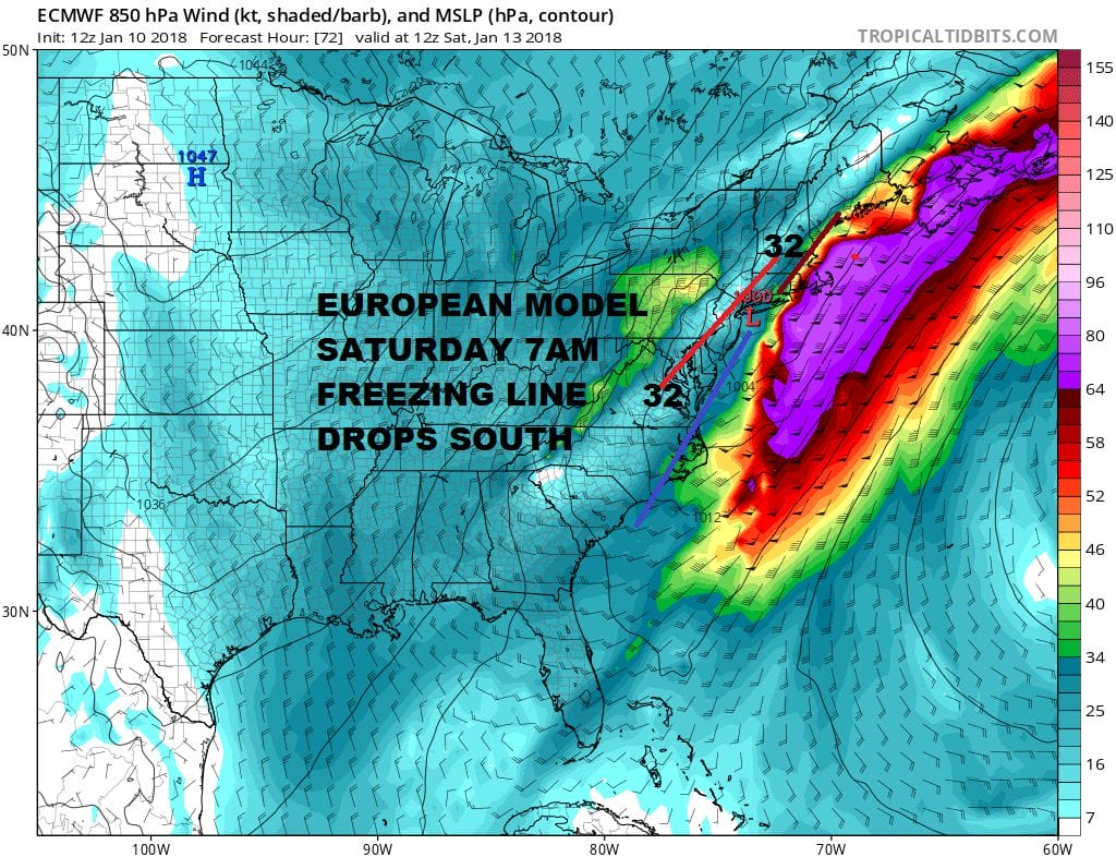
The big question for Saturday morning is the very cold air behind this and how fast does it get in here. The European model today is suggesting that cold air will be more important and possibly bleed down to the coast as precipitation is winding down. A change to sleet and freezing rain is possible Saturday morning in Northern New Jersey, Eastern Pennsylvania & the Hudson Valley. We will be watching carefully to see if models are underplaying the cold air as it arrives. Once this is all done weather condtions should begin to improve Saturday afternoon but temperatures will be falling and we will be down in the teens to near 20 by Sunday morning. Sunday we will see some sunshine but highs will just be in the upper 20s to lower 30s. Next week will be wintry again and there is the chance for some snow later Tuesday into Wednesday with the usual uncertainties that go with it.
 GET JOE A CIGAR IF YOU LIKE

FiOS1 News Weather Forecast For Long Island
FiOS1 News Weather Forecast For New Jersey
FiOS1 News Weather Forecast For Hudson Valley


