DOWNLOAD MY NEW FREE JOESTRADAMUS WEATHER APP FOR ANDROID

THE APP IS ABSOLUTELY FREE TO ALL BUT CONSIDERING SUBSCRIBING TO PATREON FOR A WEATHER EXPERIENCE FREE OF ADS, EXCLUSIVE VIDEOS FOR MEMBERS ONLY AND MUCH MORE…STARTS AT $2 A MONTH..MESSAGE ME AT ANY TIME

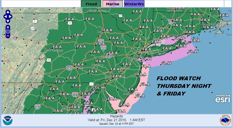
Flood Watch Major Storm Rain Wind Thunderstorms
European Model Gives Up On White Christmas
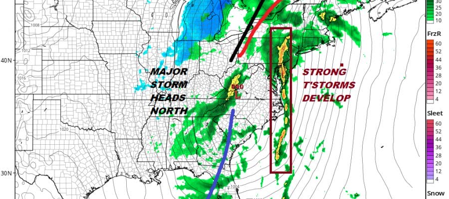
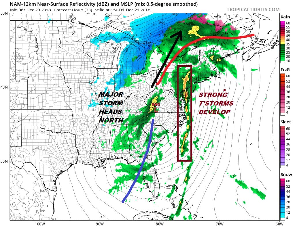
We are watching low pressure developing in the Eastern Gulf States today which is about to make the turn and move up the Appalachians tonight and Friday. We are set up for heavy rain, strong winds along the coast, thunderstorms, and some coastal flooding at high tides Friday. A Flood Watch is in effect from the Coastal Carolinas northward through the Northern Mid Atlantic to Southern New England. Depending how thunderstorms set up on Friday 2 to 3 inches of rain is likely.
This morning we are seeing high clouds beginning to push northward and they will increasing and thickening up rather rapidly. Rain will start to show up on the regional radar later today and it should develop across New Jersey during the mid to late afternoon and then reach NYC around the start of the evening commute and shortly afterwards for Long Island, the Hudson Valley & Southern New England. Temperatures today will rise through the 40s and they will keep rising overnight.
EASTERN SATELLITE

REGIONAL RADAR

Heavy rains will fall tonight into Friday morning. A short break ensues lasting a few hours and then we will see thunderstorms develop and move from west to east. Some of these storm will produce more heavy rains Friday afternoon into Friday evening. Temperatures will rise into the 60s. The storm center heads for the St Lawrence Valley and a cold front whips through here Friday night.
While weather conditions will improve on Saturday as the rain will be gone and we will see some breaks of sunshine developing, winds will still be rather strong and gusty. Travel from or into area airports will be impacted beginning today and lasting right through Saturday. Temperatures Saturday will be in the low 50s before falling off. Sunday we will see clouds and sun with temperatures in the 40s. Christmas Even and Christmas Day look to be relatively uneventful. The European model was the last hold out regarding a White Christmas and it has now caved to the other models which are showing no snow issues early next week. There is the chance for some snow across Upstate NY and into Central & Northern New England but it should not be enough to impact travel. In the meantime fasten your seat belts for tonight into Friday night.
MANY THANKS TO TROPICAL TIDBITS FOR THE USE OF MAPS
Please note that with regards to any tropical storms or hurricanes, should a storm be threatening, please consult your local National Weather Service office or your local government officials about what action you should be taking to protect life and property.

