
DOWNLOAD MY NEW FREE JOESTRADAMUS WEATHER APP FOR ANDROID

THE APP IS ABSOLUTELY FREE TO ALL BUT CONSIDERING SUBSCRIBING TO PATREON FOR A WEATHER EXPERIENCE FREE OF ADS, EXCLUSIVE VIDEOS FOR MEMBERS ONLY AND MUCH MORE…STARTS AT $2 A MONTH..MESSAGE ME AT ANY TIME

FLOOD WATCH MID ATLANTIC & NORTHEAST DCA PHL NYC BOS
HEAVY RAINS 2 TO 3 INCHES STRONG WINDS COASTAL FLOODING & T’STORMS
WINDY DRYING OUT OVER THE WEEKEND, WHITE CHRISTMAS STILL A POSSIBILITY
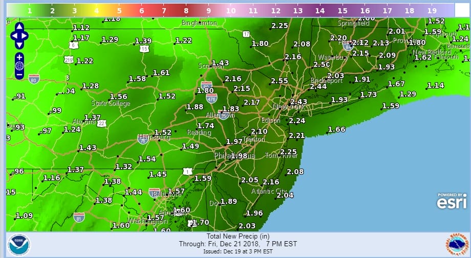
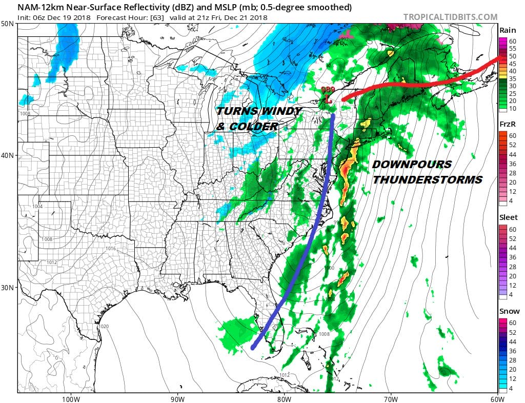
A major storm is getting organized now across the Gulf States and this is going to be a big weather maker here in the East Thursday night & Friday. Flood Watches have been expanded northeastward and southwestward from NYC with 2 to 3 inches of rain possible in some areas. There will be thunderstorms in the mix as well so some areas could see locally higher amounts out of this. In addition strong winds along the coast Thursday night into Friday morning from the south southeast will bring gusts over 50 mph and the possibility of coastal flooding at high tide for the Long Island South Shore as well as parts of the New Jersey shore.
There are no weather issues for this evening and overnight. We had some high clouds move through today which held the temperatures down a bit. We actually will clear out for awhile tonight and that will take temperatures down into the 20s in many cold spots. Most lows will be in the low to mid 30s. Then clouds will rapidly increase Thursday. Rain will be moving into Southern Pennsylvania and Maryland around midday Thursday and by evening it will reach NYC & Southern New England.
EASTERN SATELLITE

REGIONAL RADAR

Thursday night into Friday morning we will see heavy rains into daybreak with the strongest winds along the New Jersey and Long Island coastlines between 2am & 9am. The rain then moves northward and becomes more showery in nature for the rest of Friday but as temperatures rise into the 60s there could be a few thunderstorms. No risk of severe weather is being indicated however a strong thunderstorm would not be a shocker. The best chances for this will be closer to coastal areas rather than inland. Friday night into Saturday we will see winds shifting to the southwest and then west on Saturday. We will still be dealing with gusty winds to over 30 mph on Saturday at least for awhile. If you are travelling Friday or Saturday anticipate delays at the local airports.
It will turn colder and dry for Sunday and Monday Christmas Eve though there will be some upper air disturbances running around that could produce a rain or snow shower Sunday night into Monday morning. Christmas Eve should be dry and so should Christmas Day. However the European model continues to insist that we will see snow on Christmas Day.
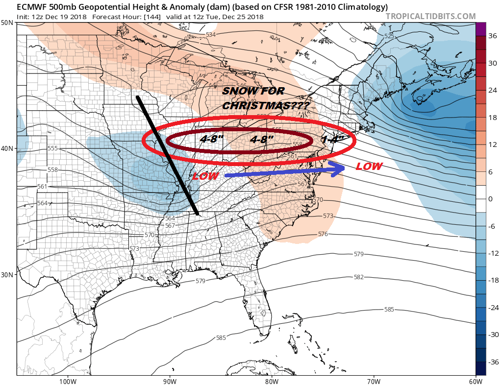
For more on the possibility of a White Christmas, check out the latest JOESTRADAMUS long range post.
MANY THANKS TO TROPICAL TIDBITS FOR THE USE OF MAPS
Please note that with regards to any tropical storms or hurricanes, should a storm be threatening, please consult your local National Weather Service office or your local government officials about what action you should be taking to protect life and property.