
DOWNLOAD MY NEW FREE JOESTRADAMUS WEATHER APP FOR ANDROID

THE APP IS ABSOLUTELY FREE TO ALL BUT CONSIDERING SUBSCRIBING TO PATREON FOR A WEATHER EXPERIENCE FREE OF ADS, EXCLUSIVE VIDEOS FOR MEMBERS ONLY AND MUCH MORE…STARTS AT $2 A MONTH..MESSAGE ME AT ANY TIME

Flood Watch Gales Coastal Flooding Thursday Night Friday
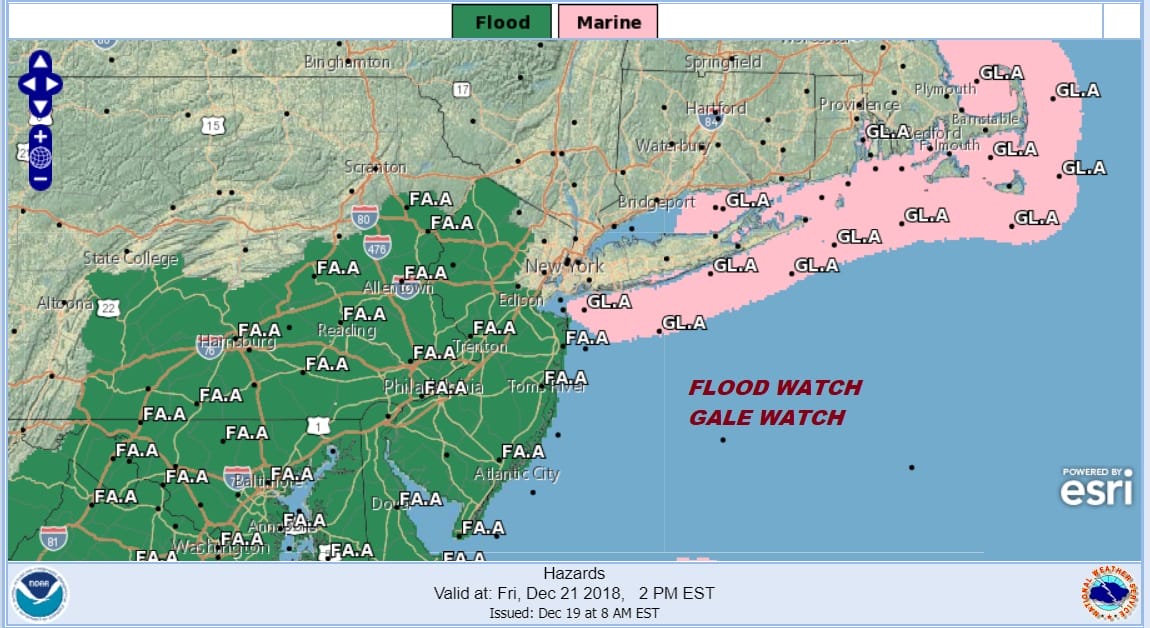
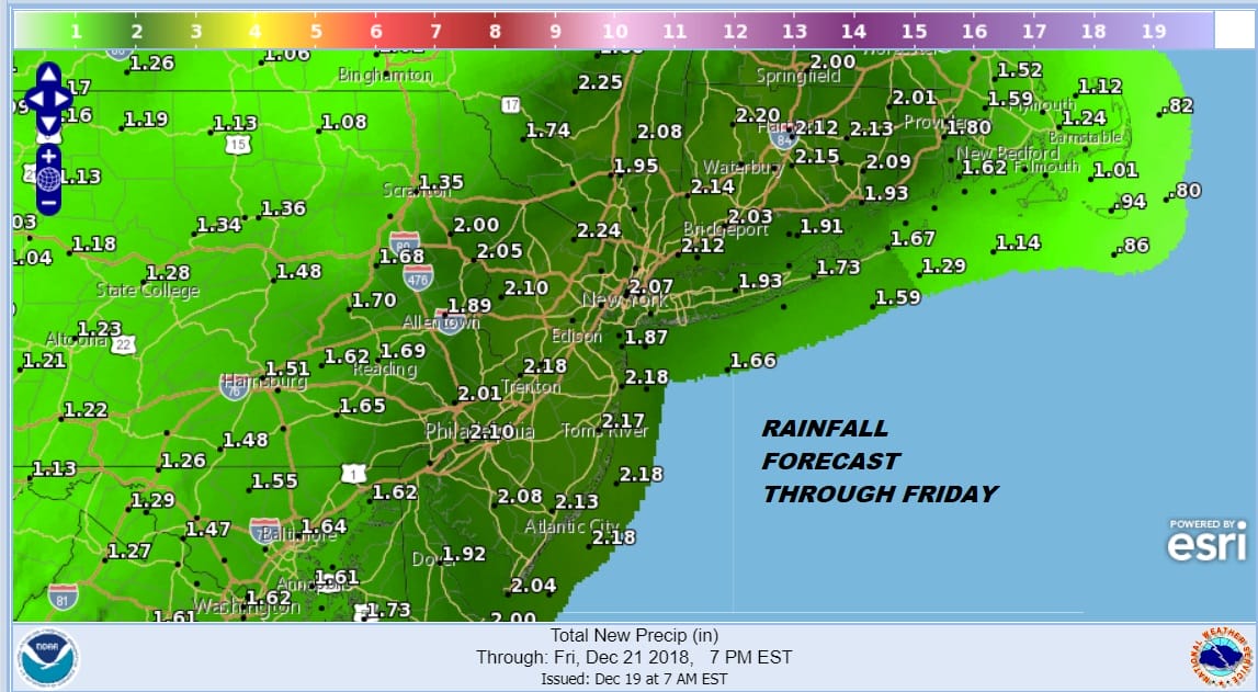
The area under a flood watch continues to grow covering much of the Middle Atlantic States northward through just about all of New Jersey. We will likely see the flood watch extended northward later today to cover NYC, Hudson Valley, Southern New England, and Long Island. Rainfall amounts should be on the order of 1 to 3 inches area wide with some locally higher amounts. This is due to the fact that we actually could see some thunderstorms in the mix here later on Friday.
We start the day cold with sunshine and much less wind. Temperatures bottomed in the 20s and teens in cold spots. Now we set our sights for highs into the 40s and lots of sunshine. Enjoy it because we will see weather conditions deteriorate on Thursday. Skies will be clear tonight before clouds arrive toward morning. Temperatures overnight will not drop very much as we hold in the 30s.
EASTERN SATELLITE

REGIONAL RADAR

Thursday we cloud up quickly with rain developing in the afternoon across New Jersey and spreading northeastward into Southern New England by evening. Then it will be rain into Friday morning with some heavier downpours. Winds along the coast will pick up to gale force from the southeast and south. This raises the prospects of Coastal Flooding at high tide Friday which is the day before the full moon which is Saturday. There could be a bit of a break in the rain Friday morning before we get one more surge of showers and thunderstorms. Temperatures will reach into the 60s for the first time in quite awhile.
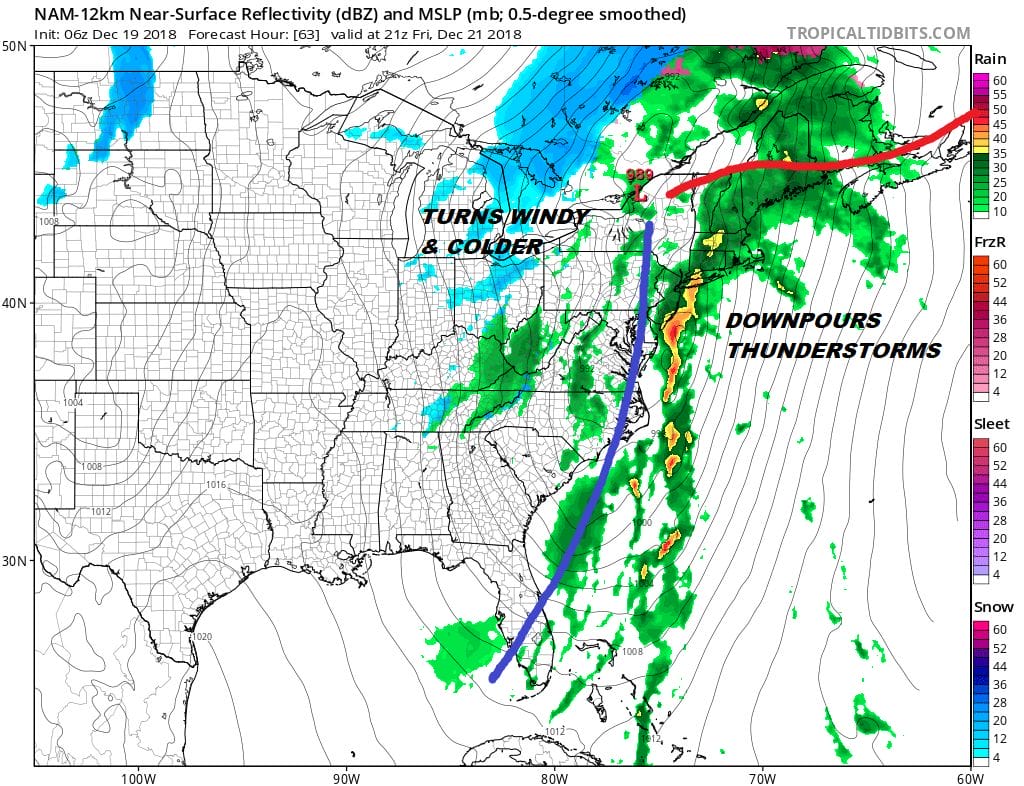
Once the front goes offshore then it will be windy Friday night and Saturday. It won’t turn colder immediately on Saturday. We should still be into the 50s before temperatures settle down to seasonal levels for Sunday and into next week. Right now Christmas Eve & Christmas Day look dry. Weather models show no snow except for the European which continues to show a weak system arriving during Christmas Day with some snow. This run the European has snow from NYC and Long Island southward! It continues to stand alone. We continue to watch.
MANY THANKS TO TROPICAL TIDBITS FOR THE USE OF MAPS
Please note that with regards to any tropical storms or hurricanes, should a storm be threatening, please consult your local National Weather Service office or your local government officials about what action you should be taking to protect life and property.

