FLOOD WATCH FOR WESTERN COUNTIES IN NORTH JERSEY FOR RAIN
COASTAL FLOOD WARNING FOR THE SHORE COUNTIES HIGH TIDES NEW MOON
RAIN ON RADAR GLOOMY RAW DAY AHEAD
This looks like a long week ahead of us weather wise between dealing with the weather of the next 2 days..and then focusing attention on Hurricane Florence which is looking more and more like a North Carolina landfall late this week. First things first is lots of clouds on the satellite that continue to stream eastward. The dry air from New England never made this far south. Temperatures today will be just in the 60s with a northeast wind thanks to a high in Eastern Canada and a warm front to the south.
EASTERN SATELLITE

REGIONAL RADAR

Radar is actually pretty loaded this morning just west of the coast with solid rain all across Pennsylvania southward to Maryland and Northern Virginia west into the Ohio Valley. Low pressure is headed there which also represents the remnants of Tropical Storm Gordon.
LOCAL RADAR NEW YORK CITY

LOCAL RADAR PHILADELPHIA


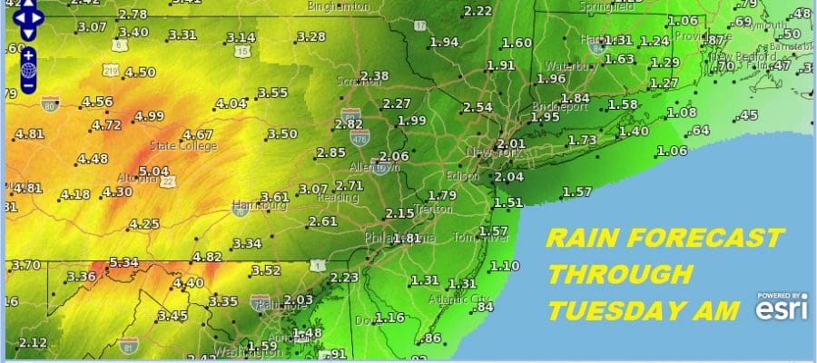
For areas north and east of NYC the dry air to the north may hold the rain back for awhile today but eventually the rain will move eastward. To the west the rain takes over with some heavy downpours and flash flooding possible. Flood Watch is up for the Western Counties in NJ north of Route 195 as well as all of Pennsylvania. We also have a new moon tonight and Coastal Flood Warnings are up for the New Jersey shore and for Delaware Bay and the Delaware River for high tides today and probably for the next few days.
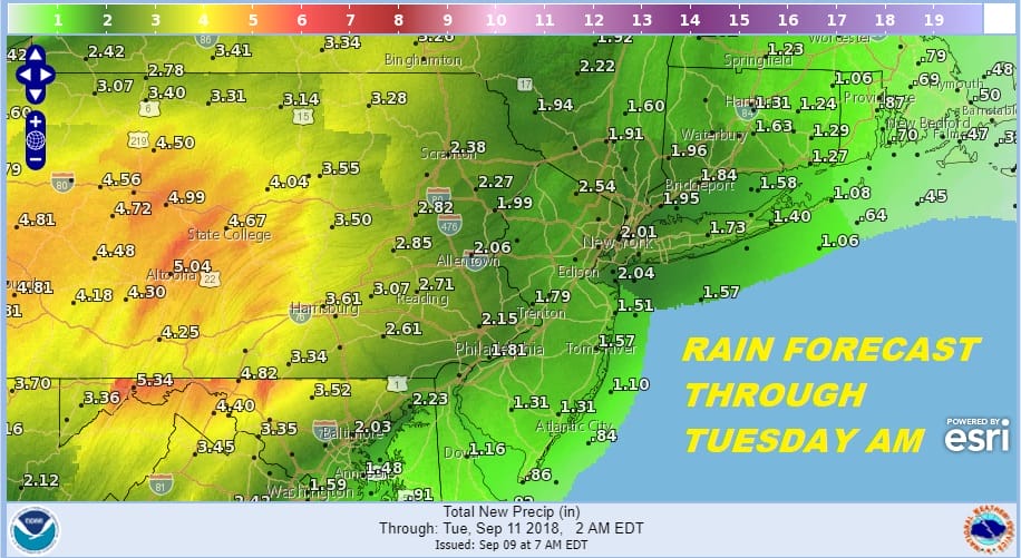
Rain continues tonight and into at least part of Monday. Notice the rainfall forecast amounts are for a solid couple of inches everywhere and some 5 inch plus amounts are possible in parts of South Central Pennsylvania southward. The warm front will be passing northward later Monday into Monday night. Temperatures Monday will inch back into the 70s slowly. Then it is back to warm and increasingly humid conditions beginning on Tuesday as the East Coast begins to set the atmosphere up for the arrival of Hurricane Florence.
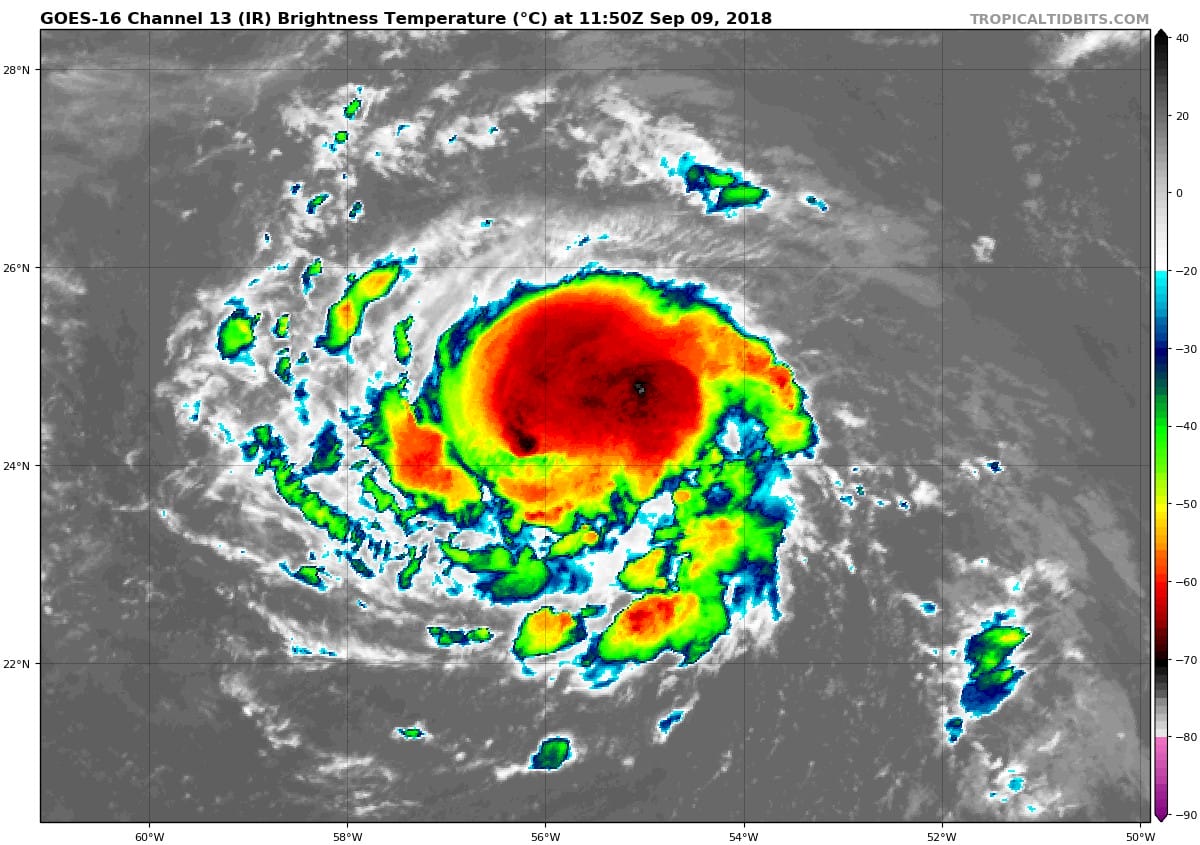
Satellite pictures this morning show that Florence continues to organize and it looks like it is almost backi to hurricane status. The core of the storm continues to improve and the system is taking on a more circular look to it. Florence is literally inching its way westward at 7 mph. Florence will miss the trough in the Atlantic today and make its way to the East Coast. The risk grows further for the Carolinas and particularly for North Carolina late this week. We will have an extensive post on Florence later this morning and look for live streams on Youtube late this morning as well. Also we have additional coverage on our new Patreon platform.
MANY THANKS TO TROPICAL TIDBITS FOR THE USE OF MAPS
Please note that with regards to any tropical storms or hurricanes, should a storm be threatening, please consult your local National Weather Service office or your local government officials about what action you should be taking to protect life and property.
LATEST JOESTRADAMUS ON THE LONG RANGE


