Flash Flood Watch Severe Weather Tornado Risk Today Tonight
Weekend Looking Good

Weather in 5/Joe & Joe Weather Show Latest Podcast
Flash Flood Watch Severe Weather Tornado Risk Today Tonight
Weekend Looking Good
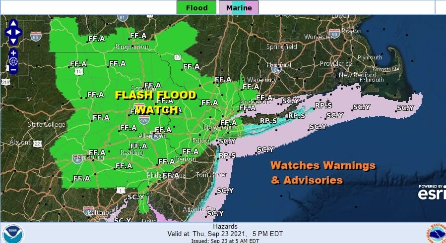
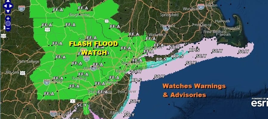
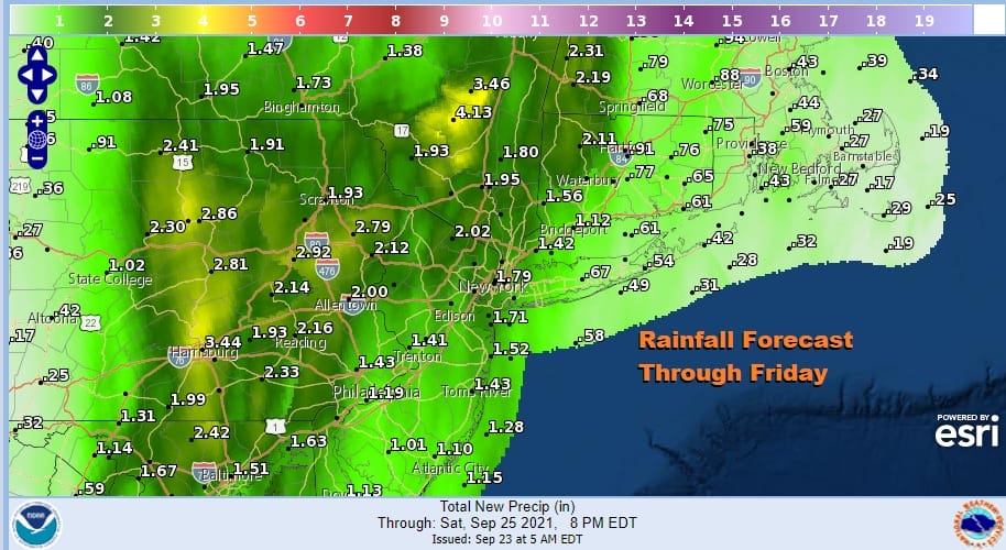
Our slow moving cold front continues to inch eastward and we have some rough weather to get through as the front passes. Flash flood watches are posted for Eastern Pennsylvania where it has been raining since yesterday. Heavy downpours and thunderstorms will produce up to 2 to 3 inches locally and a general 1 to 2 inch rainfall is likely in most areas.
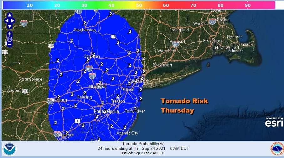
Very warm tropical air with dew points over 70 and an unstable atmosphere sets up severe weather risk and the Storm Prediction Center has a marginal risk for severe weather however they also indicate a 2 percent Tornado risk. We have seen an unusual number of severe weather events produce tornadoes over the summer and that trend continues.

The satellite shows what looks like a north south arm of moisture producing rain and thunderstorms. The band is narrow but it is very slow moving and it will take all day long for it to move out of Pennsylvania which it is doing now and reaching the coastal areas late in the day or in the evening.
SATELLITE

Ahead of the main area of downpours and thunderstorms we are seeing some light showery rains coming in from off the ocean and moving northwest. Inland see that band moving more north than east and that explains the very slow progress eastward.

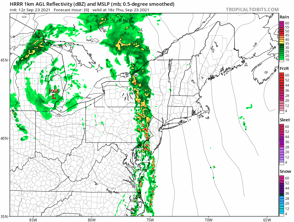
We can follow this along on the HRRR radar loop forecast in two hour increments from 1pm this afternoon until 7pm Friday. Normally these lines fly through but not this time. While you are under the band of downpours rain will fall heavy at times. Notice that it isn’t until overnight and Friday morning that we see those showers over areas east of NYC. It doesn’t even move into New Jersey until late afternoon and evening! Temperatures will be in the 70s all day with high humidity.
The slow crawling front continues to inch eastward and that will leave leftover clouds on the back side. There still could be some showers east of NYC but to the west and south, it will just be leftover clouds and maybe some breaks of sunshine develop in Pennsylvania and points south and west. Temperatures on Friday will be in the upper 60s to lower 70s in most places. Finally the front weakens and gets a nudge east so we can look ahead to a nice weekend.
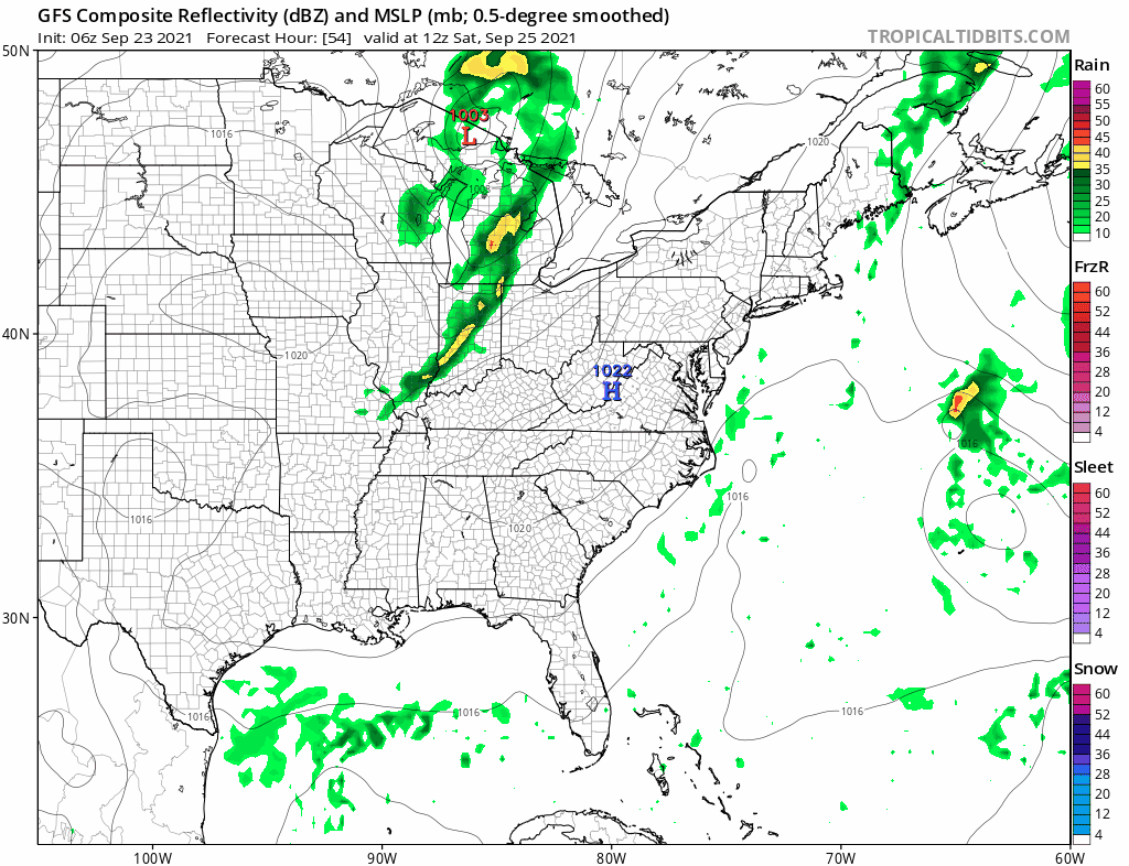
High pressure nudges in for Saturday and we should have mostly sunny skies inland and partly sunny near the coast and east. This is due to the front being still close by. An upper trough will move through Saturday night with a few clouds and that should give the offshore system one final push out to the east. Humidity levels will actually start to drop later Friday and we will have dry comfortable conditions through the weekend and for much of next week. Temperatures Saturday and Sunday will be in the low to mid 70s. Sunday should be a mostly sunny day. Next week looks dry with one cold front late Tuesday with a late day shower risk. Otherwise it should be a good week. On the lower right at the end of the GFS loop we see what will likely be Hurricane Sam and while GFS shows it offshore, we will keep the door open to a track further west thanks to a rather unstable upper air weather pattern developing late next week.
BE SURE TO DOWNLOAD THE FREE METEOROLOGIST JOE CIOFFI WEATHER APP &
ANGRY BEN’S FREE WEATHER APP “THE ANGRY WEATHERMAN!

MANY THANKS TO TROPICAL TIDBITS & F5 WEATHER FOR THE USE OF MAPS
Please note that with regards to any severe weather, tropical storms, or hurricanes, should a storm be threatening, please consult your local National Weather Service office or your local government officials about what action you should be taking to protect life and property.


