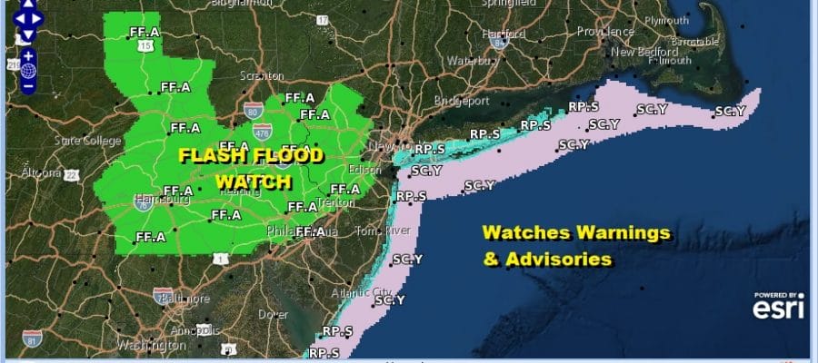
Flash Flood Watch Northwest New Jersey Late Thursday Into Friday Morning
Nice Dry Weekend

Weather in 5/Joe & Joe Weather Show Latest Podcast
Flash Flood Watch Northwest New Jersey Late Thursday Into Friday Morning
Nice Dry Weekend
A slow moving cold front in the Ohio Valley is creeping eastward. Ahead of it there is some tropical moisture moving northward on a southerly flow. It isn’t producing much in the way of showers and we think that other than a passing shower today into the first part of Thursday, most of the time it will be rain free with mostly cloudy humid conditions. Highs will be in the 70s to near 80 today and again Thursday.
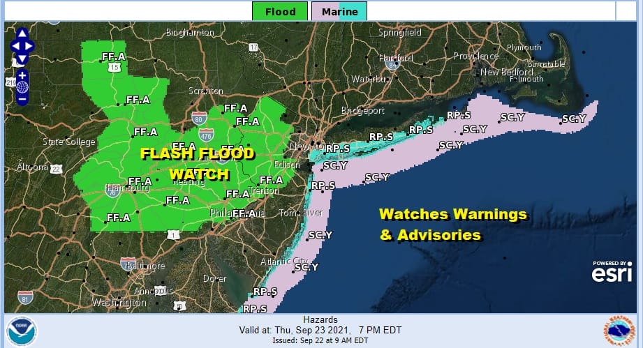
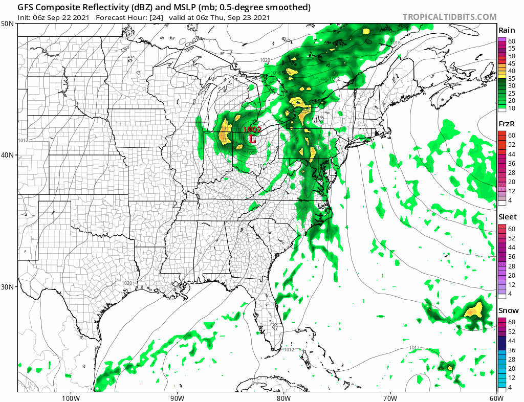
A slow moving narrow band of rain and thunderstorms will then move through late Thursday into early Friday from west to east and it is from this that we could see some heavy rain issues mostly inland. Flash Flood Watches are posted for Northern New Jersey mainly north and west of the Turnpike and along and west of Route 287. Also Flash Flood Watches cover a solid chunk of Eastern Pennsylvania. Areas to the east will deal with the front weakening and rainfall amounts there will be below flash flood thresholds.
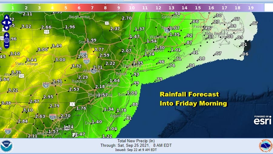
Flash Flood Watch areas could see 2 to 3 inches of rain and in some places in Eastern Pennsylvania 3 or more inches is possible but the amounts do drop off considerably as you head east. Meanwhile not much happens today. We have clouds on the satellite and while the radar is picking up on some showers out in the ocean and to the west, they are scattered and moving from south to north.
SATELLITE

WEATHER RADAR

A warm humid night lies ahead with lows in the 60s. Then Thursday we wait for the front to approach. The slow moving nature means that some areas to the east could be dry for much of the day before showers and thunderstorms move in.
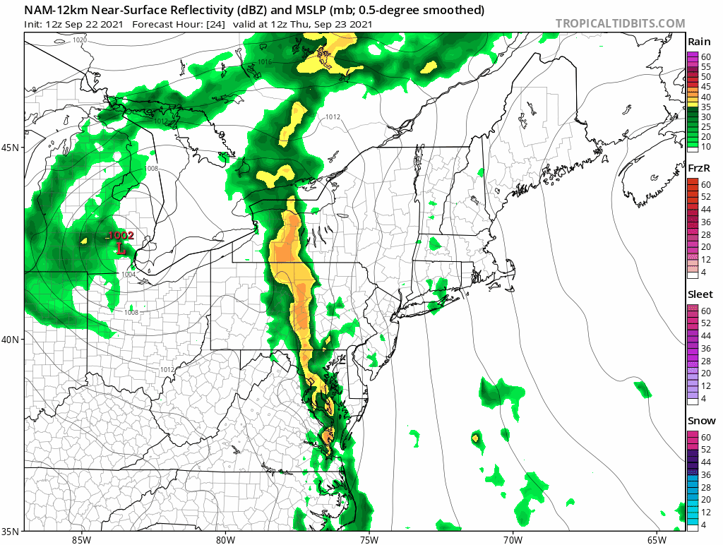
Notice the narrow nature of the rain and thunderstorms. It takes all day for the front to move a handful of miles meaning that if you are under this band you will see heavy rains for 6 to 8 hours and that could lead to flash flooding. East of that band you could see a few stray showers but you will have to wait for the band to arrive and that could take all day or even waiting until sometime Thursday night.
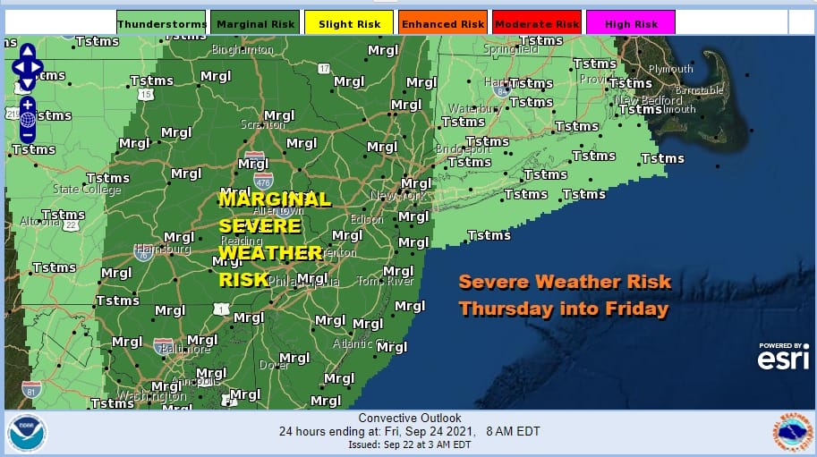
Severe weather risk is part of this equation and the Storm Prediction Center has a marginal risk of Severe Weather for Eastern Pennsylvania and New Jersey southward and east to Western Long Island and the Hudson Valley. There is a 2% tornado risk indicated for much of the marginal risk zone. Thursday highs will be in the 70s to near 80 degrees for most areas though temperatures drop once the front passes.
Friday sees slow improvement as the front crawls offshore and the showers push to the east. It will be slow clearing from west to east with decreasing clouds but it may take all day for clearing to reach the coast. Temperatures Friday will be in a range of 70 to 75. It does leave us in a good place for the weekend. Saturday we will see sunshine with highs in the low to mid 70s in most places. A weak front will pass with an upper trough Saturday night with not much with it other than a few clouds. Sunday will be dry with sunshine. Highs again in the low to mid 70s. An early look at next week seems to dry much if not all week. Humidity levels will be low. Another front passes late Tuesday and a cool dry high builds in for the second half of the week.
BE SURE TO DOWNLOAD THE FREE METEOROLOGIST JOE CIOFFI WEATHER APP &
ANGRY BEN’S FREE WEATHER APP “THE ANGRY WEATHERMAN!

MANY THANKS TO TROPICAL TIDBITS & F5 WEATHER FOR THE USE OF MAPS
Please note that with regards to any severe weather, tropical storms, or hurricanes, should a storm be threatening, please consult your local National Weather Service office or your local government officials about what action you should be taking to protect life and property.


