Flash Flood Watch Northern New Jersey to Southern New England
Flash Flood Watch Northern New Jersey to
NYC Long Island Hudson Valley Southern New England

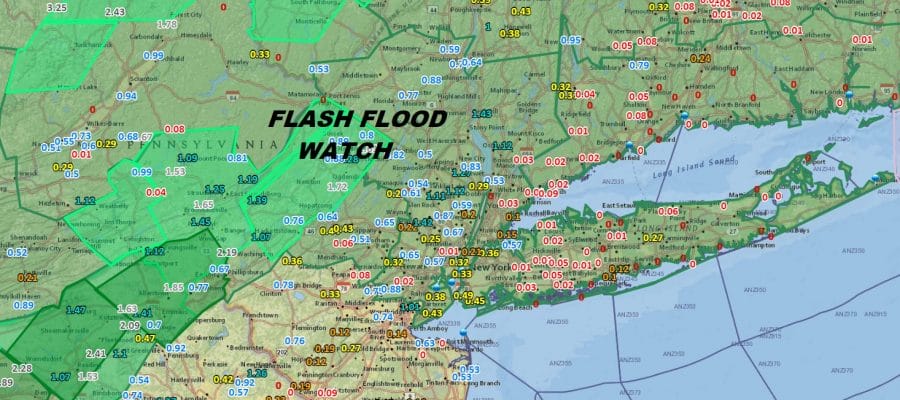
Flash Flood Watch continues for much of Eastern Pennsylvania eastward to Northern New Jersey, NYC, the Hudson Valley, Southern New England and Long Island. The map abvoe shows the watch in the green. The darker greens are flood warnings while the lighter green areas are flood advisories. Rainfall amounts on the map are for the last 24 hours. Bear in mind that much of the area inland of the coast has received over a foot of rain in the last 2 1/2 weeks. The flood threshold is very low and there is more rain coming overnight and for the first part of Saturday.
EASTERN SATELLITE

REGIONAL RADAR

Satellite and radar loops show progress is being made as the western edge of the rain shield is moving eastward. This indicates that the upper trough that has been to our west for the last several days is finally weakening and lifting out to the northeast. Heavy rains at the moment are mostly in Pennsylvania and into Northwest New Jersey and the Hudson Valley north of Route 84. This area will shift eastward overnight and reach the coast around daybreak.
LOCAL RADAR NEW YORK CITY

LOCAL RADAR PHILADELPHIA


Rain is likely at least through the first part of the day but areas west of NYC should see some improvement in the afternoon Saturday. East of NYC the rain could last into early or mid afternoon before finally moving offshore. Where weather conditions improve temperatures will reach the 80s while areas to the east struggle in the 70s until the rains clear and the clouds break.
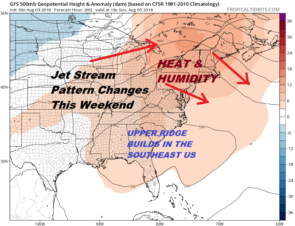
Sunday begins a 3 or 4 day stretch of 90 plus temperatures. Except for an isolated downpour or thunderstorm Sunday and Monday will be rain free and we should see a good deal of sunshine. Tuesday we will reach the 90s again but a cold front will approach with showers and thunderstorms late Tuesday or Tuesday night. Wednesday is a bit tricky temperature wise as it will depend on whether the front gets through or gets hung up. One thing that will remain constant into midweek will be the humidity which will remain stubbornly high.
Please note that with regards to any tropical storms or hurricanes, should a storm be threatening, please consult your local National Weather Service office or your local government officials about what action you should be taking to protect life and property.
 GET JOE A CIGAR IF YOU LIKE

LATEST JOESTRADAMUS ON THE LONG RANGE


