
FLASH FLOOD WARNINGS HEAVY RAIN MOVING EAST
FLASH FLOOD WARNINGS HEAVY RAIN MOVING EAST
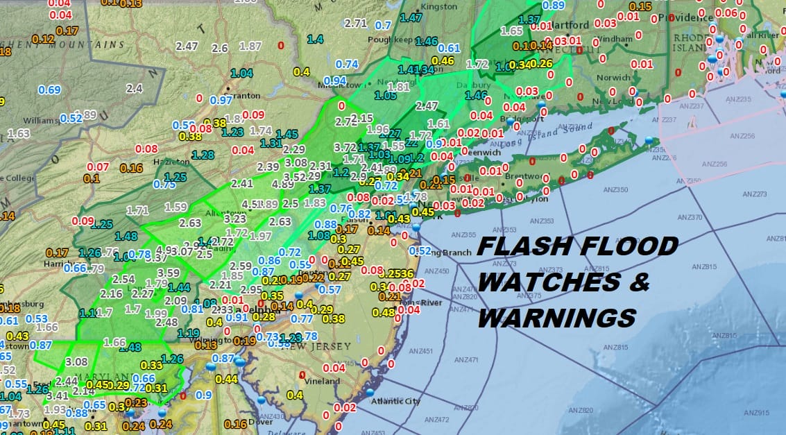
Rain overnight across New Jersey and Pennsylvania has been substantial enough to trigger flood warnings and flash flood warnings this morning over many Northern New Jersey counties. 24 hour rainfalls of up 2 inches were common and 3 day rainfall amounts have reached 6 inches in some areas.

This morning we are seeing a lot of clouds and rain overhead but the western edge of the cloud line is making eastward progress as the upper trough driving all this tropical moisture breaks down. Rain should gradually shift east and offshore as the rain finally comes to an end from west to east later today.
EASTERN SATELLITE

REGIONAL RADAR

Local radars remain busy this morning from NYC westward. Over the next several hours the rain should spread eastward across Long Island.
LOCAL RADAR NEW YORK CITY

LOCAL RADAR PHILADELPHIA


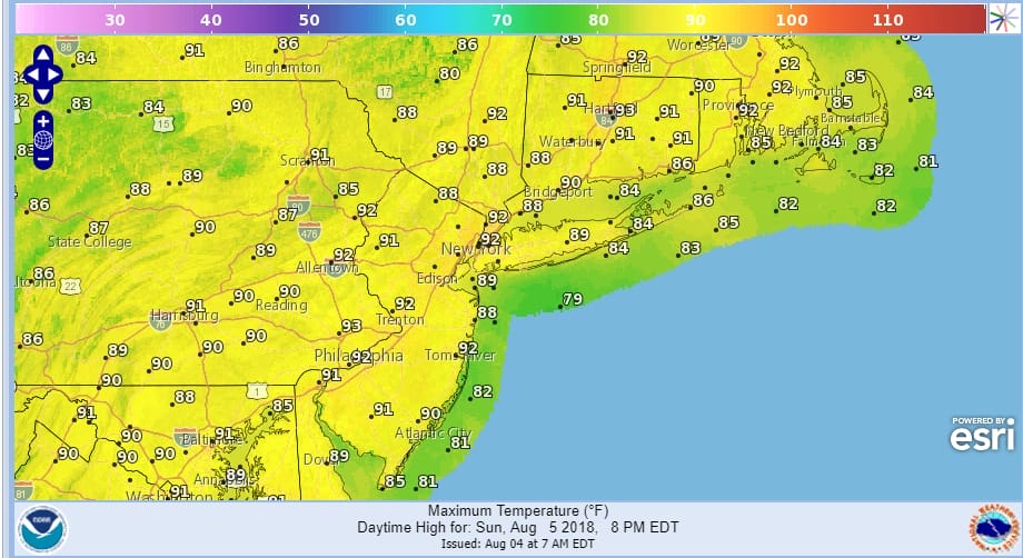
Temperatures today are going to reach into the 80s especially in areas where the rain comes to an end before midday. We will see skies clear tonight as high pressure builds along the East Coast and winds turn from southeast to westerly. Sunday begins the hot humid weather with sunshine. Highs will reach into the 90s in most locations and there should be very little in the way of shower and thunderstorm activity. The same holds for Monday.
SUNDAY FORECAST HIGH TEMPERATURES
MONDAY FORECAST HIGH TEMPERATURES
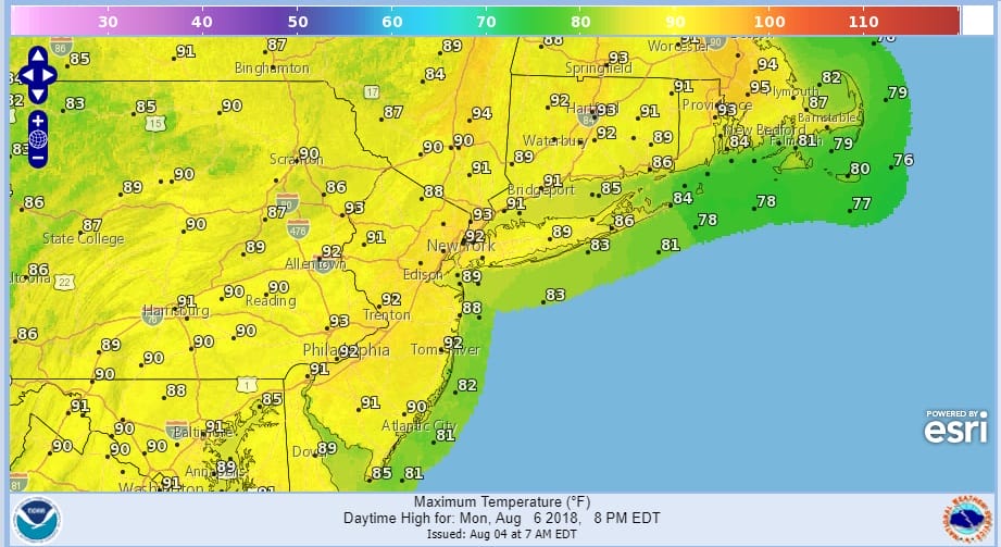
Tuesday will be a third day of 90 degree plus highs but there is a chance for thunderstorms late in the day and into Wednesday as the next cold front approaches. The humidity has been outrageous and we may have to wait until later next week for any kind of significant break.
Please note that with regards to any tropical storms or hurricanes, should a storm be threatening, please consult your local National Weather Service office or your local government officials about what action you should be taking to protect life and property.
 GET JOE A CIGAR IF YOU LIKE

LATEST JOESTRADAMUS ON THE LONG RANGE


