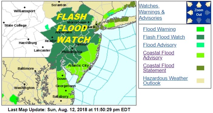
Flash Flood Watch Most of New Jersey Rains Moving North
Flash Flood Watch Most of New Jersey Rains Moving North

A new flash flood watch is in effect for Most of New Jersey and Eastern Pennsylvania. You can probably expect the Northeastern counties will be added to the flash flood watch Monday morning and even the coastal counties could be at risk for flash flooding as downpours and thunderstorms are moving northward. The satellite loop shows expanding cloud cover to our south along with a growing area of downpours and thunderstorms. This is in response the the strong upper low to our west and a wave of low pressure moving northward long the coast.
EASTERN SATELLITE

REGIONAL RADAR

LOCAL RADAR NEW YORK CITY

LOCAL RADAR PHILADELPHIA


Some downpours are likely to be scattered around during the morning rush hour commute but late morning and afternoon downpours and thunderstorms are likely to develop again. It seems the greatest risk for these downpours will be in the Northern and Western New Jersey counties where the heaviest rains are forecast.
GFS RAINFALL FORECAST THROUGH TUESDAY MORNING

Once again there will be variability in rainfall amounts with up to several inches possible. The threshold for flooding is very low with saturated grounds just about everywhere. Tuesday could see one last day where downpours are probable before weather conditions improve area wide on Wednesday. Humidity will remain high for all this week.
MANY THANKS TO TROPICAL TIDBITS FOR THE USE OF MAPS
Please note that with regards to any tropical storms or hurricanes, should a storm be threatening, please consult your local National Weather Service office or your local government officials about what action you should be taking to protect life and property.
LATEST JOESTRADAMUS ON THE LONG RANGE


