Flash Flood Warnings More Rain Later Today
Flash Flood Warnings More Rain Later Today
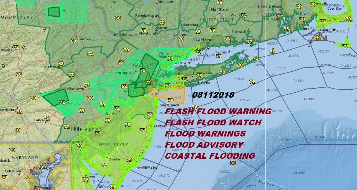
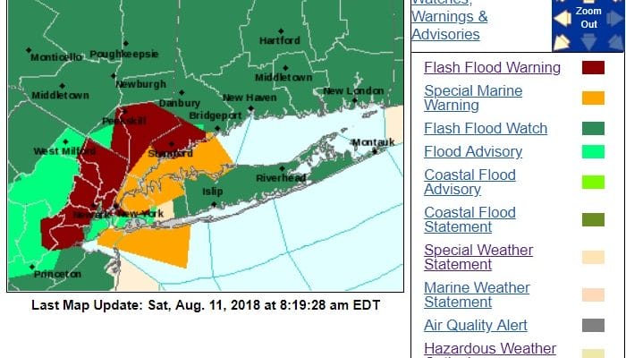
We are already waking up to Flash Flood Warnings over parts of Northern New Jersey and a slew of flood advisories, flood warnings, and coastal flood advisories. It is going to be that kind of a day with this first area of rain moving out likely to be followed by another round of heavy rain later today. Needless to say somebody is going to get clobbered with rainfall. Some areas today are going to see several inches of rain. The Flash Flood watch covers everyone from Southeastern Pennsylvania through most of New Jersey except the coastal counties, the Hudson Valley, NYC, Connecticut, and Long Island.
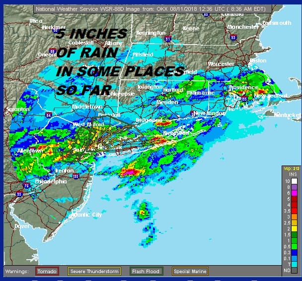
Take a look at these doppler rainfall estimates for the last 18 hours. Some areas have received 3 to 5 inches of rain already!
EASTERN SATELLITE

REGIONAL RADAR

The National Weather Service in Upton NY has issued a
* Flash Flood Warning for…
Southern Fairfield County in southern Connecticut…
Hudson County in northeastern New Jersey…
Eastern Bergen County in northeastern New Jersey…
Westchester County in southeastern New York…
Queens County in southeastern New York…
Bronx County in southeastern New York…
Kings County in southeastern New York…
Rockland County in southeastern New York…
New York (Manhattan) County in southeastern New York…
* Until 1015 AM EDT.
* At 814 AM EDT, Doppler radar indicated thunderstorms producing
heavy rain across the warned area. Flash flooding is expected to
begin shortly.
* Some locations that will experience flooding include…
Jersey City, Jamaica, Yonkers, Stamford, Norwalk, New Rochelle,
Flushing, Bayonne, White Plains, Mott Haven, Hoboken, East Tremont,
Hackensack, New City and Port Chester.
PRECAUTIONARY/PREPAREDNESS ACTIONS…
Turn around, don`t drown when encountering flooded roads. Most flood
deaths occur in vehicles.
Excessive runoff from heavy rainfall will cause flooding of small
creeks and streams, urban areas, highways, streets and underpasses as
well as other drainage areas and low lying spots
LOCAL RADAR NEW YORK CITY

LOCAL RADAR PHILADELPHIA


There really isn’t any change to the logic of the forecast right through Tuesday. With an upper low to the west and southerly flow aloft, plus a couple of waves of low pressure, the threat for downpours continues into the middle of next week. It doesn’t rain all the time but when it does, it pours. 4 day rainfall totals are likely to exceed 6 inches in some places. The HRRR drops at least half that amount today in some places.
HRRR RAINFALL THROUGH 11PM AUGUST 11, 2018

This is going to be a busy day with flood warnings and even the occasional severe thunderstorm so be cautious and pay attention to the radars.
MANY THANKS TO TROPICAL TIDBITS FOR THE USE OF MAPS
Please note that with regards to any tropical storms or hurricanes, should a storm be threatening, please consult your local National Weather Service office or your local government officials about what action you should be taking to protect life and property.
LATEST JOESTRADAMUS ON THE LONG RANGE


