Fierce Noreaster Winds Increasing Rain Changes To Snow Inland
Fierce Noreaster Winds Increasing Rain Changes To Snow Inland
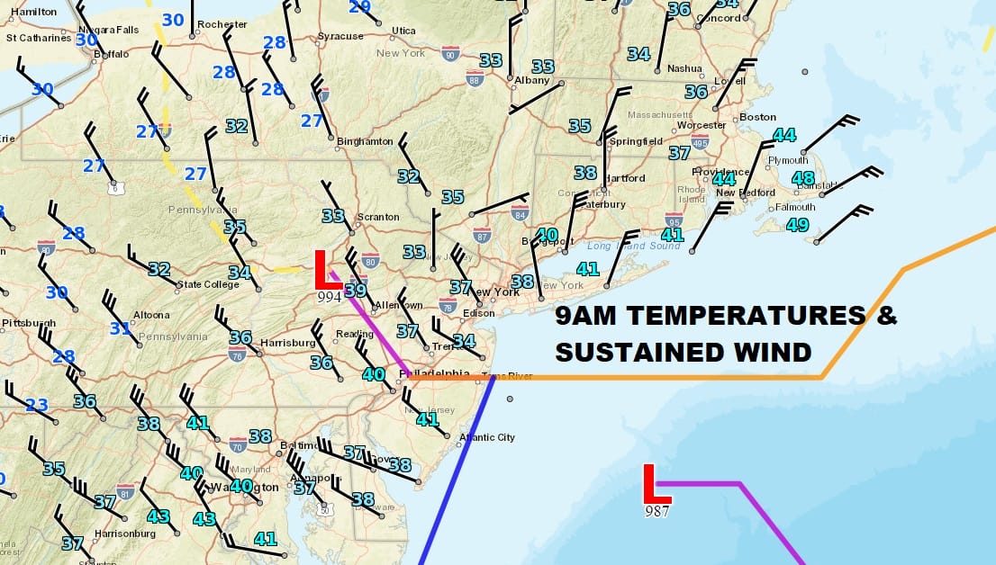
Everything appears to be occurring on schedule this morning as the secondary low intensifies rapidly just offshore. Winds have been increasing but what is a bit of a surprise is that temperatures are about 5 to 10 degrees colder than what many weather models were forecasting over the last few days. We have been seeing a change over to snow in the Hudson Valley and in Northern New Jersey and in some places further south and east as of 9am. This should continue to play out in the next few hours. Winds will be the next issue along coastal areas as they will begin to howl with gusts to 50 to 60 mph.

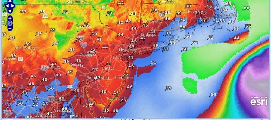
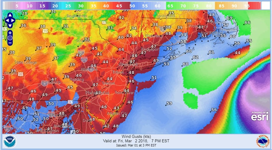
Coastal wind gusts are now starting to increase over Eastern Long Island where there have been gusts to 50 mph. Also seeing it to the south near Chesapeake Bay where there are gusts to 50 mph. Over the next few hours those strong winds will be increasing up and down the coast reaching their peaks late this afternoon and evening.
FORECAST WIND GUSTS 7PM FRIDAY
The satellite signature is taking on the signs of a major storm here with the secondary low wrapping up just offshore. This is looking like the classic intense noreasters we have seen in the past.
US SATELLITE

REGIONAL RADAR

LOCAL RADAR NEW YORK CITY

LOCAL RADAR PHILADELPHIA


WAtching the radar loops you can see the west side of the storm’s counterclockwise circulation. Rain has changed to snow in the Hudson Valley and parts of Northern New Jersey and this is going to continue into the afternoon but remember this is elevation and intensity driven so that will ultimately determine if you a get nothing, a coating, several, or many inches. Weather models are faster with the getting this all out of here by sometime this evening with weather conditions slowly improving overnight though winds will still be howling. Clouds and some breaks of sunshine should be here for Saturday with gusty winds especially along the coast and temperatures in the 40s. Sunshine and calmer on Sunday with highs in the low to mid 40s is the outlook to finish the weekend at least on a good note.
 GET JOE A CIGAR IF YOU LIKE

FiOS1 News Weather Forecast For Long Island
FiOS1 News Weather Forecast For New Jersey
FiOS1 News Weather Forecast For Hudson Valley


