
Father’s Day Weekend Starts Very Warm Stretch Into Next Week

Father’s Day Weekend Starts Very Warm Stretch Into Next Week
It figures that it waits until mid June for a nice stretch of weather but in reality it is around the water temperatures are starting to move into the 60s and that makes the marine layer less of an issue. We also are finally seeing an upper air pattern which would favor dry very warm to hot conditions verses the constant marine influence. Blocking in the North Atlantic has come and gone and this allows a big ridge to build into the Eastern US.
UPPER AIR FORECAST EARLY SUNDAY MORNING
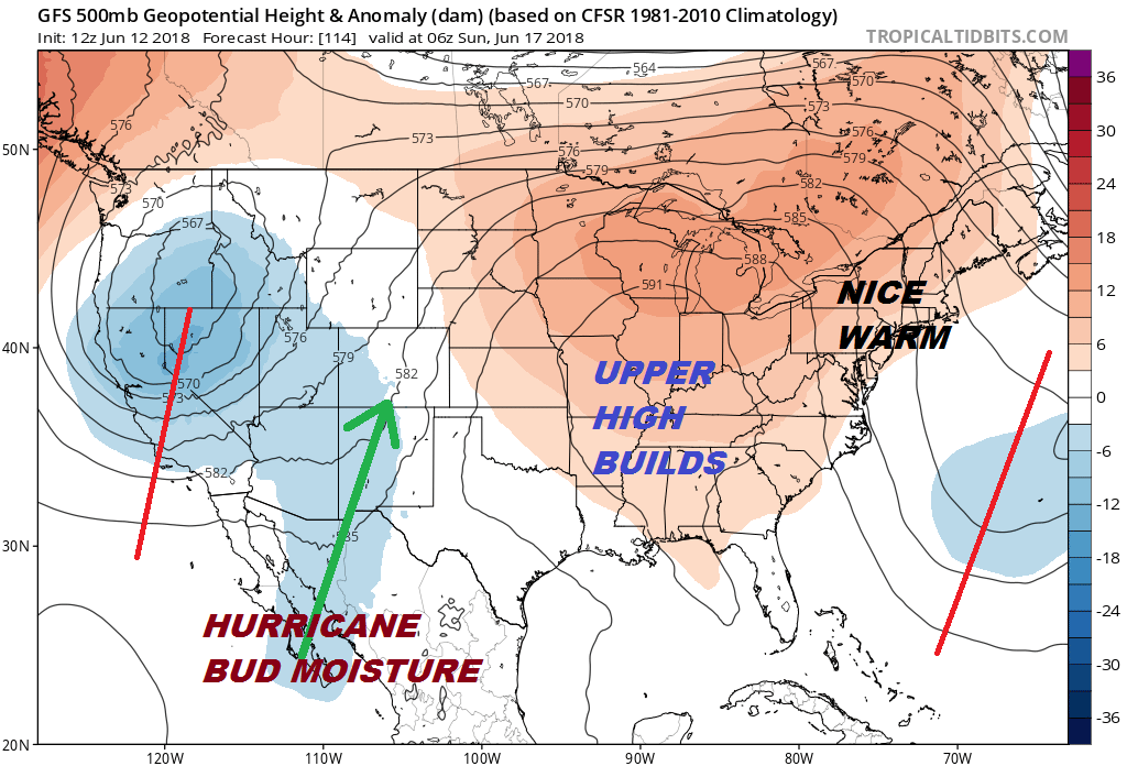
The presence of the trough to the east will produce northerly winds aloft which will keep the humidity levels reasonable at least through Saturday and probably into Sunday as well. Temperatures should reach the mid to some upper 80s both days. The sea breeze will likely be confined to the immediate coast but it should still make the 70s at the beaches. Monday looks like the hot humid day with highs reaching into the 90s and the chance there could be a thunderstorm in the afternoon and evening. No showers or thunderstorms are forecast for the weekend.
GFS SURFACE MAP MONDAY JUNE 19TH 8PM
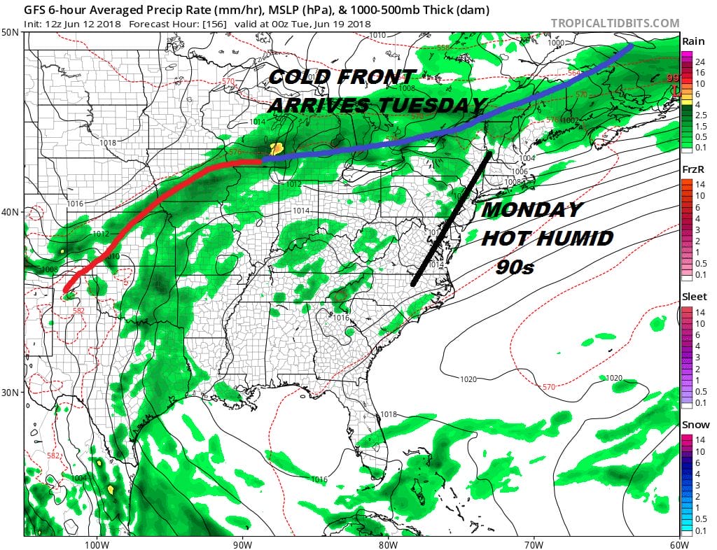
The next cold front arrives Monday night which will move through and break the short round of heat. Cooler air from Canada replaces it but right now it doesn’t seem to put us back into anything problematic. It will be warm Tuesday and Wednesday with temperatures in the 80s with reasonable humidity. At least that is the plan for the time being.
SHOP THE JOESTRADAMUS STORE
MANY THANKS TO TROPICAL TIDBITS FOR THE WONDERFUL USE OF THE MAPS

GET JOE A CIGAR IF YOU LIKE!
FiOS1 News Weather Forecast For Long Island
FiOS1 News Weather Forecast For New Jersey
FiOS1 News Weather Forecast For Hudson Valley
NATIONAL WEATHER SERVICE SNOW FORECASTS
LATEST JOESTRADAMUS ON THE LONG RANGE