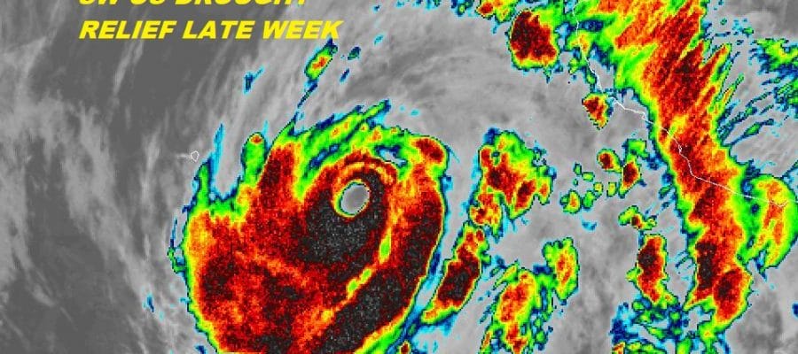
Hurricane Bud 130 MPH CAT 4 Could Ease SW US Drought
Hurricane Bud 130 MPH CAT 4 Could Ease SW US Drought
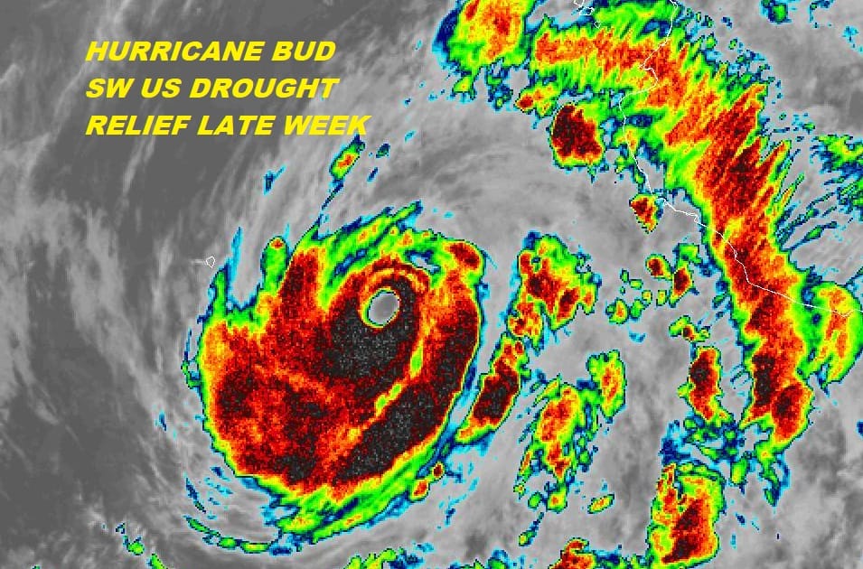
The East Pacific Hurricane Season has gotten off rather strongly with the second category 4 hurricane in less than a week. Bud has strengthened overnight with top winds of 130 mph as it heads north-northwestward parallel to the coast of Mexico. While it will start to weaken soon over the relatively colder waters to its north, enough will remain in tact to be a threat to the Southern Baja Peninsula. More importantly is the moisture from Bud may actually do some good to the drought areas of the SW US.

A deep trough off the west coast will steer this moisture northward late this week and it could bring substantial rains for parts of Arizona, New Mexico & West Texas. It is a little unusual to see a Pacific hurricane hit land this early in the season but the upper air pattern remains favorable for storms to re-curving toward the coastline rather than head out to sea.
GFS RAINFALL FORECAST THROUGH SUNDAY MORNING

Meanwhile on our side of the hurricane basin we have disturbed weather that is in the Southwest Caribbean that weather models have been showing for over a week. The proximity to land and upper level winds are not favorable for the time being but this system will eventually work its way into the Southwest Gulf of Mexico in a couple of days where conditions will be more conducive for development.

With the westward shift in the weak troughing in the Gulf of Mexico weather models have backed off from developing this system significantly however there is room for some development here and at the very least it could bring some heavy rains to parts of the Western Gulf States later this week into the weekend.
FiOS1 News Weather Forecast For Long Island
FiOS1 News Weather Forecast For New Jersey
FiOS1 News Weather Forecast For Hudson Valley