
Fall Foliage: Last Weekend of Good Viewing
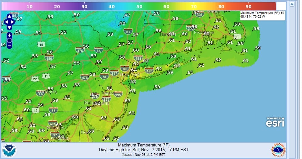
There really isn’t much that is complicated about this weekend as another dry and cooler air mass builds in. The cooler does not come in all at ounce and actually bleeds in over the next 2 days. Overnight temperatures will probably bottom in the 50s tonight but only come back to the lower 60s at best. The coolest air will arrive Saturday night into Sunday. Temperatures Sunday will not get out of the low and mid 50s in most places which is normal for this time of year. Downstate fall foliage is at or just past peak now so you should be able to get one last weekend of nice colorful viewing especially in areas south of New York City. Still even just north of the coast there is ample viewing but north and west areas now appear to be moving past their peak.

Early next week will be cool on Monday with some sunshine. Tuesday we will be dealing with an onshore flow and low pressure to the south and east. Part of that might be a tropical system that we will be watching through the weekend for possible development. For now we will leave rain out of the forecast for Tuesday as it looks to stay offshore. Then next chance for any rain or showers looks to be about Thursday as a cold front approaches and a storm heads for the Great Lakes and then northeastward into Canada.
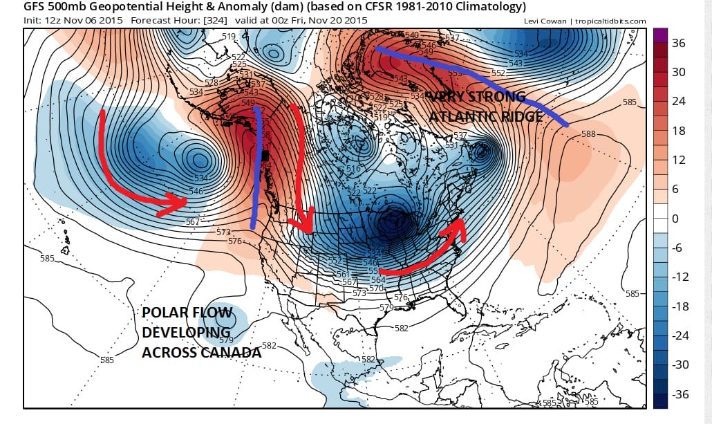
Longer range we wrote this morning that models where continuing to point to a pattern flip after around the middle of the month. This afternoon’s model guidance run strongly supports this idea and the GFS model actually was showing a fairly cold look developing after day 10 which would be after the 17-18th. My discussion this morning explains what is going on.