
Winter Predictions: Indicators Pointing to Mid Month Pattern Shift
This morning’s long range indicators are calculated and they continue the trend that has been established for the last week. Overnight models are continuing to show a gradual change in the look over North America as the North Atlantic Oscillation, the Atlantic Oscillation, and the Pacific North America Pattern are shifting.

The North Atlantic Oscillation (Greenland Block) is forecast to go negative after it peaks in the next few days. Weather forecasting models continue to push this idea. The red lines all are forecast to cross the zero line later next week and then drop to negative values. The more negative the value, the greater the likelihood of blocking to develop in the Atlantic. Remember these are medium range indicators that tend to swing every few weeks though occasionally they do lock in for long periods of time.
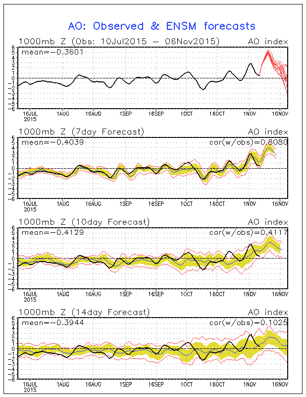
The Atlantic Oscillation is also forecast to approach and cross the zero line though it is not as negative as the North Atlantic Oscillation. Notice that it spent much of the time at zero or below since the spring.

We are adding a third indicator today that is important that is the Pacific North America pattern or PNA. This indicator is the reverse of the other 2 in that when it is strongly positive, it favors colder than normal temperatures in the Eastern States during the winter months. Notice that it has been straddling the zero line and it is forecast to go slightly negative with a little blip up to neutral at mid month.
Now what does this all mean? Well being that we have 2 of the three indicators pointing to a colder direction, the PNA will need to be watched to see if this becomes more positive during the second half of November. It could be the reason why the models overnight showed a colder look but not a very cold look in the longer range.
Now remember we are talking about a colder shift in the pattern here but it does not appear to be overly cold. It does suggest however that cold air masses will be coming down with more frequency in the second half of this month assuming that the above indicators continue to point to this idea. The other question is whether this also means a stormier pattern.
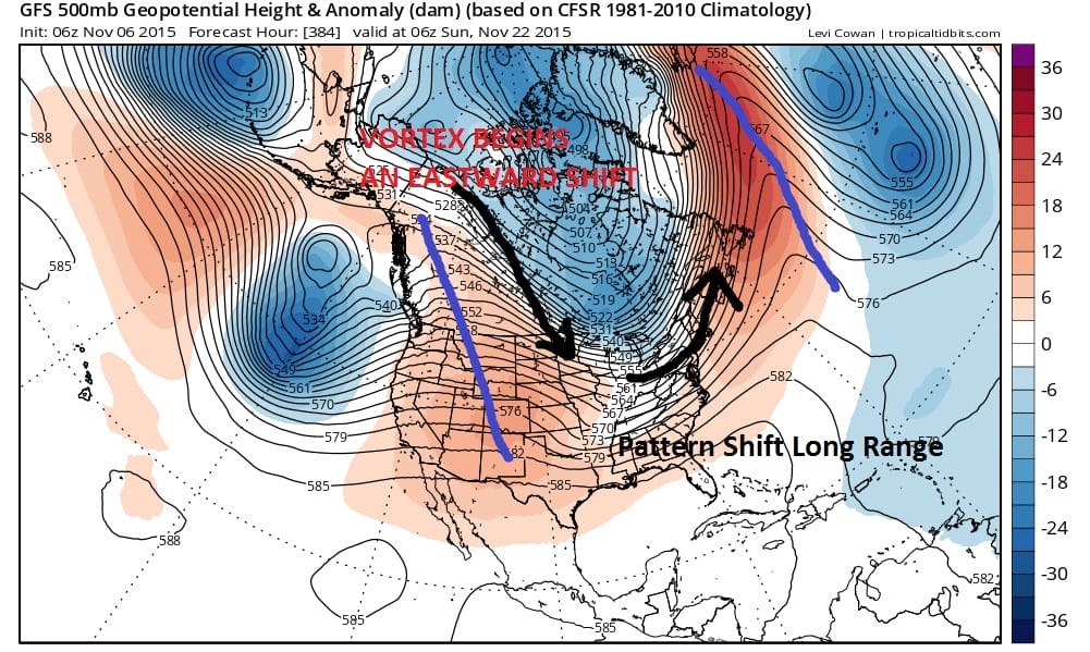
Remember it could turn colder but it could also very well be cold and dry. This is probably a tougher angle to figure out because models often times tend to overdo some approaching weather systems and they also tend to miss other systems that might be in the flow somewhere. Their are lots of pieces in this puzzle but some of the them seem to be coming together.