
Euro Model Gloomy Look Next Week

MENTION JOE CIOFFI AND GET A 5% DISCOUNT
Yesterday’s Euro model painted a pretty ugly picture for next week with several systems impacting our weather all week long and one for the end of the week which was particularly intense looking especially aloft. Other models were not nearly as dire and the Euro model has not been handling the overall weather pattern as well as some of the other models. It seems like it has been overdoing some of the energy coming down from the north. Today’s run takes us through a less robust adventure for next week. However it does suggest as the GFS model does that the weather next week will be rather unsettled with more gray wet days then dry ones.
First off with regards to tonight and Friday, the Euro model weakens the lead shot of moisture for tonight into Friday morning. This seems to match the radar presentation this afternoon. It shows one area of rain which weakens as it moves northeast over us tonight. It never looked like a big deal anyway so we will see some rain. I think the first shot will be spotty in nature. Then it keeps it cloudy on Friday with a second area of rain for late Friday and Friday evening
Euro Model Gloomy Look Next Week
Sunday Morning Surface Map
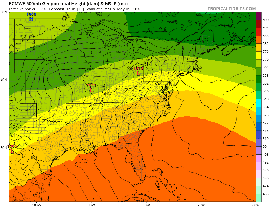
Saturday looks dry from a rain standpoint but given the onshore flow I think the amount of sun will be limited. The Euro model also remains slower than the GFS by holding rain off until Sunday morning with the next weather system The other difference is that the Euro model brings through one shot of rain Sunday and then dries it out on Monday. The GFS model and the NAM model suggest a second wave of rain for Monday. The difference lies in the upper air as the Euro model moves the upper air disturbance involved along in the flow while the other models hang things back.
Euro Model Gloomy Look Next Week
Monday Morning Surface Map
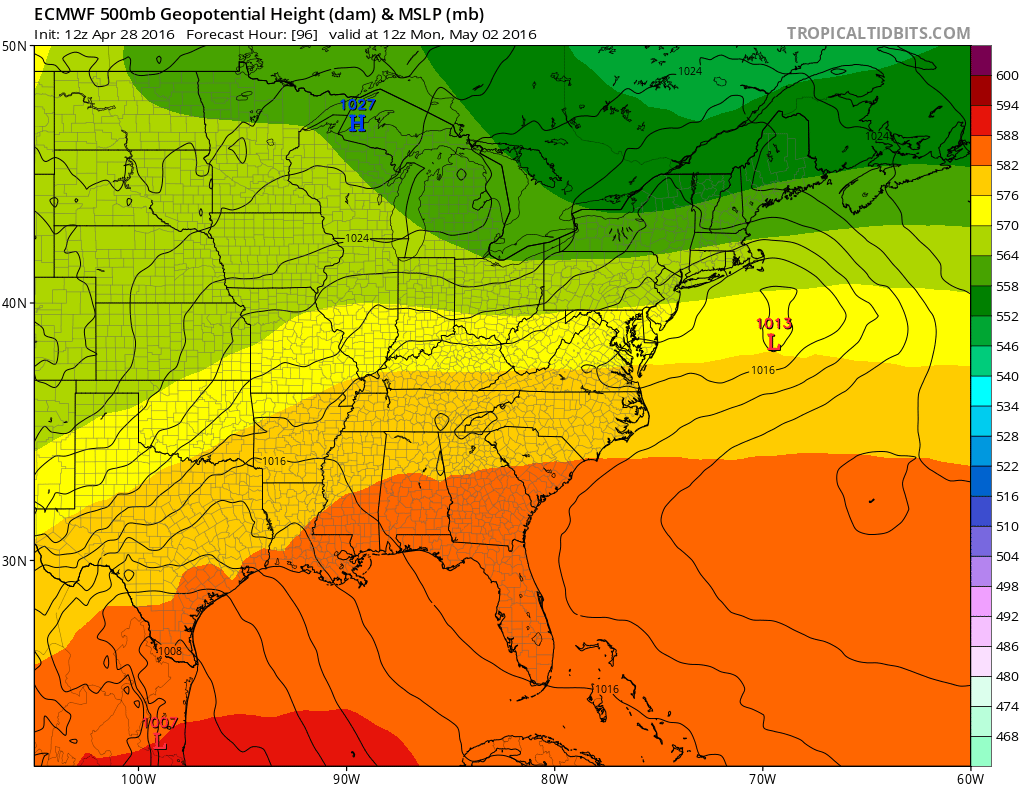
The onshore flow that starts the day Monday tends to relax as the day wears on which argues for some drying if this is correct. However the dry weather will be short lived if the Euro model is right as it fires up another low to the south and begins to lift it northward. Tuesday would be dry by this model and rain would return on Wednesday with low pressure offshore to the south of us. This means another onshore flow set up keeping things damp dismal and raw.
Euro Model Gloomy Look Next Week
Wednesday Morning Surface Map

None of these systems seems major in nature which is a good thing. The model today unlike yesterday is handling the northern energy differently. Instead of going crazy with driving a strong upper vortex southward into the Ohio Valley and to the Middle Atlantic Coast by the end of the week, it is less deep and swings the energy more to the east. This lessens the possibility of a more serious mid spring ocean low developing. This solution makes more sense than yesterday’s extreme solution and it does line up with the GFS model much better. If this is correct than weather conditions might get a little better late next week. However there is no guarantee of that because there is still more energy upstream in Canada that might want to dive southward and create problems for late next week. In fact the European still wants to bring an upper air storm to the coast. However with everything further east, low development would be offshore. This still could mean some showers possible when the upper air system moves through Thursday night into Friday. Lots of puzzle pieces out there and they are all still in play.
LATEST FIOS1 NEWS WEATHER VIDEO
FiOS1 News Weather Forecast For Long Island
FiOS1 News Weather Forecast For New Jersey
FiOS1 News Weather Forecast For Hudson Valley
NATIONAL WEATHER SERVICE SNOW FORECASTS
LATEST JOESTRADAMUS ON THE LONG RANGE

NOMINATED FOR AN APPY AWARD FOR BEST WEATHER APP!!
Weather App

Don’t be without Meteorologist Joe Cioffi’s weather app. It is really a meteorologist app because you get my forecasts and my analysis and not some automated computer generated forecast based on the GFS model. This is why your app forecast changes every 6 hours. It is model driven with no human input at all. It gives you an icon, a temperature and no insight whatsoever.
It is a complete weather app to suit your forecast needs. All the weather information you need is right on your phone. Android or I-phone, use it to keep track of all the latest weather information and forecasts. This weather app is also free of advertising so you don’t have to worry about security issues with your device. An accurate forecast and no worries that your device is being compromised.
Use it in conjunction with my website and my facebook and twitter and you have complete weather coverage of all the latest weather and the long range outlook. The website has been redone and upgraded. Its easy to use and everything is archived so you can see how well Joe does or doesn’t do when it comes to forecasts and outlooks.
Just click on the google play button or the apple store button on the sidebar for my app which is on My Weather Concierge. Download the app for free. Subscribe to my forecasts on an ad free environment for just 99 cents a month.
Get my forecasts in the palm of your hand for less than the cost of a cup of Joe!
![]()

