
Easter Sunday Dry Major Storm Impacts Eastern US Tonight Monday
High Winds Severe Weather

Happy Easter Sunday to all on what is going to be a day of increasing clouds. We have a major storm developing in the Southern Plains that will be heading into the Great Lakes. Trouble is already brewing across the Lower Ohio and Tennessee Valley south to the Gulf Coast. A widespread severe weather outbreak is expected and there will be strong tornadoes and severe thunderstorms developing tonight and tonight. The Storm Prediction Center has expanded the area of moderate risk into Georgia with enhanced risk also expanded east and north.

The severe weather risk area shifts to the East Coast on Monday. SPC raised the risk levels and took them further north to our area. This morning they increased the area of enhanced risk and extended it northward into Virginia and southward into Southeast Georgia. This covers our area on Monday with marginal to slight risk for much of our region from Eastern Pennsylvania to Southern New England.
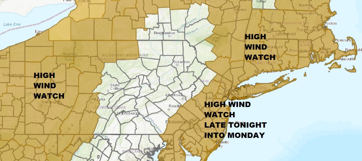
High Wind Watch has been also expanded this morning with much of the Northeast and Middle Atlantic states in the mix. The areas that are not in the watch area at the moment might just go directly to high wind warnings or wind advisories. With the very tight pressure gradient developing overnight into Monday afternoon, wind gusts to 60 mph or higher are possible especially in and around any severe weather. That could take the wind gusts much higher.
SATELLITE

REGIONAL RADAR

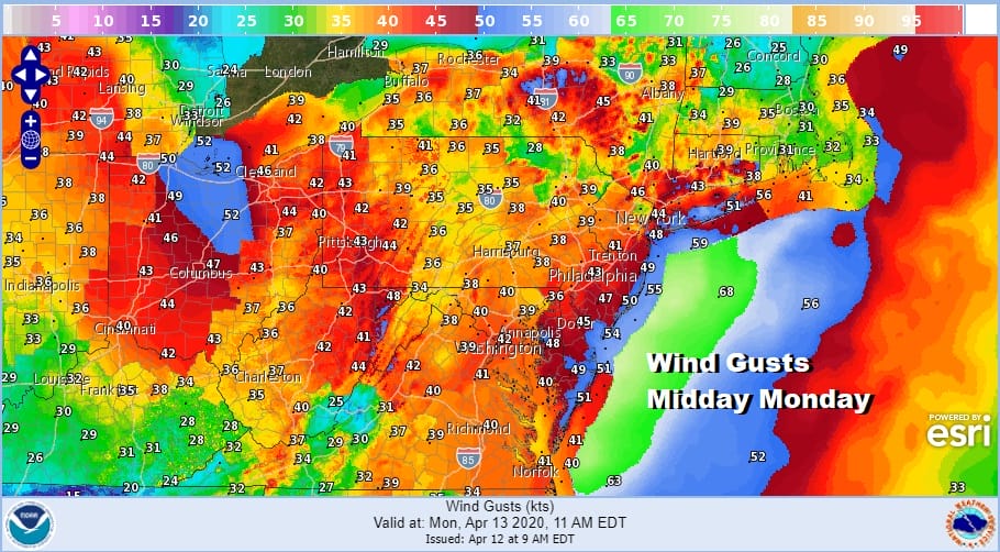
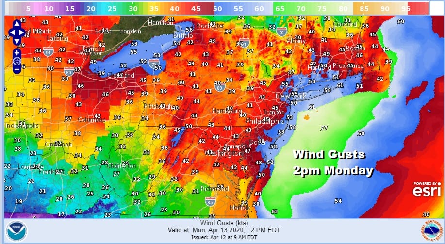
We can at least say there are no weather issues forecast for today. We will see clouds gradually increase with highs reaching the 60s away from the ocean. Rain develops tonight and winds will increase sharply during the early morning hours. Peak winds will likely occur from 9am to 5pm on Monday with frequent gusts over 50 mph. The absolute strongest will occur between noon and 3pm.
Rain arrives probably around 8pm in Southern Pennsylvania and Southern New Jersey to around 11pm or midnight in NYC and areas nearby and shortly afterwards in the Hudson Valley and Southern New England. Rain becomes heavy at times into Monday afternoon. Throw in some thunderstorms (some likely severe) and you will likely see 1 to 2 inches of rain with locally higher amounts in thunderstorms. A cold front moves through late tomorrow afternoon and weather conditions should improve slowly Monday night into Tuesday with winds diminishing but still windy Monday night. Some sunshine should return on Tuesday.
The front with this storm Monday does slow down and there could be some rain (or even snow) showers around on Wednesday as low pressure develops to our south. We will look at this a bit closer later Monday once this major weather system starts moving away.
BE SURE TO DOWNLOAD THE FREE METEOROLOGIST JOE CIOFFI WEATHER APP &
ANGRY BEN’S FREE WEATHER APP “THE ANGRY WEATHERMAN!
MANY THANKS TO TROPICAL TIDBITS FOR THE USE OF MAPS
Please note that with regards to any severe weather, tropical storms, or hurricanes, should a storm be threatening, please consult your local National Weather Service office or your local government officials about what action you should be taking to protect life and property.


