
Easter Bunny Brings Snow A Day Late, Nice Holiday Weekend
Easter Bunny Brings Snow A Day Late, Nice Holiday Weekend
We have Passover & the Easter Weekend underway and we are starting off with tons of sunshine today. The satellite loop shows nice clear skies everywhere close by. We should see highs in the mid to upper 50s except along the immediate coast where a wind off the ocean will keep temperatures in upper 40s and lower 50s. Overall a very good day indeed so do enjoy it. We haven’t see all that much sun lately.
US SATELLITE

REGIONAL RADAR

Now tonight we have a weak cold front coming through before daybreak which will weaken even further. We will cover for the possibility for a brief rain shower or snow shower inland and nothing more. This will occur between 4-7am. Then skies quickly become mostly sunny for Easter Sunday with a gusty wind and highs in the 50s.
NAM MODEL MONDAY MORNING 8AM APRIL 2, 2018
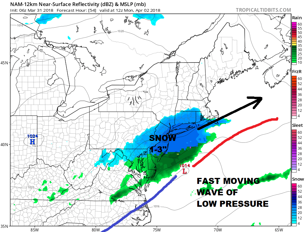
Right now this looks like a 1 to 3 inch snowfall with some possible isolated 4 inch amounts. Urban areas are likely to see less as is usually the case this time of year. Models have been trending further north and wetter overnight so I think there is a bit of room for a little upside. However this is going to be very fast as it comes in during the early morning hours on Sunday and it is done by 8-10am in most areas. They key to the accumulation will be how much falls before 8-9am. The bulk of the snow falls before this time frame especially from Western Connecticut to NYC west across New Jersey and Southeastern Pennsylvania where all of the snow falls at night. Models have also been shifting a little further north with the max area so I’m thinking that the area just south of Route 195 in New Jersey & Route 84 in NY Connecticut could see the highest amounts with a bit less to the south and north of these boundaries.
NAM PRECIPITATION FORECAST THROUGH MONDAY APRIL 2, 2018
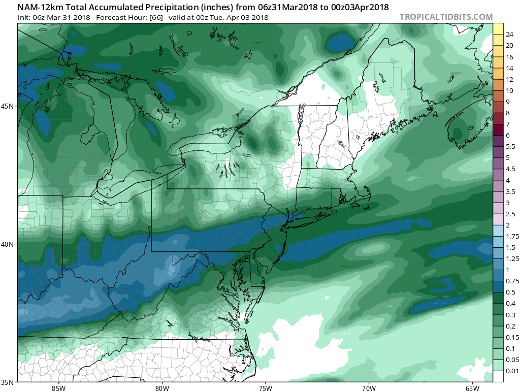
We are going to watch to see whether models trend higher today as the NAM overnight actually was very robust. This would certainly argue the higher end of the forecast range verses the lower. Remarkably the models all are on a similar page including the European model. Speed of movement, timing, and how solid a burst of precipitation are all the keys here but it does seem that an accumulating snow is likely Monday morning.
CHECK THE LATEST NATIONAL WEATHER SERVICE SNOW FORECAST MAPS HERE
 GET JOE A CIGAR IF YOU LIKE

FiOS1 News Weather Forecast For Long Island
FiOS1 News Weather Forecast For New Jersey
FiOS1 News Weather Forecast For Hudson Valley


