Drying Thursday, Rain Friday, Weekend Forecast
Drying Thursday, Rain Friday, Weekend Forecast
Weather conditions are improving somewhat today as yesterday’s system is now up in Northern New England & continuing to move away. We are starting the day off with some sunshine and we will be no worse than partly sunny today. Temperatures should respond nicely and make their way through the 60s to near 70 in some places. Overall it is looking like a nice Thursday. The satellite picture this morning shows some clouds to the northeast and some clouds to the west southwest as the next weather system gets ready to move northeastward for Friday. Clouds will be arriving and increasing overnight.
US SATELLITE
REGIONAL RADAR
Yesterday’s rain and downpours are still visible on the radar as they move away to the northeast. Radars today should be inactive for the most part.
LOCAL RADAR NEW YORK CITY
LOCAL RADAR PHILADELPHIA

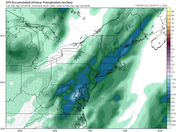
Friday brings another low up the coast much like yesterday’s so get set for some rain that will come in and go out in about 6 hours time. Rain arrives in New Jersey around mid morning and everywhere else by midday or early afternoon and then out. Rainfall amount will be on the order of half an inch to at most an inch if some heavier downpours happen to come your way.
GFS RAIN FORECAST FRIDAY
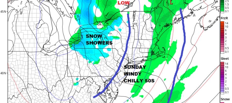
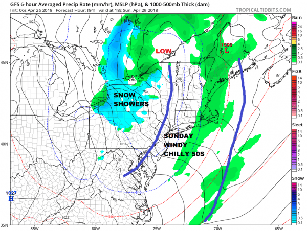
The weekend looks to be rather interesting. A cold front is approaching for Saturday so we should have partly sunny skies ahead of it and the chance for showers late in the day into Saturday night which won’t amount to much. Highs will be in the 60s to near 70. Behind the front is a shot of cold air for Sunday.
GFS FORECAST SUNDAY 2PM APRIL 29, 2018
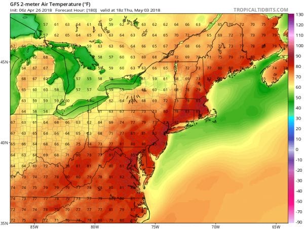
This is a very cold unstable upper air disturbance that is driving all this and I would not at all be surprised to see some snow showers develop in areas as far south as the Catskills Sunday afternoon and evening. It will be a windy chilly day with highs Sunday just in the 50s. Once this disturbance begins to pull out to the east on Monday a warm up will commence. Monday we will see sunshine with highs in the 60s. Tuesday sunshine continues with highs in the 70s. Wednesday and Thursday of next week we will see sunshine with highs in the 80s in many locations. I would not rule out the first 90 degree reading showing up somewhere on Thursday with dry air and a west wind.
GFS FORECAST TEMPERATURES 2PM THURSDAY MAY 3, 2018
The month of May will start warm however looking out longer term it will be followed by another pattern shift which is oh so typical for this time of year. Warm weather is still very hard to sustain in early May and this May will be no different.
 GET JOE A CIGAR IF YOU LIKE
FiOS1 News Weather Forecast For Long Island
FiOS1 News Weather Forecast For New Jersey
FiOS1 News Weather Forecast For Hudson Valley


